Category:St Mary the Virgin's church, Layer Marney
| Object location | | View all coordinates using: OpenStreetMap |
|---|
church in Layer Marney, Essex, UK  | |||||
| Upload media | |||||
| Instance of | |||||
|---|---|---|---|---|---|
| Dedicated to | |||||
| Location | Layer Marney, Colchester, Essex, East of England, England | ||||
| Diocese | |||||
| Has part(s) |
| ||||
| Heritage designation |
| ||||
| Inception |
| ||||
| Religion or worldview | |||||
 | |||||
Subcategories
This category has only the following subcategory.
Media in category "St Mary the Virgin's church, Layer Marney"
The following 14 files are in this category, out of 14 total.
-
 Church at Layer Marney, rear view (geograph 3952991).jpg 800 × 449; 101 KB
-
 Entrance porch to St Mary the Virgin Church, Layer Marney (geograph 1897798).jpg 4,000 × 3,000; 2.95 MB
-
 Farmland View (geograph 3203721).jpg 1,500 × 2,000; 672 KB
-
 Gardens at Layer Marney, Essex - geograph.org.uk - 1516574.jpg 640 × 431; 100 KB
-
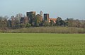 Layer Marney Tower and Church - geograph.org.uk - 1607344.jpg 640 × 416; 67 KB
-

-
 St Mary the Virgin Church, Layer Marney (geograph 1897842).jpg 4,000 × 3,000; 2.91 MB
-
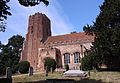
 St Mary the Virgin Church, Layer Marney - geograph.org.uk - 1142974.jpg 640 × 427; 194 KB
-
 St Mary the Virgin, Layer Marney, Essex (geograph 2010173).jpg 3,474 × 2,410; 3.97 MB
-
 St Mary, Layer Marney.jpg 5,184 × 3,888; 6.12 MB
-

-

-

-

.jpg)
.jpg)
.jpg)


.jpg)
.jpg)


