Category:St Mary the Virgin, Winterborne Stickland
| Object location | | View all coordinates using: OpenStreetMap |
|---|
church in Winterborne Stickland, Dorset, United Kingdom  | |||||
| Upload media | |||||
| Instance of | |||||
|---|---|---|---|---|---|
| Location | Winterborne Stickland, Dorset, South West England, England | ||||
| Diocese | |||||
| Heritage designation |
| ||||
| Inception |
| ||||
| Religion or worldview | |||||
 | |||||
Subcategories
This category has only the following subcategory.
Media in category "St Mary the Virgin, Winterborne Stickland"
The following 17 files are in this category, out of 17 total.
-

-

-

-
 Church of St Mary, Winterborne Stickland - geograph.org.uk - 2325387.jpg 1,600 × 1,071; 1.56 MB
-
 Detail, St Mary's Church - geograph.org.uk - 1944061.jpg 480 × 640; 140 KB
-

-
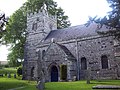
 St Mary the Virgin, Winterborne Stickland - geograph.org.uk - 459871.jpg 480 × 640; 139 KB
-
 Sundial, St Mary's Church - geograph.org.uk - 1944065.jpg 640 × 480; 103 KB
-
 Sundial, St Mary's, Winterborne Stickland.jpg 6,000 × 4,000; 10.54 MB
-
 The church of St Mary the Virgin at Winterborne Stickland - geograph.org.uk - 3922400.jpg 4,000 × 3,000; 4.34 MB
-
-

-
 Through the church gate. - geograph.org.uk - 459918.jpg 640 × 480; 127 KB
-
 Tower, St Mary's Church - geograph.org.uk - 1944072.jpg 480 × 640; 134 KB
-
 Winterborne Stickland parish church 2015.JPG 5,184 × 3,456; 8.34 MB
-
 Winterborne Stickland, church over garden - geograph.org.uk - 973029.jpg 640 × 480; 157 KB
-


