Category:St Peter's church, Boxted, Essex
English: Media relating to St Peter's church, Boxted, Essex
| Object location | | View all coordinates using: OpenStreetMap |
|---|
church in Boxted, Essex, United Kingdom  | |||||
| Upload media | |||||
| Instance of | |||||
|---|---|---|---|---|---|
| Dedicated to | |||||
| Location | Boxted, Colchester, Essex, East of England, England | ||||
| Diocese | |||||
| Has part(s) |
| ||||
| Heritage designation |
| ||||
| Religion or worldview | |||||
 | |||||
Media in category "St Peter's church, Boxted, Essex"
The following 11 files are in this category, out of 11 total.
-
 St.Peters Church, Boxted (geograph 4144259).jpg 3,072 × 2,304; 1.7 MB
-
 St Peters church, Boxted (geograph 4210404).jpg 4,320 × 3,240; 4.8 MB
-
 St Peters church, Boxted (geograph 4210405).jpg 4,320 × 3,240; 4.84 MB
-
 St. Peter (geograph 2953888).jpg 2,804 × 1,864; 1.73 MB
-
 St. Peter (geograph 2953906).jpg 1,243 × 1,870; 769 KB
-
 St. Peter's church, Boxted, Essex - geograph.org.uk - 156227.jpg 640 × 466; 100 KB
-
 St.Peters Church, Boxted (geograph 4144257).jpg 3,072 × 2,304; 1.76 MB
-
 The tower of St Peter, Boxted - geograph.org.uk - 487794.jpg 491 × 640; 115 KB
-
 Richard Blackmore grave.jpg 3,024 × 4,032; 3.83 MB
-
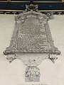 Richard Blackmore memorial.jpg 3,024 × 4,032; 1.9 MB
-
 St Peter's Church, Boxted, Essex - geograph.org.uk - 2040281.jpg 640 × 423; 149 KB
.jpg)
.jpg)
.jpg)
.jpg)
.jpg)
.jpg)


