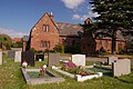
Category:St Winifrede's RC church, Neston
| Object location | | View all coordinates using: OpenStreetMap |
|---|
church in Neston, Cheshire, England, UK .JPG) | |||||
| Upload media | |||||
| Instance of | |||||
|---|---|---|---|---|---|
| Location | Neston, Cheshire West and Chester, Cheshire, North West England, England | ||||
| Heritage designation |
| ||||
 | |||||
Media in category "St Winifrede's RC church, Neston"
The following 4 files are in this category, out of 4 total.
-
 St Winefride RC Church Neston.jpg 2,256 × 1,496; 1.89 MB
-
 St Winefride's RC Church, Little Neston (1).JPG 4,320 × 3,240; 3.18 MB
-
 St Winefride's RC Church, Little Neston (2).JPG 4,320 × 3,240; 3.41 MB
-
 St Winifrede's RC church, Neston.jpg 4,904 × 3,073; 10.06 MB

.JPG)
