Category:Stadhuis (Deventer)
| Object location | | View all coordinates using: OpenStreetMap |
|---|
main municipal building of Deventer  | |||||
| Upload media | |||||
| Instance of | |||||
|---|---|---|---|---|---|
| Location | Deventer, Overijssel, Netherlands | ||||
| Street address |
| ||||
| Located on street | |||||
| Architectural style | |||||
| Architect | |||||
| Heritage designation |
| ||||
 | |||||
|
This is a category about rijksmonument number 12556
|
| Address |
|
Subcategories
This category has the following 3 subcategories, out of 3 total.
E
- Exterieur Stadhuis (Deventer) (33 F)
I
Media in category "Stadhuis (Deventer)"
The following 8 files are in this category, out of 8 total.
-
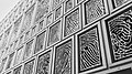 2016 Vingerafdrukken op stadhuis Deventer.jpg 1,024 × 576; 476 KB
-
 Permanent Record - Deventer Town Hall.jpg 4,568 × 3,084; 4.9 MB
-
 Stadhuis Deventer (48412462991).jpg 6,000 × 4,000; 11.68 MB
-
 Stadhuis Deventer 2016.jpg 2,048 × 1,536; 915 KB
-
 Stadhuis Deventer 2019.jpg 4,928 × 3,264; 7.02 MB
-
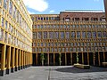
 Stadhuis Deventer binnenplaats.jpg 1,490 × 1,180; 650 KB
-
 Stadhuis Deventer nieuw.jpg 2,048 × 1,536; 1.12 MB
-
 Stadhuis van Deventer.jpg 8,691 × 4,888; 11.99 MB


.jpg)


