Category:Stadtkirche Ruhland
| Object location | | View all coordinates using: OpenStreetMap |
|---|
church building in Ruhland, Germany  .jpg) | |||||
| Upload media | |||||
| Instance of | |||||
|---|---|---|---|---|---|
| Part of | |||||
| Location | Ruhland, Oberspreewald-Lausitz District, Brandenburg, Germany | ||||
| Heritage designation | |||||
 | |||||
This is the category of the Brandenburger Baudenkmal (cultural heritage monument) with the ID 09120217 (Wikidata)
|
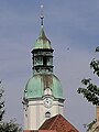
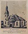
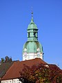
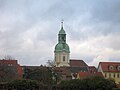
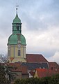
Deutsch: Die Stadtpfarrkirche in Ruhland/Rulany, Oberlausitz, Mark Brandenburg, gehört und dient einer lutherischen Gemeinde der unierten Evangelischen Kirche Berlin-Brandenburg-Schlesische Oberlausitz.
English: The Town Parish Church in Ruhland/Rulany, Upper Lusatia, March of Brandenburg, Germany, is owned and used by a Lutheran congregation within the Evangelical Church of Berlin-Brandenburg-Silesian Upper Lusatia, a united Protestant church body of Calvinist, Lutheran and united congregations.
Subcategories
This category has the following 2 subcategories, out of 2 total.
I
Media in category "Stadtkirche Ruhland"
The following 36 files are in this category, out of 36 total.
-
 12 Anatoli Riaboshenko Ruhland Kirche 50x40 Öl-Lw 2017.jpg 1,976 × 2,482; 1.98 MB
-
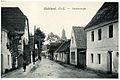 20921-Ruhland-1918-Fischerstraße-Brück & Sohn Kunstverlag.jpg 1,505 × 1,000; 563 KB
-
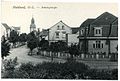 20922-Ruhland-1918-Bahnhofstraße-Brück & Sohn Kunstverlag.jpg 1,481 × 1,000; 570 KB
-
 21900-Ruhland-1921-Blick nach der Kirche-Brück & Sohn Kunstverlag.jpg 1,630 × 1,000; 719 KB
-
 Nachtwanderung Kirche Ruhland.jpg 5,472 × 3,648; 14.92 MB
-
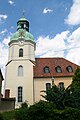
 Ruhland kirche.JPG 2,448 × 3,264; 1.79 MB
-
 Ruhland kirche2.JPG 2,448 × 3,264; 1.67 MB
-
 Ruhland, Bahnhofstr. Ecke Kirchgasse, Blick zur Stadtkirche 01.jpg 1,704 × 2,272; 289 KB
-
 Ruhland, Bahnhofstr. Ecke Kirchgasse, Blick zur Stadtkirche 02.jpg 1,704 × 2,272; 291 KB
-
 Ruhland, Bahnhofstr., zwischen Hausnr. 2-3, Kirchturm.jpg 1,704 × 2,272; 307 KB
-
 Ruhland, Elsterbogen gegenüber Ausfahrt Hausnr. 5, Blick zum Kirchturm, Frühling, 01.jpg 3,648 × 1,953; 4.46 MB
-
 Ruhland, Ernst-Thälmann-Str. bei Bahnhofstr. 8, Blick zum Kirchturm, 01.jpg 2,933 × 3,909; 632 KB
-
 Ruhland, Ernst-Thälmann-Str. bei Bahnhofstr. 8, Blick zum Kirchturm, 02.jpg 3,000 × 4,000; 1.46 MB
-
 Ruhland, Ernst-Thälmann-Str. bei Bahnhofstr. 8, Blick zum Kirchturm, 03.jpg 3,000 × 4,000; 3.47 MB
-
 Ruhland, evangelische Stadtkirche von der Kirchgasse, Spätfrühling, 01.jpg 2,112 × 2,816; 737 KB
-
 Ruhland, Kirchgasse 2, Blick zum Kirchturm.jpg 1,704 × 2,272; 440 KB
-
 Ruhland, Kirchplatz bei Hausnr. 3-5-6, Nordansicht, Spätherbst.jpg 2,272 × 1,704; 414 KB
-
 Ruhland, Kirchplatz zwischen Kirchplatz 3-4, Ostnordostansicht.jpg 2,272 × 1,704; 537 KB
-
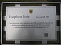 Ruhland, Kirchplatz, evangelische Kirche, Informationstafel mit QR-Code.jpg 2,272 × 1,704; 341 KB
-
 Ruhland, Kirchplatz, Ostnordostansicht der Kirche vom Kirchplatz-Stichweg, 01.jpg 1,704 × 2,272; 276 KB
-
 Ruhland, Kirchplatz, Ostnordostansicht der Kirche vom Kirchplatz-Stichweg, 02.jpg 1,704 × 2,272; 315 KB
-
 Ruhland, Kirchplatz, Stadkirche Nordostansicht, Winter, 01.jpg 1,704 × 2,272; 383 KB
-
 Ruhland, Kirchplatz, Stadtkirche 40512FotoAndreKaiser.jpg 474 × 712; 67 KB
-
 Ruhland, Kirchplatz, Stadtkirche Nordostansicht, Frühjahr, 01.jpg 1,704 × 2,272; 439 KB
-
 Ruhland, Kirchplatz, Stadtkirche Nordostansicht, Frühjahr, 02.jpg 1,704 × 2,272; 442 KB
-
 Ruhland, Kirchplatz, Stadtkirche, 1890.jpg 2,002 × 2,394; 2.87 MB
-
 Ruhland, Kirchturm vom Elsterbogen, 01.jpg 2,736 × 3,648; 4.26 MB
-
 Ruhland, Kirchturm von der Dresdener Str. 9 (Südwestansicht) P1100883.jpg 3,456 × 4,608; 2.13 MB
-
 Ruhland, Kirchturm, Ansicht vom Markt P1100704.jpg 2,723 × 3,730; 554 KB
-
 Ruhland, Kirchturmspitze, Wetterfahne P1100706.jpg 2,847 × 4,274; 871 KB
-
 Ruhland, Marienstr. hinter Wallstr. 23, Blick zur Kirche, Vorwinter, 01.jpg 3,648 × 2,736; 1.01 MB
-
 Ruhland, Marienstr. hinter Wallstr. 23, Blick zur Kirche, Vorwinter, 02.jpg 1,488 × 2,104; 359 KB
-
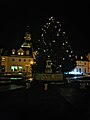 Ruhland, Marktplatz, Weihnachtsbaum, abends, 2023, 01.jpg 2,448 × 3,264; 801 KB
-
 Ruhland, Stadtkirche Nordnordwestansicht, Vorwinter abends, 01.jpg 2,448 × 3,264; 1.29 MB
-
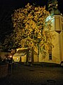 Ruhland, Stadtkirche Nordnordwestansicht, Vorwinter abends, 02.jpg 2,448 × 3,264; 1.77 MB
-
 Ruhland, Stadtkirche von der Bahnhofstr.jpg 2,592 × 3,888; 4.78 MB


_P1100883.jpg)


