Category:Stainton, South Lakeland
village and civil parish in South Lakeland, Cumbria, UK  | |||||
| Upload media | |||||
| Instance of | |||||
|---|---|---|---|---|---|
| Location | South Lakeland, Cumbria, North West England, England | ||||
| Population |
| ||||
 | |||||
Subcategories
This category has the following 3 subcategories, out of 3 total.
Media in category "Stainton, South Lakeland"
The following 122 files are in this category, out of 122 total.
-
 A swan's feather on the Lancaster Canal - geograph.org.uk - 4644378.jpg 800 × 600; 201 KB
-
 A tree near High House Farm - geograph.org.uk - 2830365.jpg 600 × 800; 86 KB
-
 A590 - geograph.org.uk - 2633692.jpg 640 × 385; 54 KB
-

-
 A65 east side of Mill Bridge - geograph.org.uk - 2991420.jpg 640 × 480; 108 KB
-
 Access Lane to Stang - geograph.org.uk - 4532161.jpg 5,184 × 3,456; 7.15 MB
-
 B6254 East of Oxenholme - geograph.org.uk - 4532341.jpg 5,184 × 3,456; 6.31 MB
-
 Beck near Dreamland Farm - geograph.org.uk - 6603382.jpg 1,600 × 1,200; 1,014 KB
-
 Beck, Mill Bridge - geograph.org.uk - 3928348.jpg 640 × 480; 122 KB
-
 Benchmark, Stainton Crossing Bridge - geograph.org.uk - 6566183.jpg 1,600 × 1,206; 701 KB
-
 Bridge 170, Lancaster Canal - geograph.org.uk - 1713922.jpg 640 × 480; 112 KB
-
 Bridge 170, Lancaster Canal - geograph.org.uk - 5243443.jpg 640 × 425; 253 KB
-
 Bridge 171, Lancaster Canal - geograph.org.uk - 4271330.jpg 640 × 425; 218 KB
-
 Bridge 171, Lancaster Canal - geograph.org.uk - 4271332.jpg 640 × 425; 216 KB
-
 Bridge 172, Lancaster Canal - geograph.org.uk - 1713948.jpg 640 × 480; 100 KB
-
 Bridge 172, Lancaster Canal - geograph.org.uk - 4271335.jpg 640 × 430; 221 KB
-
 Bridge over Stainton Beck - geograph.org.uk - 1894297.jpg 1,200 × 801; 274 KB
-
 Bridge over Stainton Beck - geograph.org.uk - 5592856.jpg 1,280 × 850; 988 KB
-

-
 Clay dam, Lancaster Canal - geograph.org.uk - 5243442.jpg 640 × 425; 248 KB
-
 Cockrigg - geograph.org.uk - 5351439.jpg 720 × 540; 146 KB
-
 Collapsed footbridge - geograph.org.uk - 6604907.jpg 1,600 × 1,204; 857 KB
-
 Coming for a drink at the tarn - geograph.org.uk - 2830386.jpg 600 × 800; 123 KB
-
 Cow and calf at Cockrigg - geograph.org.uk - 5349465.jpg 800 × 600; 93 KB
-
 Crosscrake - geograph.org.uk - 5052899.jpg 4,648 × 3,456; 1.99 MB
-
 Crosscrake church graveyard - geograph.org.uk - 4340518.jpg 640 × 448; 271 KB
-
 Farmland near Beehive - geograph.org.uk - 3405825.jpg 3,872 × 2,592; 4.68 MB
-
 Farmland south of Sedgwick - geograph.org.uk - 3823886.jpg 640 × 404; 41 KB
-
 Fields in winter - geograph.org.uk - 4795965.jpg 640 × 425; 203 KB
-
 Footbridge at Halfpenny - geograph.org.uk - 5350803.jpg 720 × 540; 193 KB
-
 Footbridge over Stainton Beck - geograph.org.uk - 3920091.jpg 3,264 × 2,448; 2.16 MB
-
 Footbridge over Stainton Beck - geograph.org.uk - 5354566.jpg 600 × 800; 166 KB
-
 Footbridge over Stainton Beck - geograph.org.uk - 6635580.jpg 1,024 × 1,280; 1.09 MB
-
 Footbridge over Stainton Beck - geograph.org.uk - 6635583.jpg 1,280 × 1,024; 1.25 MB
-
 Footpath to Stainton - geograph.org.uk - 3920078.jpg 3,264 × 2,448; 1.83 MB
-
 Ford across Stainton Beck, Stainton - geograph.org.uk - 4644364.jpg 640 × 480; 99 KB
-
 Ford at Stainton - geograph.org.uk - 5592857.jpg 1,280 × 850; 847 KB
-
 Gate onto Lane - geograph.org.uk - 3920070.jpg 3,264 × 2,448; 2.29 MB
-

-

-
 Grazing land at Stainton - geograph.org.uk - 4340505.jpg 640 × 425; 149 KB
-
 Halfpenny Ford - geograph.org.uk - 4386789.jpg 3,872 × 2,592; 4.83 MB
-
 Hawthorn trees on The Helm - geograph.org.uk - 2830423.jpg 800 × 600; 173 KB
-
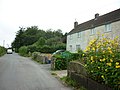 Houses at Shyreakes - geograph.org.uk - 3127158.jpg 800 × 600; 265 KB
-
 Houses near Oxenholme - geograph.org.uk - 3127057.jpg 800 × 600; 356 KB
-
 Lancaster Canal - geograph.org.uk - 1713910.jpg 640 × 480; 69 KB
-
 Lancaster Canal - geograph.org.uk - 1713941.jpg 480 × 640; 94 KB
-
 Lancaster Canal - geograph.org.uk - 1713955.jpg 480 × 640; 124 KB
-
 Lancaster Canal - geograph.org.uk - 1726341.jpg 640 × 480; 104 KB
-
 Lancaster Canal east of Stainton Crossing Bridge - geograph.org.uk - 3521528.jpg 1,600 × 1,200; 643 KB
-
 Lancaster Canal, Stainton - geograph.org.uk - 5897333.jpg 1,280 × 850; 656 KB
-
 Lancaster Canal, Stainton - geograph.org.uk - 6307181.jpg 1,280 × 850; 612 KB
-
 Lancaster Canal, Stainton - geograph.org.uk - 6307183.jpg 1,280 × 850; 631 KB
-
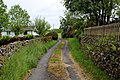
 Lane south of Stainton - geograph.org.uk - 1103026.jpg 640 × 428; 123 KB
-
 Large tarn below The Helm - geograph.org.uk - 2830359.jpg 800 × 600; 103 KB
-
 Large tarn below The Helm - geograph.org.uk - 2830392.jpg 800 × 600; 95 KB
-
 Levens Hall - geograph.org.uk - 5053158.jpg 4,386 × 2,880; 1.85 MB
-
 Map of Stainton in the 20th Century.PNG 567 × 275; 400 KB
-
 Milestone near Storth End.jpg 1,600 × 1,200; 2.05 MB
-
 Missing footbridge, Saint Sunday's Beck - geograph.org.uk - 5349474.jpg 540 × 720; 134 KB
-
 Northbound A590 near Hincaster - geograph.org.uk - 5268102.jpg 640 × 427; 378 KB
-

-
 Old Boundary Marker near Storth End (geograph 6686030).jpg 1,632 × 3,264; 1.58 MB
-

-
 Packhorse bridge at Stainton.jpg 4,000 × 3,000; 1.9 MB
-
 Packhorse bridge over Stainton Beck.jpg 480 × 640; 150 KB
-
 Path at the north end of the Helm - geograph.org.uk - 2254417.jpg 640 × 480; 99 KB
-
 Rain, rain, rain - geograph.org.uk - 2593226.jpg 4,592 × 3,056; 5.18 MB
-
 Road bridge, Viver - geograph.org.uk - 5897998.jpg 1,280 × 850; 722 KB
-

-
 Rough pasture below Lowblease Hill - geograph.org.uk - 5351435.jpg 720 × 540; 77 KB
-
 Saint Sunday's Beck (1) - geograph.org.uk - 4532152.jpg 4,620 × 3,297; 6.58 MB
-
 Saint Sunday's Beck (2) - geograph.org.uk - 4532158.jpg 5,184 × 3,456; 6.66 MB
-
 Saint Sunday's Beck at Halfpenny - geograph.org.uk - 5349478.jpg 800 × 600; 215 KB
-
 Sellet Lodge - geograph.org.uk - 4644314.jpg 800 × 600; 112 KB
-
 Sheep on a cold field - geograph.org.uk - 3405814.jpg 3,872 × 2,592; 6.2 MB
-
 Shyreakes - geograph.org.uk - 2991427.jpg 640 × 480; 105 KB
-
 Shyreakes - geograph.org.uk - 2991433.jpg 640 × 480; 109 KB
-
 Shyreakes - geograph.org.uk - 5052910.jpg 5,183 × 2,728; 1.92 MB
-
 Skettlegill - geograph.org.uk - 2040283.jpg 640 × 480; 77 KB
-
 Small Lake below The Helm - geograph.org.uk - 4531678.jpg 5,184 × 3,456; 5.53 MB
-
 Snails under the railway - geograph.org.uk - 4644305.jpg 800 × 600; 211 KB
-
 St Thomas' Church, Crosscrake - geograph.org.uk - 4340531.jpg 640 × 425; 172 KB
-
 St Thomas' Church, Crosscrake - geograph.org.uk - 4340539.jpg 640 × 432; 231 KB
-
 Stainton , A590 - geograph.org.uk - 6301585.jpg 6,000 × 4,000; 5.08 MB
-
 Stainton , A590 - geograph.org.uk - 6359787.jpg 6,000 × 4,000; 5.05 MB
-
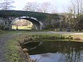
 Stainton Aqueduct - geograph.org.uk - 1713935.jpg 640 × 480; 122 KB
-
 Stainton Aqueduct - under the arch - geograph.org.uk - 6635575.jpg 1,280 × 850; 835 KB
-
 Stainton Aqueduct flood damage - geograph.org.uk - 6635536.jpg 1,280 × 850; 891 KB
-
 Stainton Aqueduct flood damage - geograph.org.uk - 6635550.jpg 1,280 × 850; 932 KB
-
 Stainton Aqueduct restored - geograph.org.uk - 6635568.jpg 1,280 × 850; 953 KB
-
 Stainton Beck - geograph.org.uk - 1713961.jpg 480 × 640; 116 KB
-
 Stainton Beck at Stainton - geograph.org.uk - 5592858.jpg 1,280 × 850; 817 KB
-
 Stainton Beck Road Bridge over - geograph.org.uk - 3920104.jpg 3,264 × 2,448; 3.49 MB
-
 Stainton Beck, Stainton - geograph.org.uk - 1103066.jpg 640 × 428; 113 KB
-
 Stainton Bridge - geograph.org.uk - 4581205.jpg 640 × 480; 131 KB
-
 Stainton Bridge End - geograph.org.uk - 5053162.jpg 5,183 × 3,102; 1.93 MB
-
 Stainton Bridge End Bridge - geograph.org.uk - 3521535.jpg 1,600 × 1,200; 955 KB
-
 Stainton Cross - geograph.org.uk - 2991415.jpg 640 × 480; 127 KB
-
 Stainton Cross - geograph.org.uk - 483284.jpg 480 × 640; 96 KB
-
 Stainton Crossing Bridge - geograph.org.uk - 6561352.jpg 1,600 × 1,217; 662 KB
-
 Stainton Ford - geograph.org.uk - 4386763.jpg 3,872 × 2,592; 4.82 MB
-
 Stainton, South Lakeland Population time series 1881-2011.jpg 469 × 272; 28 KB
-
 Steep bendy roads - geograph.org.uk - 3405584.jpg 3,872 × 2,592; 5.11 MB
-
 Steps down to Stainton Beck - geograph.org.uk - 1103297.jpg 640 × 428; 183 KB
-
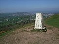 Summit of The Helm - geograph.org.uk - 1303374.jpg 640 × 480; 64 KB
-
 The A590 - geograph.org.uk - 3070685.jpg 3,991 × 2,738; 4.18 MB
-
 The footpath down to High House Farm - geograph.org.uk - 2830322.jpg 640 × 480; 87 KB
-
 The Helm - geograph.org.uk - 2254423.jpg 640 × 480; 41 KB
-
 The Helm - geograph.org.uk - 3892932.jpg 2,560 × 1,920; 2.92 MB
-
 The Helme - geograph.org.uk - 3692743.jpg 800 × 306; 49 KB
-
 The Lune Valley under the Howgill Fells - geograph.org.uk - 4281276.jpg 3,264 × 2,448; 3.36 MB
-
 The Punch Bowl - geograph.org.uk - 3892940.jpg 2,560 × 1,920; 2.08 MB
-
 The Punchbowl - Barrows Green - geograph.org.uk - 4037585.jpg 3,666 × 1,970; 3.22 MB
-

-
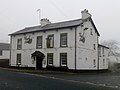
 Traffic lights by the Station Inn - geograph.org.uk - 3405566.jpg 3,872 × 2,592; 4.7 MB
-
 United Reformed Church, Stainton.jpg 640 × 480; 151 KB
-
 View towards The Helm - geograph.org.uk - 4531670.jpg 5,184 × 3,456; 6.53 MB
-
 Walkers and dog on The Helm ridge - geograph.org.uk - 2830416.jpg 800 × 503; 111 KB
-
 Wall and path, Crosscrakes - geograph.org.uk - 2040292.jpg 640 × 480; 118 KB
-
-
 Wood anemones, Saint Sunday's Beck - geograph.org.uk - 5350815.jpg 540 × 720; 157 KB


.jpg)


_-_geograph.org.uk_-_4532152.jpg)
_-_geograph.org.uk_-_4532158.jpg)


_-_geograph.org.uk_-_2040285.jpg)


