Category:Standard Maps of China
Media in category "Standard Maps of China"
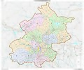
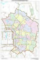
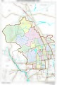
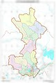
The following 24 files are in this category, out of 24 total.
-
 Mideast - National Boundary Reference Drawing Sample-Maps (China, 2014).jpg 3,531 × 2,610; 5.74 MB
-
 Standard Map of Beijing Administrative Boundary (2019).jpg 7,244 × 6,062; 14.48 MB
-
 Standard Map of Beijing Administrative Boundary 2(2019).jpg 2,368 × 2,532; 569 KB
-
 Standard Map of Changping District Administrative Boundary, Beijing(2019).jpg 4,964 × 3,475; 2.31 MB
-
 Standard Map of Chaoyang District Administrative Boundary, Beijing(2019).jpg 3,370 × 4,984; 2.75 MB
-
 Standard Map of Dongcheng District Administrative Boundary, Beijing(2019).jpg 3,380 × 4,999; 2.98 MB
-
 Standard Map of Fengtai District Administrative Boundary, Beijing(2019).jpg 4,928 × 3,445; 2.62 MB
-
 Standard Map of Fuyu City Administrative Boundary.jpg 1,320 × 1,726; 297 KB
-
 Standard Map of Haidian District Administrative Boundary, Beijing(2019).jpg 3,362 × 4,982; 2.53 MB
-
 Standard Map of Haidong City Administrative Boundary.jpg 1,320 × 880; 200 KB
-
 Standard Map of Huairou District Administrative Boundary, Beijing(2019).jpg 3,383 × 4,994; 1.97 MB
-
 Standard Map of Mile City Administrative Boundary.jpg 1,320 × 887; 182 KB
-
 Standard Map of Miyun District Administrative Boundary, Beijing(2019).jpg 4,928 × 3,485; 2.17 MB
-
 Standard Map of Pinggu District Administrative Boundary, Beijing(2019).jpg 4,928 × 3,485; 1.77 MB
-
 Standard Map of Shijingshan District Administrative Boundary, Beijing(2019).jpg 3,425 × 4,994; 1.72 MB
-
 Standard Map of Shunyi District Administrative Boundary, Beijing(2019).jpg 4,843 × 3,485; 2.2 MB
-
 Standard Map of Tongzhou District Administrative Boundary, Beijing(2019).jpg 3,419 × 4,982; 2.15 MB
-
 Standard Map of Wuhan City Administrative Boundary (2019).jpg 3,508 × 4,961; 10.16 MB
-
 Standard Map of Xicheng District Administrative Boundary, Beijing(2019).jpg 3,437 × 4,970; 3.01 MB
-
 Standard Map of Yanqing District Administrative Boundary, Beijing(2019).jpg 4,930 × 3,485; 2.03 MB
-

-
 The Map of the Second Batch of Standard South Tibet Place Names.jpg 5,827 × 4,114; 6.45 MB
-
 中华人民共和国香港特别行政区行政区域图(750000).png 984 × 803; 780 KB
-
 北京市行政区域界线基础地理底图(石景山区 - 黑白).jpg 3,383 × 4,954; 987 KB
.jpg)
.jpg)
.jpg)
.jpg)
.jpg)
.jpg)
.jpg)

.jpg)

.jpg)

.jpg)
.jpg)
.jpg)
.jpg)
.jpg)
.jpg)
.jpg)
.jpg)


