Category:Stannington, South Yorkshire
suburb of Sheffield, South Yorkshire, United Kingdom  | |||||
| Upload media | |||||
| Instance of | |||||
|---|---|---|---|---|---|
| Location | Bradfield, Sheffield, South Yorkshire, Yorkshire and the Humber, England | ||||
 | |||||
Subcategories
This category has the following 4 subcategories, out of 4 total.
R
- Rails packhorse bridge (3 F)
S
- Christ Church, Stannington (4 F)
Media in category "Stannington, South Yorkshire"
The following 46 files are in this category, out of 46 total.
-
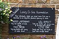 Accommodation at The Robin Hood Inn - geograph.org.uk - 971366.jpg 640 × 427; 92 KB
-
 Almshouses Sign, Ivy Road, Stannington, Sheffield - geograph.org.uk - 1700614.jpg 1,634 × 1,090; 440 KB
-
 Almshouses, Ivy Road, Stannington, Sheffield - geograph.org.uk - 1700609.jpg 2,576 × 1,932; 1.23 MB
-
 Black Lane, Loxley Valley, Sheffield - geograph.org.uk - 1709966.jpg 2,576 × 1,932; 1.3 MB
-
 Crawshaw Head - geograph.org.uk - 170823.jpg 640 × 480; 137 KB
-
 Dam Warning Sign, Loxley Valley - geograph.org.uk - 1025130.jpg 640 × 427; 139 KB
-
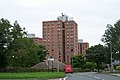
 Deer Park Flats, Stannington (geograph 5259050).jpg 4,831 × 3,603; 3.46 MB
-
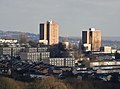
 Deer Park Tower Blocks, Stannington - geograph.org.uk - 972372.jpg 640 × 427; 70 KB
-
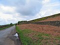
 Farmland near Stannington - geograph.org.uk - 1243011.jpg 640 × 480; 95 KB
-
 Fishing in the Loxley Valley - geograph.org.uk - 1025157.jpg 640 × 480; 146 KB
-
 Footbridge across the River Loxley - geograph.org.uk - 1024020.jpg 640 × 480; 131 KB
-
 Knowle Top from Underbank - geograph.org.uk - 972427.jpg 640 × 480; 50 KB
-
 KnowleTop Methodist Church - geograph.org.uk - 1588998.jpg 640 × 480; 106 KB
-
 Loxley Chase from Stannington 4.jpg 3,648 × 2,736; 2.34 MB
-
 Loxley Loos, Loxley Road, Sheffield - geograph.org.uk - 1606554.jpg 640 × 480; 91 KB
-

-
 Loxley Park. - geograph.org.uk - 132695.jpg 640 × 480; 230 KB
-

-
 Old Wheel Farm, Loxley Valley - geograph.org.uk - 1015123.jpg 640 × 480; 68 KB
-
 Oldfield Avenue - geograph.org.uk - 1242327.jpg 640 × 480; 55 KB
-
 Oldfield Road, Stannington - geograph.org.uk - 1243038.jpg 640 × 480; 70 KB
-

-
 Pond Farmhouse, Stannington.jpg 1,629 × 1,832; 3.14 MB
-
 River Loxley - geograph.org.uk - 1737732.jpg 640 × 426; 92 KB
-
 River Loxley at Malin Bridge, Sheffield - geograph.org.uk - 1541960.jpg 640 × 480; 130 KB
-
 Spillway, Rivelin Dams - geograph.org.uk - 1709709.jpg 480 × 640; 81 KB
-
 Spout House, Stannington.jpg 3,648 × 2,736; 3.66 MB
-
 Underbank Chapel, Stannington.JPG 3,648 × 2,736; 4.08 MB
-
 Stannington from Back Lane, Crosspool (geograph 4289738).jpg 4,898 × 3,590; 4.78 MB
-
 Stannington from Bell Hagg - geograph.org.uk - 1151535.jpg 640 × 480; 62 KB
-
 Stannington seen from Crookes (geograph 5292742).jpg 4,916 × 3,586; 4.05 MB
-
 Stannington Signs - 1 - geograph.org.uk - 972382.jpg 640 × 428; 93 KB
-
 Stannington Signs - 2 - geograph.org.uk - 972393.jpg 640 × 480; 84 KB
-
 Stannington stump cross.jpg 2,379 × 2,531; 2.95 MB
-
 Stanwood Methodist Church (geograph 5897171).jpg 640 × 339; 56 KB
-
 Stanwood Methodist Church, Stannington, Sheffield - geograph.org.uk - 5685606.jpg 3,348 × 2,040; 1.39 MB
-
 The Crown and Glove - geograph.org.uk - 1579766.jpg 640 × 480; 67 KB
-

-
 The Rose and Crown Stannington - geograph.org.uk - 1588983.jpg 640 × 480; 70 KB
-
 The Sportsman, Stannington - geograph.org.uk - 972414.jpg 640 × 480; 54 KB
-

-
 Water Pumping Station - geograph.org.uk - 970579.jpg 640 × 480; 62 KB
-
 Water Storage Tank - geograph.org.uk - 970585.jpg 640 × 480; 133 KB
-
 Well House, Stannington.jpg 3,648 × 2,736; 3.57 MB
-
 White House Farmhouse, Nethergate, Stannington.jpg 3,485 × 2,556; 3.99 MB
-
 Wraggs Crown Green Bowling Club - geograph.org.uk - 912985.jpg 640 × 480; 62 KB


.jpg)


.jpg)

.jpg)


.jpg)


