Category:Station Etten-Leur
| Object location | | View all coordinates using: OpenStreetMap |
|---|
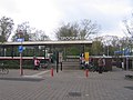
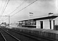
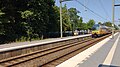
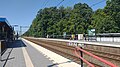
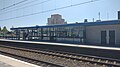
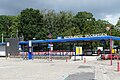
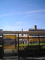
Nederlands: Afbeeldingen van het station Etten-Leur, Stationsplein, 4872 XL Etten-Leur. Gelegen nabij het centrum van Etten-Leur in de provincie Noord-Brabant in het zuiden van Nederland. Bereikbaar via de straat de Spoorlaan
railway station in the Netherlands .jpg) | |||||
| Upload media | |||||
| Instance of | |||||
|---|---|---|---|---|---|
| Location | Etten-Leur, North Brabant, Netherlands | ||||
| Architect | |||||
| Owned by | |||||
| Operator | |||||
| Date of official opening |
| ||||
| Connecting line | |||||
| Adjacent station | |||||
| official website | |||||
 | |||||
Subcategories
This category has only the following subcategory.
O
- Opening Station Etten-Leur (23 F)
Media in category "Station Etten-Leur"
The following 27 files are in this category, out of 27 total.
-
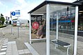
 Bushalte Station P1490824 copy2.jpg 1,337 × 893; 472 KB
-
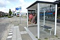
 Bushalte Station P1490835 copy.jpg 3,402 × 2,273; 1.51 MB
-
 Etten-leur 013.jpg 1,600 × 1,200; 749 KB
-
 Etten-leur 014.jpg 1,600 × 1,200; 973 KB
-
 Goederentrein op Etten-Leur-1.jpg 3,992 × 2,246; 2.74 MB
-
 Goederentrein op Etten-Leur.jpg 3,971 × 2,233; 2.25 MB
-
 HUA-150297-Gezicht op de voorgevel van het NS station Etten Leur te Etten Leur.jpg 1,455 × 1,161; 217 KB
-

-

-
 HUA-150300-Gezicht op het NS station Etten Leur te Etten Leur.jpg 3,900 × 3,947; 4.65 MB
-
 HUA-150301-Gezicht op het N.S.-station Etten-Leur te Etten-Leur.jpg 1,450 × 1,143; 245 KB
-
 HUA-153088-Gezicht op de perronzijde van het N.S.-station Etten-Leur te Etten-Leur.jpg 1,775 × 1,262; 331 KB
-
 Spoorlaan, Etten-Leur P1490835.jpg 4,000 × 2,672; 5.87 MB
-
 Station Etten-Leur (2023)-1.jpg 4,608 × 2,592; 4.55 MB
-
 Station Etten-Leur (2023)-2.jpg 3,768 × 2,119; 1.79 MB
-
 Station Etten-Leur (2023)-3.jpg 4,608 × 2,592; 4.81 MB
-
 Station Etten-Leur (2023)-4.jpg 4,608 × 2,592; 3.18 MB
-
 Station Etten-Leur (2023)-5.jpg 4,608 × 2,592; 4.23 MB
-
 Station Etten-Leur (2023)-6.jpg 4,608 × 2,592; 4.68 MB
-
 Station Etten-Leur (2023).jpg 4,608 × 2,592; 3.71 MB
-
 Station Etten-Leur P1490825.jpg 4,000 × 2,672; 6.08 MB
-
 Station Etten-Leur P1490826.jpg 4,000 × 2,672; 6.04 MB
-
 Station Etten-Leur P1490827.jpg 4,000 × 2,672; 6.15 MB
-
 Station Etten-Leur P1490831.jpg 4,000 × 2,672; 6.08 MB
-
 Station Etten-Leur P1490832.jpg 4,000 × 2,672; 5.96 MB
-
 Station-Etten-Leur Sint-Lambertuskerk-02.jpg 1,944 × 2,592; 1.07 MB
-
 Station-Etten-Leur-01.jpg 2,592 × 1,944; 990 KB


-1.jpg)
-2.jpg)
-3.jpg)
-4.jpg)
-5.jpg)
-6.jpg)


