Category:Stob a' Choire Odhair
945m high mountain on the Argyll and Bute/Highland boundary, Scotland, UK  | |||||
| Upload media | |||||
| Instance of | |||||
|---|---|---|---|---|---|
| Location |
| ||||
| Mountain range | |||||
| Topographic prominence |
| ||||
| Elevation above sea level |
| ||||
 | |||||
Media in category "Stob a' Choire Odhair"
The following 22 files are in this category, out of 22 total.
-
 Field by Achallader - geograph.org.uk - 716398.jpg 1,000 × 661; 173 KB
-
 Loch Buidhe from Stob a'Choire Odhair - geograph.org.uk - 750465.jpg 640 × 483; 35 KB
-

-

-
 Ptarmigan on Stob a' Choire Odhair - geograph.org.uk - 1003221.jpg 800 × 600; 228 KB
-
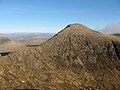
 Stob a Choire Odhair from the SE.jpg 1,623 × 1,146; 245 KB
-
 Stob a' Choire Odhair - geograph.org.uk - 1014573.jpg 640 × 429; 109 KB
-
 Stob a' Choire Odhair - geograph.org.uk - 1229966.jpg 640 × 480; 84 KB
-
 Stob a' Choire Odhair - geograph.org.uk - 331403.jpg 640 × 480; 82 KB
-

-
 The Aonach Eagach of Stob Ghabhar - geograph.org.uk - 902240.jpg 640 × 480; 101 KB
-
 The summit of Stob a' Choire Odhair - geograph.org.uk - 1003233.jpg 800 × 600; 228 KB
-
 The west ridge of Stob a' Choire Odhair - geograph.org.uk - 538585.jpg 800 × 600; 254 KB
-
 View north from Stob a' Choire Odhair - geograph.org.uk - 638345.jpg 800 × 600; 248 KB
-
 View northeast from Stob a' Choire Odhair - geograph.org.uk - 638351.jpg 800 × 600; 189 KB
-
 View northwest from Stob a' Choire Odhair - geograph.org.uk - 638352.jpg 800 × 600; 195 KB
-
 West ridge of Stob a' Choire Odhair - geograph.org.uk - 328393.jpg 640 × 480; 123 KB
-
 Beinn Toaig - geograph.org.uk - 358982.jpg 640 × 486; 77 KB
-
 Coire na Muic - geograph.org.uk - 540183.jpg 800 × 600; 179 KB
-
 Coire Toaig - geograph.org.uk - 538575.jpg 800 × 600; 237 KB
-
 Stob a' Choire Odhair - geograph.org.uk - 358970.jpg 640 × 544; 81 KB
-
 Stob a' Choire Odhair - geograph.org.uk - 358993.jpg 640 × 480; 120 KB


