Category:Stoke Abbott
English: Stoke Abbott is a village in west Dorset, England, two miles west of Beaminster. The village has a population of 209 (
Nederlands: Stoke Abbott is een Engels dorp in West Dorset, op 3 km van Beaminster. De plaats telt 209 inwoners (2001) en heeft veel tweede verblijven. De oudste nog bewaarde woning dateert van 1613, met heel wat gebouwen van de 18e eeuw. De kerktoren werd op 8 december 1828 getroffen door een blikseminslag en nadien deels in een andere stijl herbouwd.
village and civil parish in Dorset, United Kingdom  | |||||
| Upload media | |||||
| Instance of | |||||
|---|---|---|---|---|---|
| Location | Dorset, South West England, England | ||||
 | |||||
Subcategories
This category has only the following subcategory.
S
Media in category "Stoke Abbott"
The following 200 files are in this category, out of 257 total.
(previous page) (next page)-
 A dead tree at Monkwood Farm - geograph.org.uk - 529359.jpg 623 × 493; 40 KB
-
 A deer at Swilletts Farm - geograph.org.uk - 528504.jpg 623 × 493; 86 KB
-
 A Glimpse of Stoke Water House - geograph.org.uk - 462571.jpg 640 × 480; 191 KB
-
 A Very Neat Woodpile - geograph.org.uk - 2774737.jpg 640 × 492; 557 KB
-
 Approaching Chart Knolle - geograph.org.uk - 4023868.jpg 1,920 × 1,218; 448 KB
-
 Arable field near Yardley - geograph.org.uk - 5025761.jpg 3,060 × 1,949; 1.23 MB
-
 Ash on the lane to Four Ashes - geograph.org.uk - 5484283.jpg 2,048 × 3,072; 1.59 MB
-
 B3162 and Crabb's Hill - geograph.org.uk - 6185973.jpg 1,600 × 1,200; 346 KB
-
 B3162 near Yardley - geograph.org.uk - 5025764.jpg 3,072 × 2,048; 1.24 MB
-
 B3162 to Buck's Head - geograph.org.uk - 5025768.jpg 3,059 × 1,929; 1.13 MB
-
 Backney Farm - geograph.org.uk - 529300.jpg 623 × 493; 48 KB
-
 Barn, Stoke Knapp Farm - geograph.org.uk - 3658329.jpg 4,000 × 3,000; 2.84 MB
-
 Beech tree, Lewesdon Hill Lane - geograph.org.uk - 3657250.jpg 4,000 × 3,000; 2.81 MB
-

-
 Bend in the road under Crabb's Hill - geograph.org.uk - 2164153.jpg 640 × 480; 88 KB
-
 Blackney Lane - geograph.org.uk - 5484054.jpg 1,937 × 2,520; 834 KB
-
 Blackney, Little Venn Farm - geograph.org.uk - 935795.jpg 640 × 480; 62 KB
-
 Blackney, Venn Farm - geograph.org.uk - 935802.jpg 640 × 470; 102 KB
-
 Bluebells in Great Beach Coppice - geograph.org.uk - 4834313.jpg 640 × 480; 132 KB
-
 Bluebells, Lewesdon Hill - geograph.org.uk - 2379106.jpg 640 × 473; 540 KB
-
 Bluebells, Pucketts Wood - geograph.org.uk - 4042339.jpg 1,920 × 1,477; 887 KB
-
 Bridleway and woodland, Crabb's Hill - geograph.org.uk - 5601731.jpg 640 × 480; 151 KB
-
 Bridleway at Glitney Farm - geograph.org.uk - 5862507.jpg 640 × 427; 57 KB
-

-
 Bridleway sign west of Four Ashes - geograph.org.uk - 5484367.jpg 3,072 × 2,048; 1.62 MB
-
 Bridleway to Blackney - geograph.org.uk - 5484383.jpg 2,962 × 1,955; 1.73 MB
-

-
 Brimley Coombe - geograph.org.uk - 2600124.jpg 1,500 × 1,045; 1.35 MB
-
 Brimley Coombe Farm - geograph.org.uk - 5484305.jpg 3,068 × 1,831; 1.53 MB
-
 Brimley Coombe Farm - geograph.org.uk - 971544.jpg 640 × 480; 63 KB
-
 Brimley Farm (geograph 5484429).jpg 3,072 × 2,048; 1.41 MB
-
 Brimley Farm - geograph.org.uk - 4199743.jpg 640 × 480; 88 KB
-
 Brimley House near Stoke Abbott - geograph.org.uk - 4833966.jpg 640 × 480; 69 KB
-
 Chart Knolle - geograph.org.uk - 3935411.jpg 1,920 × 1,333; 364 KB
-
 Chart Knolle - geograph.org.uk - 4023932.jpg 1,920 × 1,126; 309 KB
-
 Chart Knolle - geograph.org.uk - 4840072.jpg 640 × 480; 89 KB
-

-
 Churchyard, Stoke Abbott - geograph.org.uk - 5484752.jpg 3,072 × 2,048; 2.03 MB
-
 Churchyard, Stoke Abbott - geograph.org.uk - 5484766.jpg 3,072 × 2,048; 1.51 MB
-
 Combe below Chart Knolle - geograph.org.uk - 3935207.jpg 3,890 × 2,658; 1.83 MB
-
 Contrast in fields by the Wessex Ridgeway - geograph.org.uk - 3935033.jpg 1,920 × 1,326; 507 KB
-
 Cottages, on Brimley Coombe Farm - geograph.org.uk - 971575.jpg 640 × 480; 80 KB
-
-
 Countryside west of Beaminster - geograph.org.uk - 4023980.jpg 1,920 × 1,440; 601 KB
-
 Crabb's Hill in autumn - geograph.org.uk - 4849493.jpg 480 × 640; 116 KB
-
 Descending Lewesdon Hill - geograph.org.uk - 3630286.jpg 1,920 × 2,560; 2.03 MB
-
 Donkeys, Stokewater Meadow - geograph.org.uk - 4042138.jpg 1,920 × 1,340; 432 KB
-
 Door to church, Stoke Abbott - geograph.org.uk - 5484905.jpg 2,048 × 3,072; 1.12 MB
-
 Dwarfed by Trees - geograph.org.uk - 870672.jpg 640 × 588; 215 KB
-
 Fallen beech, Lewesdon Hill Lane - geograph.org.uk - 5285978.jpg 3,776 × 2,520; 4.11 MB
-
 Farm road through Brimley Coombe - geograph.org.uk - 971562.jpg 640 × 480; 110 KB
-
 Farm track to Wall - geograph.org.uk - 971641.jpg 640 × 480; 104 KB
-
 Farm track, Brimley - geograph.org.uk - 5658223.jpg 1,024 × 683; 373 KB
-
 Farmland east of Stoke Abbott - geograph.org.uk - 5485200.jpg 3,060 × 1,811; 1.47 MB
-
 Farmland near Brimley Coombe Farm - geograph.org.uk - 5484373.jpg 3,072 × 2,048; 1.38 MB
-
 Field and view by the Wessex Ridgeway - geograph.org.uk - 3933799.jpg 1,920 × 1,284; 739 KB
-
 Field by Lewesdon Farm - geograph.org.uk - 2164155.jpg 640 × 480; 79 KB
-
 Field by the Wessex Ridgeway - geograph.org.uk - 3933867.jpg 1,920 × 1,168; 550 KB
-
 Field by Wessex Ridgeway - geograph.org.uk - 3935076.jpg 1,920 × 1,368; 691 KB
-
 Field near Laverstock - geograph.org.uk - 5409361.jpg 3,072 × 2,048; 1.28 MB
-
 Fields at Stoke Knapp - geograph.org.uk - 3934731.jpg 1,920 × 1,090; 487 KB
-
 Footbridge in Little Giant Wood - geograph.org.uk - 5070774.jpg 480 × 640; 111 KB
-
 Footpath near Four Ashes - geograph.org.uk - 4199231.jpg 640 × 480; 122 KB
-
 Footpath towards Gerrard's Hill - geograph.org.uk - 2731030.jpg 1,024 × 768; 330 KB
-
 Four Ashes - geograph.org.uk - 5410231.jpg 3,072 × 2,048; 1.4 MB
-
 Four Ashes Crossroads - geograph.org.uk - 4848849.jpg 620 × 640; 105 KB
-
 Fox wind vane at Stoke Knapp Farm - geograph.org.uk - 4815950.jpg 640 × 480; 57 KB
-
 Gate and fields by the Wessex Ridgeway - geograph.org.uk - 3935170.jpg 1,920 × 1,440; 772 KB
-
 Gate on Wessex Ridgeway - geograph.org.uk - 3935084.jpg 1,920 × 1,440; 775 KB
-
 George V postbox, Stoke Abbott - geograph.org.uk - 1114940.jpg 640 × 480; 184 KB
-
 Gerrard's Hill - geograph.org.uk - 1232634.jpg 640 × 480; 66 KB
-
 Gerrard's Hill - geograph.org.uk - 3934714.jpg 1,920 × 1,440; 529 KB
-
 Gerrard's Hill - geograph.org.uk - 3938043.jpg 1,920 × 2,560; 1.24 MB
-
 Gerrard's Hill - geograph.org.uk - 3938072.jpg 1,920 × 1,440; 526 KB
-
 Gerrard's Hill - geograph.org.uk - 4024153.jpg 1,920 × 1,364; 810 KB
-
 Gerrard's Hill - geograph.org.uk - 4414552.jpg 3,072 × 2,304; 3.15 MB
-
 Gravestone, St Mary's Churchyard, Stoke Abbott - geograph.org.uk - 5410374.jpg 2,048 × 3,072; 1.62 MB
-

-
 Hanging Banks Coppice - geograph.org.uk - 5484420.jpg 3,072 × 2,048; 1.31 MB
-
 Heading towards a dead end - geograph.org.uk - 5862536.jpg 640 × 427; 68 KB
-
 Hedgerow near Blackney - geograph.org.uk - 4084428.jpg 640 × 480; 106 KB
-
 Hillside below Chart Knolle - geograph.org.uk - 3935095.jpg 1,920 × 1,264; 531 KB
-
 Inside St Mary, Stoke Abbott (IX) - geograph.org.uk - 3969595.jpg 480 × 640; 53 KB
-
 Jubilee Trail near Laverstock Farm - geograph.org.uk - 5409281.jpg 3,072 × 2,048; 1.49 MB
-
 Jubilee Trail west of Four Ashes - geograph.org.uk - 5484318.jpg 3,060 × 1,722; 1.52 MB
-
 Jubilee Trail west of Four Ashes - geograph.org.uk - 5484322.jpg 3,048 × 1,924; 1.45 MB
-
 Junction on B3164 - geograph.org.uk - 4714991.jpg 1,920 × 1,386; 983 KB
-

-
 Lane to Blackney - geograph.org.uk - 5484029.jpg 3,052 × 1,790; 1.19 MB
-
 Lane to Brimley Farm - geograph.org.uk - 5484435.jpg 2,048 × 2,896; 1.55 MB
-
 Lane to Four Ashes - geograph.org.uk - 5484416.jpg 2,030 × 2,988; 1.44 MB
-
 Lane to Horsehill Farm - geograph.org.uk - 5485068.jpg 3,072 × 2,048; 1.55 MB
-
 Lane to Laverstock Farm - geograph.org.uk - 5484073.jpg 3,062 × 1,761; 1.44 MB
-
 Lane to Pilsdon Pen - geograph.org.uk - 5484044.jpg 2,048 × 3,072; 1.32 MB
-
 Lane to Stoke Abbott - geograph.org.uk - 5484464.jpg 3,072 × 2,048; 1.54 MB
-
 Lane to Stoke Abbott - geograph.org.uk - 5485012.jpg 3,072 × 2,048; 1.27 MB
-
 Lane to Stoke Abbott - geograph.org.uk - 5485088.jpg 2,018 × 2,843; 1.38 MB
-
 Laverstock House - geograph.org.uk - 4834165.jpg 640 × 480; 73 KB
-
 Lewesdon Hill Lane - geograph.org.uk - 3657234.jpg 4,000 × 3,000; 7.43 MB
-
 Lewesdon Hill Lane - geograph.org.uk - 3933536.jpg 1,920 × 1,440; 1.12 MB
-
 Lewesdon Hill Lane - geograph.org.uk - 4840051.jpg 640 × 480; 148 KB
-
 Lewesdon Hill Lane view - geograph.org.uk - 5904287.jpg 2,048 × 1,536; 876 KB
-
-
 Little Giant Wood - geograph.org.uk - 5485258.jpg 3,072 × 2,048; 1.44 MB
-
 Long Barrow Lane - geograph.org.uk - 4200204.jpg 640 × 480; 89 KB
-
 Lower Monkwood Farm - geograph.org.uk - 5862513.jpg 640 × 427; 58 KB
-
 Maize Field near Monkwood - geograph.org.uk - 4084396.jpg 640 × 480; 140 KB
-
 Narrow Minor Road (geograph 4414603).jpg 3,072 × 2,304; 2.78 MB
-
 Near Laverstock - geograph.org.uk - 5409316.jpg 1,626 × 2,457; 1,008 KB
-
 North from the Wessex Ridgeway - geograph.org.uk - 3935538.jpg 1,920 × 1,261; 579 KB
-
 North from the Wessex Ridgeway - geograph.org.uk - 4024118.jpg 1,920 × 1,151; 453 KB
-
 Notices, St Mary's church, Stoke Abbott - geograph.org.uk - 5484956.jpg 1,832 × 2,746; 706 KB
-
 Old Farm Buildings at Brimley Farm - geograph.org.uk - 4199735.jpg 640 × 480; 82 KB
-
 On Gerrard's Hill - geograph.org.uk - 4023942.jpg 1,920 × 1,440; 968 KB
-
 Outbuilding attached to Chart Knolle - geograph.org.uk - 5270114.jpg 5,184 × 3,456; 6.83 MB
-

-
 Pasture, Brimley - geograph.org.uk - 5658224.jpg 1,024 × 683; 393 KB
-
 Path and bridleway crossing at Chartknolle - geograph.org.uk - 5285991.jpg 3,776 × 2,520; 4.01 MB
-
 Path from Brimley Coombe to Wall - geograph.org.uk - 971590.jpg 480 × 640; 136 KB
-
 Path past Chart Knolle - geograph.org.uk - 4023820.jpg 1,920 × 1,280; 724 KB
-
 Path Through The Woods - geograph.org.uk - 2379114.jpg 640 × 432; 514 KB
-
 Path, Crabb's Hill - geograph.org.uk - 4280690.jpg 800 × 1,200; 360 KB
-
 Pheasant Cover ^ - geograph.org.uk - 3630276.jpg 2,250 × 1,254; 572 KB
-
 Pilsdon Pen from Lewesdon Hill - geograph.org.uk - 2774731.jpg 640 × 434; 331 KB
-
 Ploughing Brimley Farm - geograph.org.uk - 870664.jpg 640 × 399; 117 KB
-
 Power pole by the Wessex Ridgeway - geograph.org.uk - 3934966.jpg 1,920 × 1,440; 381 KB
-
 Private Driveway near Stoke Abbott - geograph.org.uk - 4199921.jpg 640 × 480; 160 KB
-

-
 Private Road To Chart Knolle - geograph.org.uk - 4414587.jpg 3,072 × 2,304; 2.13 MB
-
 Rabbit warren, Lewesdon Hill Lane - geograph.org.uk - 3933767.jpg 1,920 × 1,440; 793 KB
-
 Road junction at Four Ashes - geograph.org.uk - 2164151.jpg 640 × 480; 120 KB
-
 Road leading to Glitney Farm - geograph.org.uk - 529373.jpg 623 × 493; 49 KB
-
 Roadside verge by Long Barrow Lane - geograph.org.uk - 5485185.jpg 3,072 × 2,048; 1.51 MB
-
 Sign for the New Inn - geograph.org.uk - 1114935.jpg 480 × 640; 122 KB
-
 Signpost at Four Ashes - geograph.org.uk - 5410260.jpg 3,072 × 2,048; 1.7 MB
-
 Signpost on Jubilee Trail - geograph.org.uk - 5409304.jpg 3,072 × 2,048; 1.58 MB
-
 Signpost, Wessex Ridgeway - geograph.org.uk - 3933781.jpg 1,920 × 2,560; 1.63 MB
-
 St Mary's Church, Stoke Abbott - geograph.org.uk - 5070734.jpg 640 × 480; 72 KB
-
 St Mary's Church, Stoke Abbott - geograph.org.uk - 5410347.jpg 2,849 × 2,261; 1.13 MB
-
 St Mary's Church, Stoke Abbott - geograph.org.uk - 5484974.jpg 2,725 × 1,845; 831 KB
-
 St Mary, Stoke Abbott- church hall (geograph 3969559).jpg 640 × 480; 83 KB
-
 Stand of trees and Triangulation Pillar atop Gerrards Hill - geograph.org.uk - 3935938.jpg 3,000 × 4,000; 4.89 MB
-
 Stile on the Wessex Ridgeway - geograph.org.uk - 4042137.jpg 1,920 × 2,560; 727 KB
-
 Stiles on Wessex Ridgeway - geograph.org.uk - 3938110.jpg 1,920 × 1,440; 989 KB
-
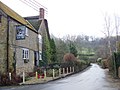
 Stoke Abbot - geograph.org.uk - 5658219.jpg 1,024 × 683; 413 KB
-
 Stoke Abbott (geograph 4199929).jpg 640 × 480; 81 KB
-
 Stoke Abbott, New Inn - geograph.org.uk - 1383327.jpg 640 × 480; 78 KB
-
 Stoke Abbott, The Anchor - geograph.org.uk - 1383333.jpg 640 × 480; 93 KB
-

-
 Stoke Abbott- Old Sawyers (geograph 4406435).jpg 640 × 480; 78 KB
-
 Stoke Knapp Cottage - geograph.org.uk - 4203114.jpg 640 × 480; 120 KB
-
 Stoke Knapp Farm - geograph.org.uk - 3934053.jpg 1,920 × 1,260; 397 KB
-
 Stoke Knapp Farm - geograph.org.uk - 3934063.jpg 1,920 × 1,440; 520 KB
-
 Stoke Knapp Farm - geograph.org.uk - 3934080.jpg 1,920 × 1,307; 421 KB
-
 Stoke Knapp Farm - geograph.org.uk - 5270107.jpg 5,184 × 3,456; 6.48 MB
-
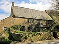
 Stoke Knapp Farmhouse and attached front walls - geograph.org.uk - 5285987.jpg 3,776 × 2,520; 4.15 MB
-
 Stoke Water - geograph.org.uk - 4042298.jpg 4,000 × 3,000; 4.24 MB
-
 Stoke Water - geograph.org.uk - 4042300.jpg 1,920 × 2,560; 1.38 MB
-
 Stoke Water valley - geograph.org.uk - 4024381.jpg 1,920 × 1,440; 752 KB
-
 Stoke Water valley from Gerrard's Hill - geograph.org.uk - 3935713.jpg 1,920 × 1,440; 787 KB
-
 Stokewater Meadow - geograph.org.uk - 4024423.jpg 1,920 × 1,440; 471 KB
-
 Summit of Gerrard's Hill - geograph.org.uk - 5285997.jpg 3,776 × 2,520; 3.75 MB
-
 Sweed Moor - geograph.org.uk - 5484178.jpg 3,060 × 1,782; 1.31 MB
-
 Sweed Moor - geograph.org.uk - 5484268.jpg 3,062 × 1,968; 1.56 MB
-
 Sweed Moor - geograph.org.uk - 5484279.jpg 3,070 × 1,842; 1.19 MB
-
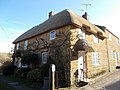
 Thatched cottage, Stoke Abbott - geograph.org.uk - 5484470.jpg 3,072 × 2,048; 1.5 MB
-
 The New Inn, Stoke Abbott - geograph.org.uk - 1114931.jpg 640 × 480; 94 KB
-

-

-
-

-

-

-

-

-
-

-

-

-

-
 The Orange Way in Dorset and Somerset (48) (geograph 3030092).jpg 800 × 600; 153 KB
-
 The Orange Way in Dorset and Somerset (49) (geograph 3030096).jpg 800 × 600; 152 KB
-

-

-

-

-

-
 The path to Wall - geograph.org.uk - 971627.jpg 480 × 640; 116 KB
-
 The Summit of Gerrard's Hill - geograph.org.uk - 5270122.jpg 5,184 × 3,456; 5.23 MB
-
 Towards Beaminster - geograph.org.uk - 4023966.jpg 1,920 × 1,157; 510 KB
-
 Towards Beaminster - geograph.org.uk - 4024330.jpg 1,920 × 1,219; 446 KB
-
 Towards Chart Knolle - geograph.org.uk - 3935434.jpg 1,920 × 1,440; 763 KB
-
 Towards Gerrard's Hill - geograph.org.uk - 5484997.jpg 3,072 × 2,048; 1.59 MB
-
 Towards Stoke Abbott - geograph.org.uk - 3935337.jpg 1,920 × 1,318; 463 KB
-
 Towards Stoke Water House - geograph.org.uk - 4024014.jpg 1,920 × 1,259; 388 KB
-
 Track near Stoke Water Farm - geograph.org.uk - 5485218.jpg 3,072 × 2,048; 1.38 MB
-
-
 Track, Sweed Moor - geograph.org.uk - 5484290.jpg 3,072 × 2,048; 1.6 MB
-
 Tree by the Wessex Ridgeway - geograph.org.uk - 4024338.jpg 1,920 × 2,295; 652 KB
-
 Tree near Brimley Farm - geograph.org.uk - 5410272.jpg 2,519 × 1,501; 948 KB


.jpg)


_-_geograph.org.uk_-_3969595.jpg)


.jpg)


.jpg)


.jpg)


.jpg)
.jpg)


_-_geograph.org.uk_-_3030021.jpg)
_-_geograph.org.uk_-_3030023.jpg)
_-_geograph.org.uk_-_3030026.jpg)
_-_geograph.org.uk_-_3030032.jpg)
_-_geograph.org.uk_-_3030035.jpg)
_-_geograph.org.uk_-_3030040.jpg)
_-_geograph.org.uk_-_3030048.jpg)
_-_geograph.org.uk_-_3030055.jpg)
_-_geograph.org.uk_-_3030061.jpg)
_-_geograph.org.uk_-_3030067.jpg)
_-_geograph.org.uk_-_3030073.jpg)
_-_geograph.org.uk_-_3030076.jpg)
_-_geograph.org.uk_-_3030086.jpg)
_(geograph_3030092).jpg)
_(geograph_3030096).jpg)
_-_geograph.org.uk_-_3030101.jpg)
_-_geograph.org.uk_-_3030949.jpg)
_-_geograph.org.uk_-_3030950.jpg)
_-_geograph.org.uk_-_3030954.jpg)
_-_geograph.org.uk_-_3030956.jpg)


