Category:Stratton, Dorset
English: Stratton is a civil parish in west Dorset, England, situated in the Frome valley five km (three miles) north west of Dorchester. The parish includes the village itself and the hamlets of Grimstone, Ash Hill and Wrackleford, all of which lie on or near main road, the A37. Ash Hill is a small estate east of the village near the railway. Wrackleford is a group of houses further east and centred about Wrackleford House and including Higher Wrackleford and Lower Wrackleford. In addition there are a number of isolated farms and houses including a few in an area called Langford near the Sydling Water in the north-west part of the parish.
village and civil parish in Dorset, England, United Kingdom .JPG) | |||||
| Upload media | |||||
| Instance of | |||||
|---|---|---|---|---|---|
| Location | Dorset, South West England, England | ||||
| official website | |||||
 | |||||
Subcategories
This category has the following 3 subcategories, out of 3 total.
G
S
Media in category "Stratton, Dorset"
The following 103 files are in this category, out of 103 total.
-
 A37 at Grimstone - geograph.org.uk - 4982152.jpg 1,600 × 1,187; 465 KB
-
 A37 at Wrackleford - geograph.org.uk - 550512.jpg 640 × 480; 86 KB
-
 A37 northbound - geograph.org.uk - 3002417.jpg 640 × 480; 60 KB
-
 A37 northbound - geograph.org.uk - 3002440.jpg 640 × 480; 62 KB
-
 A37 southbound - geograph.org.uk - 3286569.jpg 640 × 480; 58 KB
-
 A37 westbound - geograph.org.uk - 4399091.jpg 640 × 435; 60 KB
-
 A37 westbound - geograph.org.uk - 4399096.jpg 640 × 458; 37 KB
-
 A37 westbound - geograph.org.uk - 4399122.jpg 640 × 460; 54 KB
-
 A37, Grimstone - geograph.org.uk - 3002402.jpg 640 × 388; 64 KB
-
 A37, Muckleford - geograph.org.uk - 3002393.jpg 640 × 411; 51 KB
-
 A37, Stratton - geograph.org.uk - 3002377.jpg 640 × 440; 57 KB
-
 A37, Stratton - geograph.org.uk - 3002386.jpg 640 × 423; 59 KB
-
 A37, Sydling St. Nicholas - geograph.org.uk - 3002410.jpg 640 × 480; 67 KB
-
 A37, Wrackleford - geograph.org.uk - 3002362.jpg 640 × 480; 80 KB
-
 Abandoned Car in Floodwater - geograph.org.uk - 1158977.jpg 640 × 390; 75 KB
-
 Badger Latrine - geograph.org.uk - 2103662.jpg 640 × 480; 151 KB
-
 Bridlepath Gateway in Crete Bottom - geograph.org.uk - 2103593.jpg 640 × 480; 88 KB
-
 Copse and tumulus, Grimstone Down - geograph.org.uk - 1046514.jpg 640 × 428; 84 KB
-
 Countryside at Stratton Down - geograph.org.uk - 1049678.jpg 640 × 428; 81 KB
-
 Cream teas sign at St Mary, Stratton - geograph.org.uk - 3160273.jpg 640 × 480; 122 KB
-
 Crossing the railway line near Grimstone - geograph.org.uk - 5154177.jpg 640 × 426; 120 KB
-

-
-

-
 Dry Valley Stratton Down - geograph.org.uk - 1049677.jpg 640 × 428; 60 KB
-
 Entrance to Grimstone - geograph.org.uk - 3286556.jpg 640 × 480; 54 KB
-
 Entrance to Grimstone - geograph.org.uk - 4399105.jpg 640 × 479; 51 KB
-
 Entrance to Wrackleford - geograph.org.uk - 3286592.jpg 640 × 453; 60 KB
-
 Entrance to Wrakleford - geograph.org.uk - 3002356.jpg 640 × 480; 66 KB
-
 Farm Track to Stratton Down - geograph.org.uk - 958127.jpg 640 × 480; 80 KB
-
 Farmland, Stratton - geograph.org.uk - 540190.jpg 640 × 480; 194 KB
-
 Field of clover, Grimstone Down - geograph.org.uk - 545417.jpg 640 × 480; 170 KB
-
 Flooded A37 at Ash Hill - geograph.org.uk - 1158978.jpg 640 × 428; 66 KB
-
 Flooded A37 near Stratton - geograph.org.uk - 1158976.jpg 640 × 428; 80 KB
-
 Flooded Road near Stratton - geograph.org.uk - 1158980.jpg 640 × 425; 81 KB
-
 Flooding in the Frome Valley - geograph.org.uk - 1134697.jpg 640 × 424; 56 KB
-
 Flooding near Wrackleford - geograph.org.uk - 1134696.jpg 640 × 394; 74 KB
-
 Footpath across a paddock, near Charminster - geograph.org.uk - 3446768.jpg 4,608 × 3,072; 7.03 MB
-

-
 Former settlement on Stratton Down - geograph.org.uk - 5154280.jpg 640 × 426; 64 KB
-
 Grimstone , Dorset - geograph.org.uk - 1046512.jpg 640 × 419; 64 KB
-
 Grimstone Dairy - geograph.org.uk - 5154165.jpg 640 × 426; 45 KB
-
 Grimstone Down - geograph.org.uk - 908478.jpg 640 × 480; 129 KB
-
 Grimstone, River Frome - geograph.org.uk - 4727094.jpg 1,024 × 768; 137 KB
-
-
 Hog Hill Grimstone, Dorset - geograph.org.uk - 1046515.jpg 640 × 428; 80 KB
-
 House in the meadow - geograph.org.uk - 5373866.jpg 640 × 427; 88 KB
-
 Houses in Stratton - geograph.org.uk - 499281.jpg 640 × 480; 71 KB
-

-
 Jackman's Cross - geograph.org.uk - 1049475.jpg 640 × 428; 120 KB
-
 Jackman's Cross - geograph.org.uk - 4124884.jpg 1,600 × 1,200; 471 KB
-
 Jackman's Cross, Stratton Down - geograph.org.uk - 5154293.jpg 426 × 640; 119 KB
-
 Junction on A37 Dorchester Road - geograph.org.uk - 6179880.jpg 1,024 × 768; 227 KB
-
 Langford Farm - geograph.org.uk - 5416669.jpg 640 × 480; 162 KB
-
 Memorial to Joanna Loving, Wrackleford. - geograph.org.uk - 794182.jpg 640 × 426; 119 KB
-
 Milestone on Dorchester Road at Grimstone - geograph.org.uk - 3799294.jpg 1,536 × 1,152; 936 KB
-
 Muckleford Corner Toll House, Stratton (geograph 6115351).jpg 640 × 452; 91 KB
-
 Muddy Track, Grimstone Down - geograph.org.uk - 1046516.jpg 640 × 428; 90 KB
-

-
 Ordnance Survey Flush Bracket 213 - geograph.org.uk - 3940322.jpg 4,000 × 3,000; 3.16 MB
-

-
 Post box at Statton - geograph.org.uk - 3160268.jpg 640 × 480; 142 KB
-
 Rail bridge goes over the A37 at Stratton - geograph.org.uk - 4982137.jpg 1,600 × 1,050; 320 KB
-
 Railway bridge over A37 east of Stratton - geograph.org.uk - 3799322.jpg 1,536 × 1,024; 1,016 KB
-
 Railway track at Grimstone - geograph.org.uk - 1046513.jpg 640 × 428; 117 KB
-
 River Frome in flood. - geograph.org.uk - 655193.jpg 640 × 427; 72 KB
-

-
 Rivet on Old Mill, Grimstone - geograph.org.uk - 5154269.jpg 426 × 640; 104 KB
-
 Roman Road to Grimstone - geograph.org.uk - 730727.jpg 640 × 480; 131 KB
-
 Signpost at Watcombe Bottom - geograph.org.uk - 5154186.jpg 640 × 426; 112 KB
-
 Snapped^ - geograph.org.uk - 1049681.jpg 640 × 428; 119 KB
-
 Stratton Bottom - geograph.org.uk - 540186.jpg 640 × 480; 152 KB
-
 Stratton Bottom - geograph.org.uk - 545433.jpg 640 × 480; 149 KB
-
 Stratton Down - geograph.org.uk - 540181.jpg 640 × 480; 183 KB
-
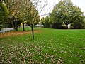 Stratton Village Green - geograph.org.uk - 4726934.jpg 1,024 × 768; 258 KB
-
 Stratton Village Hall - geograph.org.uk - 4726923.jpg 1,024 × 768; 146 KB
-
 Stratton, Dorset Jackman's Cross (Apr 2007).JPG 1,520 × 2,032; 1.08 MB
-
 Stratton, footpath - geograph.org.uk - 4727083.jpg 1,024 × 768; 204 KB
-
 Stratton, former school - geograph.org.uk - 4726944.jpg 1,024 × 768; 217 KB
-
 Stratton, Meadow Bottom - geograph.org.uk - 4727036.jpg 1,024 × 768; 140 KB
-
 Stratton, postbox - geograph.org.uk - 4727047.jpg 1,024 × 768; 248 KB
-
 Stratton, Saxon Arms - geograph.org.uk - 4726914.jpg 1,024 × 764; 180 KB
-
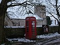 Stratton, the telephone box - geograph.org.uk - 3304708.jpg 640 × 480; 106 KB
-
 Stream at Stratton - geograph.org.uk - 3446985.jpg 4,608 × 3,072; 7.25 MB
-
 Sydling Brook, near Frampton - geograph.org.uk - 2344254.jpg 1,280 × 960; 440 KB
-
 Sydling Valley, water meadows - geograph.org.uk - 2344267.jpg 1,280 × 960; 407 KB
-
 Thatched cottage - Grimstone - geograph.org.uk - 1889399.jpg 527 × 640; 93 KB
-
 Thatched Cottage in Stratton - geograph.org.uk - 108065.jpg 640 × 480; 117 KB
-
 The Mill, Grimstone - geograph.org.uk - 5154274.jpg 426 × 640; 28 KB
-
 The Old Bull Inn, Stratton - geograph.org.uk - 5672271.jpg 3,648 × 2,736; 2.55 MB
-
 The Old Bull Inn, Stratton - geograph.org.uk - 5672275.jpg 3,648 × 2,736; 2.91 MB
-
 The Saxon Arms, Stratton - geograph.org.uk - 3668202.jpg 4,147 × 2,566; 7.8 MB
-
 The Saxon Inn, Stratton - geograph.org.uk - 2346140.jpg 1,280 × 960; 354 KB
-
 The Square, Stratton - geograph.org.uk - 5672281.jpg 3,648 × 2,736; 2.84 MB
-
 The Sydling valley near Grimstone - geograph.org.uk - 551663.jpg 640 × 480; 149 KB
-

-
 Tumulus on Grimstone Down - geograph.org.uk - 5154285.jpg 640 × 426; 123 KB
-

-
 View over fields to Stratton - geograph.org.uk - 3446794.jpg 4,608 × 3,072; 5.89 MB
-
 Village green and sign for Saxon Arms inn, Stratton - geograph.org.uk - 3799315.jpg 1,536 × 1,152; 1.09 MB
-
 Woods and Tumulus - geograph.org.uk - 1049671.jpg 640 × 446; 165 KB
-
 Direction post at Three Corners - geograph.org.uk - 151967.jpg 480 × 640; 165 KB
-


_-_geograph.org.uk_-_4842020.jpg)
_-_geograph.org.uk_-_4842024.jpg)
_-_geograph.org.uk_-_4842032.jpg)


.jpg)


