Category:Streams in Hertfordshire
Ceremonial counties of England: Bedfordshire · Berkshire · Buckinghamshire · Cambridgeshire · Cheshire · Cornwall · Cumbria · Derbyshire · Devon · Dorset · Durham · East Riding of Yorkshire · East Sussex · Essex · Gloucestershire · Greater London · Greater Manchester · Hampshire · Herefordshire · Hertfordshire · Kent · Lancashire · Leicestershire · Lincolnshire · Merseyside · Norfolk · North Yorkshire · Northamptonshire · Northumberland · Nottinghamshire · Oxfordshire · Rutland · Shropshire · Somerset · South Yorkshire · Staffordshire · Suffolk · Surrey · Tyne and Wear · Warwickshire · West Midlands · West Sussex · West Yorkshire · Wiltshire · Worcestershire
City-counties: Bristol ·
Former historic counties:
Other former counties:
City-counties: Bristol ·
Former historic counties:
Other former counties:
Subcategories
This category has the following 3 subcategories, out of 3 total.
Media in category "Streams in Hertfordshire"
The following 31 files are in this category, out of 31 total.
-
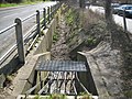 Brickendon Brook in Hertford (1) - geograph.org.uk - 723857.jpg 640 × 480; 120 KB
-
 Brickendon Brook in Hertford (2) - geograph.org.uk - 723868.jpg 640 × 480; 110 KB
-
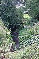 Brook by Saffron Green - geograph.org.uk - 920955.jpg 427 × 640; 282 KB
-
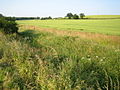
 Brook near Warrengate Farm - geograph.org.uk - 1416773.jpg 2,304 × 3,072; 3.04 MB
-

-
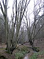
 Cuffley Brook, Northaw Great Wood - geograph.org.uk - 448376.jpg 480 × 640; 138 KB
-
 Dane End Tributary and Smart's Hill - geograph.org.uk - 194261.jpg 640 × 480; 130 KB
-
 From the Old to the New - geograph.org.uk - 239217.jpg 480 × 640; 243 KB
-
 Frozen River, Tollgate Road, North Mymms. - geograph.org.uk - 111800.jpg 479 × 640; 147 KB
-
 Green stream - geograph.org.uk - 607557.jpg 540 × 640; 202 KB
-
 Hunsdon Brook - geograph.org.uk - 320442.jpg 640 × 428; 208 KB
-
 Junction of Rowbourne Brook and another - geograph.org.uk - 448405.jpg 640 × 480; 131 KB
-

-
 Marshy ground alongside Watery Lane - geograph.org.uk - 606842.jpg 448 × 640; 175 KB
-
 Mimmshall Brook in Water End - geograph.org.uk - 1037519.jpg 640 × 480; 131 KB
-
 Mimmshall Brook near Potters Bar - geograph.org.uk - 1037732.jpg 640 × 480; 121 KB
-
 Mimmshall Brook near Potters Bar - geograph.org.uk - 140720.jpg 640 × 480; 134 KB
-
 Radlett Brook - geograph.org.uk - 1265048.jpg 640 × 480; 132 KB
-
 Radlett Brook - geograph.org.uk - 1266362.jpg 640 × 480; 140 KB
-
 Radlett, Tykes Water - geograph.org.uk - 89392.jpg 640 × 480; 158 KB
-
 Rags Brook in Goff's Oak - geograph.org.uk - 202081.jpg 640 × 480; 154 KB
-
 Spital Brook on Ermine Street - geograph.org.uk - 787102.jpg 640 × 480; 133 KB
-
 Spital Brook on Ermine Street - geograph.org.uk - 787133.jpg 640 × 480; 137 KB
-
 Spital Brook, Cowheath Wood - geograph.org.uk - 1737284.jpg 1,200 × 1,600; 634 KB
-
 Stream by Blanche Lane, Ridge - geograph.org.uk - 136281.jpg 480 × 640; 283 KB
-
 Stream near Ardeley - geograph.org.uk - 214663.jpg 640 × 480; 125 KB
-

-
 Bridge over The Old Bourne - geograph.org.uk - 214494.jpg 640 × 480; 234 KB
-
 Pix Brook - geograph.org.uk - 384432.jpg 640 × 480; 100 KB
-

-
 Stevenage Brook near Oaks Cross farm - geograph.org.uk - 120026.jpg 482 × 640; 188 KB
_-_geograph.org.uk_-_723857.jpg)
_-_geograph.org.uk_-_723868.jpg)


