Category:Street lights in Kent
Ceremonial counties of England: Bedfordshire · Berkshire · Buckinghamshire · Cambridgeshire · Cheshire · Cornwall · Cumbria · Derbyshire · Devon · Dorset · Durham · East Riding of Yorkshire · East Sussex · Essex · Gloucestershire · Greater London · Greater Manchester · Hampshire · Herefordshire · Hertfordshire · Isle of Wight · Kent · Lancashire · Leicestershire · Lincolnshire · Merseyside · Norfolk · North Yorkshire · Northamptonshire · Northumberland · Nottinghamshire · Oxfordshire · Rutland · Shropshire · Somerset · South Yorkshire · Staffordshire · Suffolk · Surrey · Tyne and Wear · Warwickshire · West Midlands · West Sussex · West Yorkshire · Wiltshire · Worcestershire
City-counties: Bristol ·
Former historic counties:
Other former counties:
City-counties: Bristol ·
Former historic counties:
Other former counties:
Media in category "Street lights in Kent"
The following 41 files are in this category, out of 41 total.
-

-
 19th-century municipal buildings Margate Kent England.jpg 2,500 × 2,500; 3.32 MB
-
 Albert Terrace Margate Kent England.jpg 3,000 × 1,689; 3.48 MB
-
 Beachfront lamp post Viking Bay Broadstairs Kent England.jpg 4,000 × 2,667; 4.84 MB
-
 Al fresco eating at The Parade in Margate Kent England.jpg 3,000 × 2,000; 4.12 MB
-
 Another gas lantern in a front garden^ - geograph.org.uk - 1485572.jpg 640 × 480; 128 KB
-
 Bayfront lamp standard Viking Bay promenade Broadstairs Kent England.jpg 2,000 × 3,000; 2.46 MB
-
 Beachfront lamp posts Viking Bay Broadstairs Kent England.jpg 3,648 × 5,472; 14.95 MB
-
 Beachside lamp standard Margate Kent England.jpg 2,000 × 3,000; 2.23 MB
-
 Broadstairs Bay from the Pier - geograph.org.uk - 347299.jpg 640 × 480; 106 KB
-

-
-
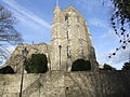
 Holy Trinity Church. Broadstairs - geograph.org.uk - 1203164.jpg 640 × 428; 108 KB
-
 Buenos Ayres café Margate Kent England.jpg 3,000 × 2,000; 3.23 MB
-
 Canterbury Road lamp post Margate Kent England.jpg 2,250 × 3,000; 2.55 MB
-
 Canterbury - St Alphege.jpg 1,200 × 794; 266 KB
-
 St Alphege Lane - geograph.org.uk - 67729.jpg 640 × 477; 130 KB
-
 St Mary the Virgin Church, Chalk - geograph.org.uk - 1088974.jpg 481 × 640; 85 KB
-
 St. Mary's, Chalk - geograph.org.uk - 1402364.jpg 640 × 480; 91 KB
-
 St Martin, Cheriton, Kent - Tower - geograph.org.uk - 326036.jpg 497 × 640; 156 KB
-
 Chillenden Kent England - fingerposts and street light.jpg 2,000 × 3,000; 4.35 MB
-
 Easole Street, Nonington, Kent, England - road looking southeast.jpg 3,000 × 2,250; 5.38 MB
-
 Eastchurch Sheppey 9215.JPG 3,488 × 2,616; 2.26 MB
-
 St John's Church, Folkestone - geograph.org.uk - 1150003.jpg 640 × 481; 83 KB
-
 MaidstoneAllSaints0114.JPG 2,048 × 1,536; 778 KB
-
 Riverhead Church - geograph.org.uk - 19984.jpg 640 × 475; 76 KB
-
 Rochester, UK - panoramio (3).jpg 1,600 × 1,200; 327 KB
-
 Elim Pentecostal Church, Rochester - geograph.org.uk - 1044604.jpg 481 × 640; 88 KB
-
 St. Peter's Church, Rochester - geograph.org.uk - 1044597.jpg 640 × 481; 63 KB
-
 Church of St Nicholas, St Nicholas at Wade.jpg 640 × 480; 55 KB
-
 The Church of St Nicholas - geograph.org.uk - 355117.jpg 620 × 457; 45 KB
-
 St John the Baptist's Church, Sevenoaks.JPG 2,592 × 1,944; 766 KB
-
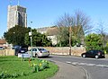
 Holy Trinity, Sittingbourne, Kent - geograph.org.uk - 324731.jpg 640 × 425; 107 KB
-
 St Justus Catholic Church, Strood - geograph.org.uk - 1053613.jpg 640 × 481; 83 KB
-
 All Saints Church, Swanscombe (1) - geograph.org.uk - 1411876.jpg 640 × 480; 66 KB
-
 High Street, Tenterden. Kent - geograph.org.uk - 1606186.jpg 640 × 480; 123 KB
-
 St. Mildred's Church, Tenterden, Kent.JPG 3,505 × 2,782; 1.28 MB
-
 St Mildred, Tenterden, the tower.JPG 1,536 × 2,048; 1.22 MB
-
 St Peter's Church, Bayhall Road, Tunbridge Wells.JPG 1,860 × 2,300; 563 KB
-
 Baptist Church, Upper Grosvenor Rd - geograph.org.uk - 1671850.jpg 640 × 430; 118 KB
-


.jpg)


_-_geograph.org.uk_-_1411876.jpg)


