Category:Street lights in the East Riding of Yorkshire
Subcategories
This category has the following 2 subcategories, out of 2 total.
K
L
Media in category "Street lights in the East Riding of Yorkshire"
The following 118 files are in this category, out of 118 total.
-
 A Brighter Future (geograph 5555143).jpg 4,398 × 2,925; 2.2 MB
-
 A path leading to Springhead Avenue, Anlaby (geograph 3309156).jpg 800 × 600; 133 KB
-
 A164 (geograph 5355889).jpg 640 × 426; 63 KB
-
 A164 near West Ella - geograph.org.uk - 87905.jpg 640 × 480; 122 KB
-
 A164 north of Willerby (geograph 3802095).jpg 2,846 × 1,862; 2.81 MB
-
 A164 straight to the Willerby Hill roundabout (geograph 3802104).jpg 2,630 × 1,706; 2.46 MB
-
 A164 Willerby bypass (geograph 6463042).jpg 1,024 × 768; 107 KB
-
 A63 eastbound at Melton (geograph 5254433).jpg 640 × 511; 63 KB
-
 A63 Sep23 East Riding New Lighting 01.jpg 4,176 × 2,784; 3.42 MB
-
 A63 towards the M62 - geograph.org.uk - 1462053.jpg 640 × 491; 48 KB
-
 A63 westbound (geograph 5658077).jpg 640 × 480; 46 KB
-
 A63(T) - geograph.org.uk - 535148.jpg 640 × 480; 124 KB
-
 A63(T) 1.jpg 1,024 × 768; 195 KB
-
 A63, Melton - geograph.org.uk - 584121.jpg 640 × 440; 165 KB
-
 Another field going for housing (geograph 4881133).jpg 4,608 × 3,456; 5.84 MB
-
 Approaching Willerby Hill Roundabout, A164 (geograph 5355894).jpg 640 × 426; 54 KB
-
 Bellcroft Lane - geograph.org.uk - 51696.jpg 640 × 480; 151 KB
-
-
 Boothferry Road - geograph.org.uk - 292870.jpg 640 × 384; 88 KB
-
 Boothferry Road, Goole.jpg 2,403 × 1,661; 2.35 MB
-
 Bridlington 1.jpg 3,072 × 2,304; 3.06 MB
-
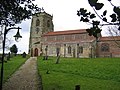
 Bridlington Priory Church 2009 03 20.jpg 640 × 480; 138 KB
-
 Burton Pidsea main road - geograph.org.uk - 45247.jpg 640 × 441; 74 KB
-
 Clive Sullivan Way, Hull IMG 6664 - panoramio.jpg 1,400 × 916; 393 KB
-
 Cottingham IMG 7699 - panoramio.jpg 1,109 × 1,600; 802 KB
-
 Cottingham, Station Walk - panoramio.jpg 1,067 × 1,600; 769 KB
-
 Crossroads in Kilnwick (geograph 6522296).jpg 1,024 × 683; 497 KB
-
 Defibrillator on Church Lane, Nunburnholme (geograph 7046599).jpg 1,024 × 739; 156 KB
-
 Field Head Facing South - geograph.org.uk - 725812.jpg 640 × 480; 63 KB
-
 Fish or chips next^ - geograph.org.uk - 1065668.jpg 640 × 480; 265 KB
-
 Focus, Willerby - geograph.org.uk - 177945.jpg 640 × 480; 79 KB
-
 Footbridge over the A63(T) - geograph.org.uk - 536454.jpg 640 × 480; 122 KB
-
 Footpath to Saltend - geograph.org.uk - 792393.jpg 640 × 621; 95 KB
-
 Footpath to the A63 footbridge - geograph.org.uk - 1199898.jpg 480 × 640; 102 KB
-
 Gibson Lane, Melton (geograph 4609104).jpg 1,200 × 818; 324 KB
-
 Grovehill Lock.JPG 2,272 × 1,704; 1.27 MB
-

-
 Hive, East Riding of Yorkshire.jpg 640 × 480; 104 KB
-
 Hornsea 2.jpg 3,072 × 2,304; 2.72 MB
-
 Hornsea Prom - geograph.org.uk - 515872.jpg 523 × 640; 66 KB
-
 Hornsea Promenade - geograph.org.uk - 324674.jpg 640 × 375; 91 KB
-
 Hornsea Promenade - geograph.org.uk - 360308.jpg 640 × 480; 70 KB
-
 Houses on Kitchen Lane, Beverley (geograph 4402462).jpg 1,600 × 1,062; 722 KB
-
 St Thomas Church, Hotham Road South - geograph.org.uk - 407702.jpg 640 × 510; 238 KB
-
 Keepers Cottage Eske Lane.jpg 640 × 480; 94 KB
-
 Kenley House Farm - geograph.org.uk - 34856.jpg 640 × 480; 77 KB
-
 George Lamb Memorial Chapel - geograph.org.uk - 453743.jpg 640 × 463; 167 KB
-
 The Mission - geograph.org.uk - 240495.jpg 640 × 571; 134 KB
-
 The Mission, Dagger Lane - geograph.org.uk - 312355.jpg 412 × 640; 131 KB
-
 The Mission, Posterngate - geograph.org.uk - 289774.jpg 640 × 476; 80 KB
-
 Swedish Church, Hull. - geograph.org.uk - 525969.jpg 640 × 426; 90 KB
-
 060-SFEC-HULL-20070329-ST MARYS LOWGATE.JPG 3,888 × 2,592; 1.12 MB
-
 Hull Church of St Mary (cropped).jpg 631 × 684; 210 KB
-
 Hull Church of St Mary.jpg 739 × 702; 252 KB
-
 St. Mary's Church - geograph.org.uk - 241081.jpg 425 × 640; 102 KB
-

-
 Ladysmith Road off The Parkway, Willerby (geograph 3741751).jpg 1,024 × 681; 209 KB
-
 Leven - East - geograph.org.uk - 72569.jpg 640 × 480; 118 KB
-
 Main Street Burstwick.jpg 640 × 480; 87 KB
-
 Main Street, Willerby (geograph 4479971).jpg 2,448 × 1,624; 1.81 MB
-
 Main Street, Willerby (geograph 6127926).jpg 1,280 × 960; 975 KB
-
 Main Street, Willerby (north) - geograph.org.uk - 405101.jpg 640 × 480; 150 KB
-
 Main Street, Willerby (south) - geograph.org.uk - 405108.jpg 640 × 480; 134 KB
-
 Main Street, Willerby at Willerby Low Road (geograph 4481065).jpg 2,448 × 1,624; 1.62 MB
-
 Annandale Road, Greatfield Estate - geograph.org.uk - 20417.jpg 640 × 480; 94 KB
-
 Market Green, Cottingham - geograph.org.uk - 879320.jpg 480 × 640; 87 KB
-
 Market Place Driffield.jpg 640 × 481; 114 KB
-
 Market Weighton Roundabout - geograph.org.uk - 825168.jpg 640 × 485; 166 KB
-
 Medici Ristorante Italiano - geograph.org.uk - 1462065.jpg 640 × 480; 87 KB
-
 Melton Junction - geograph.org.uk - 901039.jpg 498 × 640; 96 KB
-
 National Cycle Route 65, Melton (geograph 5658053).jpg 640 × 480; 57 KB
-
 New Street Lights for Sheriff Highway (geograph 5379492).jpg 3,197 × 4,061; 1.71 MB
-
 Overton Avenue near Collynson Close (geograph 4478491).jpg 2,448 × 1,624; 712 KB
-
 Path leading to Kitchen Lane, Beverley (geograph 4402441).jpg 1,600 × 1,062; 902 KB
-
 Path leading to Wolfreton Garth, Kirk Ella (geograph 5194606).jpg 1,600 × 1,065; 788 KB
-

-
 Public house and flats on South Ella Way (geograph 6129973).jpg 800 × 456; 72 KB
-
 Quiet day on the Prom - geograph.org.uk - 1220760.jpg 640 × 448; 61 KB
-
 Saint Marys Hall Cottingham.jpg 612 × 640; 102 KB
-
 Sancton Main Road.jpg 216 × 285; 10 KB
-
 Seafront, Withernsea - geograph.org.uk - 51712.jpg 640 × 480; 111 KB
-
 Seaton House 1.jpg 640 × 354; 176 KB
-
 Seaton House.jpg 640 × 427; 214 KB
-
 Methodist Church - geograph.org.uk - 452638.jpg 640 × 480; 92 KB
-
 Methodist Church, Skidby - geograph.org.uk - 1733550.jpg 800 × 615; 104 KB
-
 Skidby IMG 1894 - panoramio.jpg 1,200 × 767; 251 KB
-
 St John the Baptist Church Carnaby.jpg 640 × 480; 109 KB
-
 St Mary's Avenue, Cottingham (geograph 3307609).jpg 640 × 480; 53 KB
-
 St. Andrew's Church, Baker Street - geograph.org.uk - 766075.jpg 640 × 420; 107 KB
-
 Street Lights at the side of Saltend Flyover (geograph 3264198).jpg 1,814 × 2,627; 952 KB
-
 The Anlaby to Beverley road. - geograph.org.uk - 63732.jpg 640 × 480; 95 KB
-
 The end of the promenade (geograph 2096143).jpg 800 × 600; 175 KB
-
 The entrance to Willerby Hill Business Park (geograph 6231823).jpg 1,872 × 1,204; 1.5 MB
-
 The Fairway, West Ella - geograph.org.uk - 1000359.jpg 640 × 475; 120 KB
-
 The Light Dragoon Etton.jpg 640 × 480; 77 KB
-
 The Lights of Bond Street - geograph.org.uk - 1013664.jpg 640 × 511; 115 KB
-
 The Old School House on Church Lane, Nunburnholme (geograph 7046603).jpg 1,024 × 757; 126 KB
-
 The Parkway, Willerby (geograph 3743515).jpg 1,024 × 681; 283 KB
-
 The Parkway, Willerby (geograph 3743520).jpg 1,024 × 681; 263 KB
-
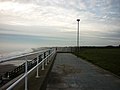
 The Promenade, Hornsea - geograph.org.uk - 1059680.jpg 640 × 461; 320 KB
-
 Two Cottages Full Sutton.jpg 640 × 352; 62 KB
-
 Victoria Square - geograph.org.uk - 1428873.jpg 552 × 640; 100 KB
-
 Waitrose et al, Willerby - geograph.org.uk - 698800.jpg 640 × 267; 52 KB
-
 Waitrose, Willerby - geograph.org.uk - 177941.jpg 640 × 480; 73 KB
-
 Waitrose, Willerby - geograph.org.uk - 945563.jpg 640 × 426; 53 KB
-
 We have light (geograph 1981814).jpg 800 × 600; 297 KB
-
 Weighton Lock - panoramio.jpg 3,264 × 2,448; 3.76 MB
-
 West End, Walkington (geograph 6468550).jpg 1,024 × 768; 1.26 MB
-
 Wet weather Willerby Waitrose (geograph 5708618).jpg 640 × 480; 59 KB
-
 White House Close on Main Street, Willerby (geograph 4479882).jpg 2,448 × 1,624; 1.12 MB
-
 Wilberfoss Winter - geograph.org.uk - 1726754.jpg 1,744 × 1,308; 1.16 MB
-
 Willerby Bypass (geograph 6126755).jpg 1,280 × 1,139; 841 KB
-
 Willerby Hill Business Park (geograph 6234720).jpg 1,906 × 1,260; 1.44 MB
-
 Willerby Hill Roundabout (geograph 6231822).jpg 1,852 × 1,168; 1.33 MB
-
 Willerby Low Road toward the A164 (geograph 3988501).jpg 4,608 × 3,456; 3.62 MB
-
 Willerby Shopping Centre - geograph.org.uk - 177943.jpg 640 × 480; 68 KB
-
 Withernsea 1.jpg 3,072 × 2,304; 2.18 MB
-
 Withernwick village street (geograph 1807269).jpg 4,000 × 3,000; 2.82 MB
.jpg)
.jpg)
.jpg)

.jpg)
.jpg)
.jpg)
.jpg)


.jpg)
_-_geograph.org.uk_-_535148.jpg)
_1.jpg)

.jpg)
.jpg)

_(28634461652).jpg)


.jpg)
.jpg)


_-_geograph.org.uk_-_536454.jpg)


.jpg)


.jpg)


.jpg)


.jpg)


.jpg)
.jpg)
_-_geograph.org.uk_-_405101.jpg)
_-_geograph.org.uk_-_405108.jpg)
.jpg)


.jpg)
.jpg)
.jpg)
.jpg)
.jpg)

.jpg)


.jpg)

.jpg)

.jpg)
.jpg)


.jpg)
.jpg)
.jpg)


.jpg)

.jpg)
.jpg)
.jpg)

.jpg)
.jpg)
.jpg)
.jpg)


.jpg)