Category:Street signs in Hertfordshire
Ceremonial counties of England: Bedfordshire · Berkshire · Buckinghamshire · Cambridgeshire · Cheshire · Cornwall · Cumbria · Derbyshire · Devon · Dorset · Durham · East Riding of Yorkshire · East Sussex · Essex · Gloucestershire · Greater London · Greater Manchester · Hampshire · Herefordshire · Hertfordshire · Kent · Lancashire · Leicestershire · Lincolnshire · Merseyside · Norfolk · North Yorkshire · Northamptonshire · Northumberland · Nottinghamshire · Oxfordshire · Rutland · Shropshire · Somerset · South Yorkshire · Staffordshire · Suffolk · Surrey · Tyne and Wear · Warwickshire · West Midlands · West Sussex · West Yorkshire · Wiltshire · Worcestershire
City-counties: Bristol · City of London
Former historic counties:
Other former counties:
City-counties: Bristol · City of London
Former historic counties:
Other former counties:
Subcategories
This category has the following 2 subcategories, out of 2 total.
B
- Street signs in Berkhamsted (2 F)
H
- Harpenden Street Signs (23 F)
Media in category "Street signs in Hertfordshire"
The following 39 files are in this category, out of 39 total.
-
 A change of road name - geograph.org.uk - 38096.jpg 640 × 480; 33 KB
-
 Auckland Road, Potters Bar - geograph.org.uk - 1042261.jpg 640 × 426; 99 KB
-
 Colesdale Farm, Northaw Road West - geograph.org.uk - 75209.jpg 640 × 480; 176 KB
-
 Cucumber Lane, Wildhill - geograph.org.uk - 1330727.jpg 640 × 480; 198 KB
-
 Dorian Close, Tring - geograph.org.uk - 565735.jpg 640 × 480; 90 KB
-
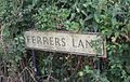 Ferrers Lane.jpg 640 × 407; 82 KB
-
 GOC Hoddesdon 069 Cock Lane, Hoddesdon (28822525693).jpg 3,828 × 2,869; 2.95 MB
-

-
 High St Cottages and Flowers - geograph.org.uk - 191606.jpg 640 × 426; 177 KB
-
 Hinxworth (5627063938).jpg 2,640 × 1,980; 1,009 KB
-

-

-
 Lucas Lane, Hitchin - geograph.org.uk - 562672.jpg 640 × 480; 92 KB
-
 Pembridge Lane - geograph.org.uk - 239274.jpg 480 × 640; 180 KB
-
 Pre-Worboys 'No Through Road' sign - geograph.org.uk - 1130584.jpg 640 × 480; 104 KB
-
 Preston (5559920842).jpg 2,562 × 1,921; 785 KB
-
 Radburn way - panoramio.jpg 3,264 × 2,448; 4.59 MB
-
 Radlett, Kendals Close - geograph.org.uk - 89382.jpg 640 × 480; 82 KB
-
 Redcoats Green (4991372197).jpg 2,640 × 1,980; 1.03 MB
-
 Road name sign - geograph.org.uk - 988401.jpg 640 × 480; 170 KB
-
 Road off Horn Hill Whitwell - geograph.org.uk - 45397.jpg 640 × 480; 28 KB
-
 Road sign Cherry Tree Lane. - geograph.org.uk - 41164.jpg 640 × 480; 29 KB
-
 Road sign for the Golden Parsonage. - geograph.org.uk - 41199.jpg 640 × 480; 31 KB
-
 Road sign in Abbots Langley - geograph.org.uk - 39636.jpg 640 × 480; 25 KB
-
 Road Sign in Puddephats Lane - geograph.org.uk - 41338.jpg 640 × 480; 27 KB
-
 Road sign with woods behind - geograph.org.uk - 47548.jpg 640 × 480; 37 KB
-
 Robbery Bottom Lane - geograph.org.uk - 229201.jpg 640 × 480; 87 KB
-
 Rose Cottage Gardens - geograph.org.uk - 989344.jpg 640 × 480; 199 KB
-
 Shepherds Road - geograph.org.uk - 1174274.jpg 640 × 480; 80 KB
-
 South Oxhey, Mundesley Close - geograph.org.uk - 1375131.jpg 640 × 480; 67 KB
-
 Salvation Army Church Hall in Bedwell, Hertfordshire.jpg 640 × 480; 95 KB
-
 Telford Avenue. - geograph.org.uk - 30518.jpg 640 × 480; 117 KB
-
 Temple Close - geograph.org.uk - 1175111.jpg 640 × 480; 81 KB
-
 The postbox at Sacombe Green - geograph.org.uk - 1323973.jpg 640 × 480; 100 KB
-
 The village green at Kimpton - geograph.org.uk - 1263422.jpg 640 × 480; 107 KB
-
 Ver Road - geograph.org.uk - 956849.jpg 640 × 480; 69 KB
-
 Waterford, Vicarage Lane - geograph.org.uk - 1518552.jpg 640 × 480; 103 KB
-
 West End Road - geograph.org.uk - 347949.jpg 640 × 480; 127 KB
-
 Road sign to Hill Farm Lane - geograph.org.uk - 47550.jpg 640 × 480; 19 KB


.jpg)


.jpg)


.jpg)


.jpg)


