Category:Street signs in the London Borough of Bromley

Media in category "Street signs in the London Borough of Bromley"
The following 52 files are in this category, out of 52 total.
-
 Allington Road and Andover Road - geograph.org.uk - 2537105.jpg 3,072 × 2,304; 1.94 MB
-
 Anerley Hill - geograph.org.uk - 4356682.jpg 1,024 × 768; 111 KB
-
 Anerley Hill Street Sign - geograph.org.uk - 391168.jpg 640 × 479; 96 KB
-
 Avenue road south end 2018 6760.jpg 3,024 × 4,032; 4.44 MB
-
 Barnet Wood Road sign - geograph.org.uk - 5084170.jpg 3,072 × 2,304; 2 MB
-
 Barwell Crescent "One of the Few" - geograph.org.uk - 2642827.jpg 4,288 × 3,216; 6.63 MB
-
 Bogey Lane, Orpington BR6 - geograph.org.uk - 55491.jpg 640 × 640; 102 KB
-
 Borkwood Park - geograph.org.uk - 1271771.jpg 640 × 480; 105 KB
-
 Bungalow's end - geograph.org.uk - 151126.jpg 640 × 480; 133 KB
-
 Chelsfield village sign - geograph.org.uk - 3262390.jpg 3,000 × 4,000; 3.83 MB
-
 Church Road, Chelsfield Village - geograph.org.uk - 1224645.jpg 640 × 480; 84 KB
-
 Coal Tax Post no 195 - geograph.org.uk - 1162634.jpg 640 × 426; 123 KB
-
 Corn Mill Drive - geograph.org.uk - 1580254.jpg 640 × 426; 83 KB
-
 Cottages, Church Hill - geograph.org.uk - 1266075.jpg 640 × 480; 97 KB
-
 Cross House Post Office, Chelsfield.jpg 5,184 × 3,456; 8.4 MB
-
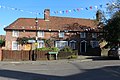
 Crystal Palace, The Paxton Arms Hotel - geograph.org.uk - 1745730.jpg 3,368 × 2,204; 5.39 MB
-
 Cudham street sign - geograph.org.uk - 3365263.jpg 640 × 425; 364 KB
-

-
 Footpath - geograph.org.uk - 1195593.jpg 480 × 640; 126 KB
-
 Green Farm Close - geograph.org.uk - 1607413.jpg 640 × 426; 74 KB
-
 Hayes Common by Warren Rd - geograph.org.uk - 3094194.jpg 429 × 640; 85 KB
-
 Hayes Convenience - geograph.org.uk - 1337200.jpg 546 × 640; 104 KB
-
 Hillcrest View - geograph.org.uk - 3601839.jpg 640 × 480; 94 KB
-
 Horton Tower, St Mary Cray - geograph.org.uk - 731817.jpg 480 × 640; 68 KB
-
 Houses in Hamlet Road, Upper Norwood - geograph.org.uk - 1466233.jpg 640 × 480; 101 KB
-
 Is this the way the world ends^ - geograph.org.uk - 144061.jpg 640 × 504; 60 KB
-
 Kydbrook Close, BR5 - geograph.org.uk - 2431605.jpg 640 × 480; 76 KB
-
 Mayfield Avenue, Orpington - geograph.org.uk - 692685.jpg 640 × 480; 81 KB
-
 Moxey Close Roadsign.jpg 1,024 × 350; 190 KB
-
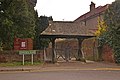 Lych Gate, All Saints Church - geograph.org.uk - 1232379.jpg 640 × 426; 97 KB
-
 Pavement in Bickley Park Road - geograph.org.uk - 1910603.jpg 640 × 480; 128 KB
-
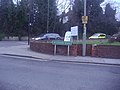
 Penfold postbox, Royal Parade - geograph.org.uk - 1530879.jpg 426 × 640; 135 KB
-
 Rodway Road - geograph.org.uk - 2984657.jpg 800 × 600; 125 KB
-
 Rookery Gardens, St Mary Cray - geograph.org.uk - 731779.jpg 640 × 480; 71 KB
-
 Rosecroft Social Club - geograph.org.uk - 1221103.jpg 640 × 490; 129 KB
-
 Ruskin Drive, Orpington - geograph.org.uk - 720144.jpg 640 × 480; 107 KB
-
 Skeet Hill Lane, Well Hill - geograph.org.uk - 1593810.jpg 640 × 480; 64 KB
-

-
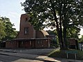 St Paul's Church, Crofton.jpg 2,016 × 1,512; 1.21 MB
-
 Sydenham Avenue SE26.JPG 4,320 × 3,240; 5.46 MB
-
 The corner of Wickham Road and Bromley Road, Beckenham - geograph.org.uk - 2783177.jpg 1,600 × 1,200; 602 KB
-

-
 The Imperial Arms - geograph.org.uk - 2569385.jpg 640 × 425; 112 KB
-
 The Penge hedge monster. (37626610776).jpg 4,002 × 2,660; 7.2 MB
-
 The Rose and Crown - geograph.org.uk - 1603681.jpg 640 × 426; 88 KB
-
 Vancouver Close - geograph.org.uk - 1162597.jpg 640 × 480; 85 KB
-
 Victorian street sign, Belvedere Road SE19 - geograph.org.uk - 3380587.jpg 1,064 × 1,600; 377 KB
-
 View of the War Memorial from the end of Church Row - geograph.org.uk - 2447087.jpg 3,456 × 2,592; 3.07 MB
-
 Waldegrave Road SE19, misspelled roadsign - geograph.org.uk - 2214719.jpg 1,024 × 681; 174 KB
-
 Watermans Square, High Street, Penge - geograph.org.uk - 494709.jpg 610 × 640; 147 KB
-
 West Common Road - geograph.org.uk - 1335821.jpg 480 × 640; 95 KB
-
 Wolfe Close - geograph.org.uk - 3601814.jpg 640 × 480; 75 KB


.jpg)


