Category:Streets in Willerby, East Riding of Yorkshire
Media in category "Streets in Willerby, East Riding of Yorkshire"
The following 129 files are in this category, out of 129 total.
-
 A crowd, a host? On Kingston Road, Willerby (geograph 6788827).jpg 936 × 1,024; 1.74 MB
-
 A walk from Hessle Square No19 (geograph 2006193).jpg 800 × 600; 306 KB
-
 An unnamed road off Blackthorn Lane, Willerby (geograph 3315435).jpg 800 × 600; 145 KB
-
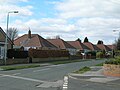
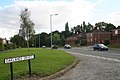
 Approaching Willerby Square roundabout (geograph 5756525).jpg 3,573 × 2,712; 2.95 MB
-
 Ashdene Close off Gorton Road (geograph 4478023).jpg 2,448 × 1,624; 1.3 MB
-
 Aston Road, Willerby (geograph 3887611).jpg 640 × 426; 205 KB
-
 Autumn on Wolfreton Lane (geograph 4205317).jpg 1,024 × 768; 266 KB
-
 Beauty Therapy Unlimited on Main Street, Willerby (geograph 4479269).jpg 2,448 × 1,624; 1.34 MB
-
 Birch Drive, Willerby - geograph.org.uk - 511141.jpg 640 × 468; 100 KB
-
 Bungalows on The Parkway, Willerby (geograph 3741730).jpg 1,024 × 681; 296 KB
-
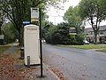
 Bus stop and shelter on Kingston Road (B1232) (geograph 6116493).jpg 5,184 × 3,888; 4.47 MB
-
 Businesses on Main Street, Willerby (geograph 4479227).jpg 2,448 × 1,624; 1.13 MB
-
 Carr Lane at Ash Grove, Willerby (geograph 4478952).jpg 2,448 × 1,624; 800 KB
-
 Carr Lane at Willow Court, Willerby (geograph 4478950).jpg 2,448 × 1,624; 1.05 MB
-
 Carr Lane from The Parkway, Willerby (geograph 3743497).jpg 1,024 × 681; 208 KB
-
 Carr Lane towards Willerby Square (geograph 4478948).jpg 2,448 × 1,624; 1.27 MB
-
 Carr Lane towards Willerby Square (geograph 4478954).jpg 2,448 × 1,624; 1.23 MB
-
 Carr Lane towards Willerby Square (geograph 4478995).jpg 2,448 × 1,624; 1.24 MB
-
 Carr Lane towards Willerby Square (geograph 4479003).jpg 2,448 × 1,624; 1.47 MB
-
 Carr Lane, Willerby (geograph 3743500).jpg 1,024 × 681; 278 KB
-
 Chestnut Avenue off The Parkway, Willerby (geograph 3743552).jpg 1,024 × 681; 285 KB
-
 Cottage on Main Street, Willerby (geograph 4479306).jpg 2,448 × 1,624; 1.63 MB
-
 Elizabeth II postbox on Kingston Road, Willerby (geograph 6117377).jpg 2,448 × 4,210; 2.32 MB
-
 Elizabeth II postbox on Wolfreton Road, Willerby (geograph 6116538).jpg 2,594 × 5,159; 2.12 MB
-
 Flats on Kingston Road, Willerby (geograph 4478200).jpg 2,448 × 1,624; 1.04 MB
-
 Former Methodist Church, Willerby Square (geograph 4479220).jpg 2,448 × 1,624; 1.2 MB
-
 George V postbox on Kingston Road (B1232) (geograph 6116056).jpg 2,312 × 4,361; 2.06 MB
-
 George V postbox on Kingston Road, Willerby (geograph 6117363).jpg 347 × 640; 61 KB
-
 George V postbox on Kingston Road, Willerby (geograph 6117389).jpg 2,496 × 4,537; 2.78 MB
-
 George V postbox on The Parkway, Willerby (geograph 6117648).jpg 2,368 × 4,357; 2.7 MB
-
 Gorton Road at Kenwardly Road (geograph 4478042).jpg 2,448 × 1,624; 1.56 MB
-
 Gorton Road at Kenwardly Road (geograph 4478175).jpg 2,448 × 1,624; 1.63 MB
-
 Gorton Road towards Kingston Road, Willerby (geograph 4478195).jpg 2,448 × 1,624; 1.34 MB
-
 Gorton Road, Willerby (geograph 3743640).jpg 1,024 × 681; 247 KB
-
 Gorton Road, Willerby (geograph 3743643).jpg 1,024 × 681; 271 KB
-
 Gorton Road, Willerby (geograph 3743648).jpg 1,024 × 681; 320 KB
-
 Gorton Road, Willerby (geograph 3743664).jpg 1,024 × 681; 355 KB
-
 Gorton Road, Willerby (geograph 3743667).jpg 1,024 × 681; 451 KB
-
 H B C Wheelie Bin Cleaning Van (geograph 4478944).jpg 2,448 × 1,624; 1.41 MB
-
 Hawthorne Avenue at Carr Lane, Willerby (geograph 4478945).jpg 2,448 × 1,624; 1.76 MB
-
 Hawthorne Avenue off Carr Lane, Willerby (geograph 4478855).jpg 2,448 × 1,624; 1.15 MB
-
 Hawthorne Avenue off Carr Lane, Willerby (geograph 4478862).jpg 2,448 × 1,624; 1.12 MB
-
 Houses on Gorton Road (geograph 4478029).jpg 2,448 × 1,624; 1.61 MB
-
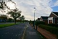
 Houses on Kingston Road (geograph 6116490).jpg 800 × 503; 139 KB
-
 Houses on Kingston Road, Willerby (geograph 6117364).jpg 4,499 × 3,011; 2.97 MB
-
 Houses on Main Street, Willerby (geograph 4479242).jpg 2,448 × 1,624; 1.56 MB
-
 Houses on Main Street, Willerby (geograph 4479274).jpg 2,448 × 1,624; 925 KB
-
 Houses on Main Street, Willerby (geograph 4479328).jpg 2,448 × 1,624; 1.43 MB
-
 Houses on Main Street, Willerby (geograph 4479902).jpg 2,448 × 1,624; 1.83 MB
-
 Houses on Main Street, Willerby (geograph 6115869).jpg 640 × 487; 82 KB
-
 Houses on Oak Hill, Willerby (geograph 4479916).jpg 2,448 × 1,624; 1.49 MB
-
 Houses on The Parkway off Kingston Road (geograph 4478462).jpg 2,448 × 1,624; 1.38 MB
-
 Houses on The Parkway, Willerby (geograph 3741715).jpg 1,024 × 681; 212 KB
-
 Houses on Wolfreton Road, Anlaby (geograph 6129965).jpg 800 × 570; 115 KB
-
 Houses on York Gardens, Willerby (geograph 4479908).jpg 2,448 × 1,624; 1.61 MB
-
 John Gray Court off Main Street, Willerby (geograph 4479264).jpg 2,448 × 1,624; 1.36 MB
-
 K6 telephone box on Kingston Road (geograph 6116487).jpg 800 × 600; 121 KB
-
 Kingston Rd Willerby IMG 2814 - panoramio.jpg 1,200 × 777; 347 KB
-
 Kingston Road (B1232) (geograph 6116057).jpg 800 × 661; 190 KB
-
 Kingston Road (B1232) (geograph 6116060).jpg 4,759 × 3,047; 3.16 MB
-
 Kingston Road (B1232) (geograph 6116061).jpg 4,399 × 3,009; 3.06 MB
-
 Kingston Road (B1232) approaching roundabout (geograph 6116492).jpg 800 × 531; 114 KB
-
 Kingston Road, Willerby (geograph 3315464).jpg 800 × 600; 200 KB
-
 Kingston Road, Willerby (geograph 4478197).jpg 2,448 × 1,624; 1.27 MB
-
 Kingston Road, Willerby (geograph 6117365).jpg 5,184 × 3,888; 4.14 MB
-
 Kingston Road, Willerby (geograph 6117366).jpg 4,749 × 3,048; 2.54 MB
-
 Kingston Road, Willerby (geograph 6117381).jpg 4,939 × 3,323; 4.33 MB
-
 Kingston Road, Willerby (geograph 6117391).jpg 4,780 × 3,426; 3.35 MB
-
 Kingston Road, Willerby (geograph 6117392).jpg 4,528 × 3,010; 2.69 MB
-
 Kingston Road, Willerby - geograph.org.uk - 416838.jpg 640 × 416; 285 KB
-
 Kingston Road, Willerby - geograph.org.uk - 511204.jpg 640 × 470; 111 KB
-
 Ladysmith Road off The Parkway, Willerby (geograph 3741751).jpg 1,024 × 681; 209 KB
-
 Lime Avenue, off the Parkway - geograph.org.uk - 1774384.jpg 640 × 480; 59 KB
-
-
 Luthers Rise off Main Street, Willerby (geograph 4479967).jpg 2,448 × 1,624; 2.01 MB
-
 Main St Willerby IMG 2849 - panoramio.jpg 1,400 × 933; 612 KB
-
 Main Street, Willerby (geograph 4479225).jpg 2,448 × 1,624; 1.1 MB
-
 Main Street, Willerby (geograph 6127926).jpg 1,280 × 960; 975 KB
-
 Oakdale Avenue off The Parkway, Willerby (geograph 3743600).jpg 1,024 × 681; 269 KB
-
 Oaklands Drive (geograph 6127518).jpg 1,280 × 940; 834 KB
-
 Overton Avenue near Collynson Close (geograph 4478491).jpg 2,448 × 1,624; 712 KB
-
 Overton Avenue towards Carr Lane, Willerby (geograph 4478498).jpg 2,448 × 1,624; 1.42 MB
-
 Phone box at the border (geograph 4205309).jpg 1,024 × 768; 253 KB
-
 Roadworks on Main Street, Willerby (geograph 4479289).jpg 2,448 × 1,624; 1.76 MB
-
 Roger Garth off Overton Avenue (geograph 4478485).jpg 2,448 × 1,624; 1.28 MB
-
 Shop and houses on Wolfreton Road, Anlaby (geograph 6129964).jpg 800 × 602; 124 KB
-
 Shop and houses on Wolfreton Road, Willerby (geograph 6116539).jpg 5,026 × 3,042; 2.14 MB
-
 Shops on Kingston Road, Willerby (geograph 3743608).jpg 1,024 × 681; 342 KB
-
 Shops on Kingston Road, Willerby (geograph 6117378).jpg 4,905 × 3,313; 3.74 MB
-
 Shops on Kingston Road, Willerby (geograph 6117380).jpg 3,746 × 2,604; 2.1 MB
-
 Shops on Main Street (geograph 6127778).jpg 1,280 × 960; 766 KB
-
 Shops on Main Street, Willerby (geograph 4479222).jpg 2,448 × 1,624; 1.05 MB
-
 Small wooded area on Main Street, Willerby (geograph 4481061).jpg 2,448 × 1,624; 1.82 MB
-
 Spring Display IMG 2699 - panoramio.jpg 993 × 1,400; 885 KB
-
 Star Inn, Willerby (geograph 6031264).jpg 1,024 × 768; 133 KB
-
 Star Inn, Willerby IMG 2839 - panoramio.jpg 1,400 × 777; 329 KB
-
 The Hollies, Willerby (geograph 5864596).jpg 1,024 × 768; 866 KB
-
 The junction of Overton Avenue and Hawthorne Avenue (geograph 4478854).jpg 2,448 × 1,624; 1.43 MB
-
 The Parkway - geograph.org.uk - 1774382.jpg 640 × 480; 91 KB
-
 The Parkway at Lime Avenue, Willerby (geograph 3743535).jpg 1,024 × 681; 274 KB
-
 The Parkway at Overton Avenue, Willerby (geograph 3743592).jpg 1,024 × 681; 287 KB
-
 The Parkway from Carr Lane, Willerby (geograph 3743505).jpg 1,024 × 681; 306 KB
-
 The Parkway, Willerby (geograph 3743509).jpg 1,024 × 681; 416 KB
-
 The Parkway, Willerby (geograph 3743515).jpg 1,024 × 681; 283 KB
-
 The Parkway, Willerby (geograph 3743520).jpg 1,024 × 681; 263 KB
-
 The Parkway, Willerby (geograph 3743524).jpg 1,024 × 681; 249 KB
-
 The Parkway, Willerby (geograph 3743593).jpg 1,024 × 681; 332 KB
-
 The Parkway, Willerby (geograph 3743601).jpg 1,024 × 681; 303 KB
-
 The Parkway, Willerby (geograph 6117649).jpg 4,295 × 2,893; 4.18 MB
-
 The Parkway, Willerby (geograph 6117650).jpg 4,503 × 2,795; 3.49 MB
-
 The Parkway, Willerby, East Yorkshire (geograph 3741701).jpg 1,024 × 681; 368 KB
-
 The Star Inn on Main Street, Willerby (geograph 4479279).jpg 2,448 × 1,624; 1.12 MB
-
 The Star Inn, Willerby (geograph 6115871).jpg 800 × 628; 117 KB
-
 The Star Inn, Willerby (geograph 6115872).jpg 800 × 539; 106 KB
-
 Well Lane, Willerby (geograph 5708609).jpg 640 × 482; 42 KB
-
 Well Lane, Willerby (geograph 6116554).jpg 640 × 480; 122 KB
-
 Well Lane, Willerby - geograph.org.uk - 1774360.jpg 640 × 480; 76 KB
-
 Wheatcroft Avenue off The Parkway, Willerby (geograph 3741736).jpg 1,024 × 681; 183 KB
-
 White House Close on Main Street, Willerby (geograph 4479335).jpg 2,448 × 1,624; 1.22 MB
-
 White House Close on Main Street, Willerby (geograph 4479882).jpg 2,448 × 1,624; 1.12 MB
-
 Willerby & Kirkella Parish Institute (geograph 6127791).jpg 1,280 × 918; 812 KB
-
 Willerby Homes & Gardens Shop (geograph 4479241).jpg 2,448 × 1,624; 1.86 MB
-
 Willerby Methodist Church.jpg 640 × 466; 178 KB
-
 Willerby Methodist Hall, Willerby (geograph 4479210).jpg 2,448 × 1,624; 1.92 MB
-
 Willerby Square IMG 2826 - panoramio.jpg 1,400 × 854; 762 KB
-
 Willerby, Hull, UK - panoramio.jpg 1,400 × 962; 686 KB
-
 Wolfreton Lane, Willerby - geograph.org.uk - 407721.jpg 640 × 480; 297 KB
-
 Wolfreton Road, Willerby (geograph 6116541).jpg 5,184 × 3,888; 3.16 MB
-
 Wolfreton Road, Willerby (geograph 6116544).jpg 4,660 × 2,858; 2.38 MB
.jpg)
.jpg)
.jpg)
.jpg)
.jpg)
.jpg)
.jpg)
.jpg)

.jpg)
_(geograph_6116493).jpg)
.jpg)
.jpg)
.jpg)
.jpg)
.jpg)
.jpg)
.jpg)
.jpg)
.jpg)
.jpg)
.jpg)
.jpg)
.jpg)
.jpg)
.jpg)
_(geograph_6116056).jpg)
.jpg)
.jpg)
.jpg)
.jpg)
.jpg)
.jpg)
.jpg)
.jpg)
.jpg)
.jpg)
.jpg)
.jpg)
.jpg)
.jpg)
.jpg)
.jpg)
.jpg)
.jpg)
.jpg)
.jpg)
.jpg)
.jpg)
.jpg)
.jpg)
.jpg)
.jpg)
.jpg)
.jpg)
.jpg)
.jpg)

_(geograph_6116057).jpg)
_(geograph_6116060).jpg)
_(geograph_6116061).jpg)
_approaching_roundabout_(geograph_6116492).jpg)
.jpg)
.jpg)
.jpg)
.jpg)
.jpg)
.jpg)
.jpg)


.jpg)

.jpg)
.jpg)

.jpg)
.jpg)
.jpg)
.jpg)
.jpg)
.jpg)
.jpg)
.jpg)
.jpg)
.jpg)
.jpg)
.jpg)
.jpg)
.jpg)
.jpg)
.jpg)
.jpg)

.jpg)

.jpg)
.jpg)

.jpg)
.jpg)
.jpg)
.jpg)
.jpg)
.jpg)
.jpg)
.jpg)
.jpg)
.jpg)
.jpg)
.jpg)
.jpg)
.jpg)
.jpg)
.jpg)
.jpg)

.jpg)
.jpg)
.jpg)
.jpg)
.jpg)

.jpg)


.jpg)
.jpg)