Category:Structures in Dumfries and Galloway
Council areas (municipalities) of Scotland: Aberdeen · Aberdeenshire · Angus · Argyll and Bute · Clackmannanshire · Dumfries and Galloway · Dundee · East Ayrshire · East Dunbartonshire · East Lothian · East Renfrewshire · Edinburgh · Falkirk · Fife · Glasgow · Highland · Inverclyde · Midlothian · Moray · North Ayrshire · North Lanarkshire · Outer Hebrides · Orkney Islands · Perth and Kinross · Renfrewshire · Scottish Borders · Shetland Islands · South Ayrshire · South Lanarkshire · Stirling · West Dunbartonshire · West Lothian
Wikimedia category | |||||
| Upload media | |||||
| Instance of | |||||
|---|---|---|---|---|---|
| Category combines topics |
| ||||
| |||||
Subcategories
This category has the following 14 subcategories, out of 14 total.
Media in category "Structures in Dumfries and Galloway"
The following 49 files are in this category, out of 49 total.
-
 107 of 'Rambles in Galloway. (Second edition.) L.P' (11299983065).jpg 955 × 1,098; 212 KB
-
 An enclosure on Crawthat Hill - geograph.org.uk - 994221.jpg 640 × 427; 126 KB
-
-
 Bail Hill Striding Arch - geograph.org.uk - 1619970.jpg 640 × 360; 46 KB
-
 Beacon at Glencaple - geograph.org.uk - 21298.jpg 480 × 640; 96 KB
-
 Bentpath ROC Post - geograph.org.uk - 1410559.jpg 640 × 480; 99 KB
-
 Boreland ROC Post - geograph.org.uk - 1407874.jpg 480 × 640; 89 KB
-
 Canonbie ROC Post - geograph.org.uk - 1407890.jpg 480 × 640; 147 KB
-
 Clatteringshaws Dam (41464670420).jpg 5,472 × 3,648; 9.67 MB
-
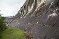 Clatteringshaws Dam (42555963744).jpg 5,472 × 3,648; 14.18 MB
-
 Clatteringshaws Dam (43274450461).jpg 3,648 × 5,472; 8.61 MB
-
 Clatteringshaws Dam (43274465451).jpg 2,855 × 2,855; 5.93 MB
-
 Close up picture of old ROC lookout Tower - geograph.org.uk - 332346.jpg 480 × 640; 119 KB
-
 Concrete structure, Ericstane - geograph.org.uk - 378278.jpg 640 × 480; 140 KB
-
 Cummertrees ROC Post - geograph.org.uk - 1410565.jpg 640 × 480; 101 KB
-
 Disused pheasant release pen - geograph.org.uk - 1534638.jpg 640 × 428; 117 KB
-
 Dumfries Recycles - geograph.org.uk - 672368.jpg 640 × 480; 76 KB
-
 Ecodeco Plant, Dumfries - geograph.org.uk - 751519.jpg 640 × 480; 69 KB
-
 Entrance to old ROC Bunker - geograph.org.uk - 332349.jpg 640 × 480; 147 KB
-
 Fire fighting equipment in car park - geograph.org.uk - 927589.jpg 640 × 480; 94 KB
-
 Forestry Commission observation tower - geograph.org.uk - 261586.jpg 640 × 474; 75 KB
-
 GPO Telegraph Pole at Bentpath ROC Post - geograph.org.uk - 1410568.jpg 480 × 640; 152 KB
-
 Grouse Butts on Kirklea - geograph.org.uk - 779618.jpg 640 × 480; 176 KB
-
 Hartfell Spa.jpg 1,520 × 1,824; 3.31 MB
-
 Horse Engine Shed, Drumbreg Farm - geograph.org.uk - 751488.jpg 640 × 480; 101 KB
-
 Kirkton water pump - geograph.org.uk - 861477.jpg 640 × 405; 71 KB
-

-
 Lochrutton Structure - geograph.org.uk - 181910.jpg 480 × 640; 87 KB
-
 Lockerbie Creamery - geograph.org.uk - 17727.jpg 640 × 404; 73 KB
-
 Minor road near Chapelcross - geograph.org.uk - 452547.jpg 640 × 483; 78 KB
-
 Mobile phone masts, Barskeoch Fell - geograph.org.uk - 778790.jpg 640 × 480; 70 KB
-
 Moffat Well - geograph.org.uk - 44382.jpg 640 × 480; 112 KB
-
 Old ROC Lookout Tower - geograph.org.uk - 331665.jpg 640 × 480; 163 KB
-
 Old Windmill - geograph.org.uk - 767511.jpg 640 × 268; 27 KB
-
 Over Phawhope - geograph.org.uk - 634827.jpg 640 × 357; 61 KB
-
 Railway Improvements, Annan - geograph.org.uk - 884156.jpg 640 × 480; 131 KB
-

-
 Shasun at Annan - geograph.org.uk - 572139.jpg 640 × 480; 96 KB
-
 Shooters perch, Mid Rig - geograph.org.uk - 565833.jpg 480 × 640; 112 KB
-
-
 Smithy water pump - geograph.org.uk - 925714.jpg 480 × 640; 116 KB
-
 Solar power at Marbrack - geograph.org.uk - 1756167.jpg 640 × 480; 84 KB
-
 Structure alongside dismantled railway - geograph.org.uk - 1768397.jpg 1,024 × 768; 597 KB
-
 Tree Planters Bothy, Carrifran - geograph.org.uk - 815751.jpg 480 × 640; 94 KB
-
 View inside old ROC Bunker - geograph.org.uk - 332354.jpg 640 × 480; 103 KB
-
 Wardhouse Tower - geograph.org.uk - 494908.jpg 640 × 480; 137 KB
-
 Water Tank - geograph.org.uk - 331661.jpg 640 × 480; 95 KB
-
 Windpump - geograph.org.uk - 486076.jpg 640 × 480; 45 KB
-
 Winterhope Dam - geograph.org.uk - 1546809.jpg 459 × 640; 123 KB
_L.P%27_(11299983065).jpg)


.jpg)
.jpg)
.jpg)
.jpg)


