Category:Sundhope Height

Media in category "Sundhope Height"
The following 16 files are in this category, out of 16 total.
-
 A cairn at Sundhope Height - geograph.org.uk - 1503665.jpg 427 × 640; 160 KB
-
-
 A sheepfold at Ladhope Shank - geograph.org.uk - 1503685.jpg 640 × 427; 135 KB
-
 Boundary fence, Scar Hill - geograph.org.uk - 328582.jpg 480 × 640; 108 KB
-
 Cairn, Sundhope Height. - geograph.org.uk - 328615.jpg 640 × 480; 92 KB
-
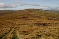
 Ettrick Forest countryside - geograph.org.uk - 1503661.jpg 427 × 640; 117 KB
-
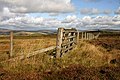
 Gate and fence junction, Sundhope Height. - geograph.org.uk - 328587.jpg 640 × 480; 100 KB
-
 Peat Law - geograph.org.uk - 906525.jpg 640 × 427; 128 KB
-
 Pike Cairn - geograph.org.uk - 1503676.jpg 640 × 390; 119 KB
-
 Rough grazing and farm track - geograph.org.uk - 543395.jpg 640 × 480; 100 KB
-
 Strange structure, Sundhope Height. - geograph.org.uk - 328622.jpg 640 × 480; 79 KB
-
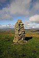
 Summit cairn, Sundhope Height. - geograph.org.uk - 328611.jpg 640 × 480; 82 KB
-
 Sundhope Height - geograph.org.uk - 1503668.jpg 640 × 427; 135 KB
-
 Sundhope Height and the Yarrow Water - geograph.org.uk - 69586.jpg 640 × 480; 72 KB
-
 The summit of Sundhope Height - geograph.org.uk - 1503673.jpg 640 × 427; 148 KB
-
 Wannel Cairn, Sundhope Height. - geograph.org.uk - 328626.jpg 640 × 480; 102 KB


