Category:Swerford
village and civil parish in West Oxfordshire, England  | |||||
| Upload media | |||||
| Instance of | |||||
|---|---|---|---|---|---|
| Location | West Oxfordshire, Oxfordshire, South East England, England | ||||
| official website | |||||
 | |||||
English: Swerford is a village and civil parish on the River Swere in the Cotswold Hills in Oxfordshire, England. It is about northeast of Chipping Norton. Swerford has two main neighbourhoods: Church End and East End. The area between them contains very few houses and is called Between Towns.
Media in category "Swerford"
The following 96 files are in this category, out of 96 total.
-
 A junction of roads near Coltscombe - geograph.org.uk - 5596627.jpg 4,000 × 3,000; 4.09 MB
-
 Across the field - geograph.org.uk - 2032799.jpg 4,288 × 3,216; 1.66 MB
-
 Across the field - geograph.org.uk - 3002214.jpg 4,320 × 3,240; 4.55 MB
-
 Approaching Banbury Road Belt - geograph.org.uk - 3038253.jpg 1,024 × 680; 271 KB
-
 Approaching the green, Swerford (geograph 7383734).jpg 4,288 × 2,848; 2.48 MB
-
 Ash Hill Farm - geograph.org.uk - 3011834.jpg 4,320 × 3,240; 4.95 MB
-
 Banbury Road - geograph.org.uk - 3002355.jpg 4,320 × 3,240; 4.75 MB
-
 Banbury Road milestone - geograph.org.uk - 3011776.jpg 3,240 × 4,320; 5.08 MB
-
 Bridge over the River Swere - geograph.org.uk - 3038146.jpg 1,024 × 680; 264 KB
-
 Butler's Barn (1) - geograph.org.uk - 3011640.jpg 4,320 × 3,240; 5.06 MB
-
 Butler's Barn (2) - geograph.org.uk - 3011654.jpg 4,320 × 3,240; 4.94 MB
-
 Church End, Swerford (geograph 7383783).jpg 3,401 × 2,147; 1.21 MB
-
 Country junction - geograph.org.uk - 2032791.jpg 4,288 × 3,216; 2.78 MB
-
 Cow Lane heading to Swerford - geograph.org.uk - 5596631.jpg 4,000 × 3,000; 4.19 MB
-
 Field edge bridleway - geograph.org.uk - 3002426.jpg 4,320 × 3,240; 4.93 MB
-
 Footpath leaves road - geograph.org.uk - 2032794.jpg 4,288 × 3,216; 3.52 MB
-
 Footpath leaves road - geograph.org.uk - 2032796.jpg 4,288 × 3,216; 3.6 MB
-
 Footpath leaves road - geograph.org.uk - 3011801.jpg 4,320 × 3,240; 4.92 MB
-
 Footpath to Swerford - geograph.org.uk - 3038144.jpg 1,024 × 680; 305 KB
-
 Four ways to go (1) - geograph.org.uk - 3002282.jpg 4,320 × 3,240; 4.98 MB
-
 Four ways to go (2) - geograph.org.uk - 3002294.jpg 4,320 × 3,240; 4.96 MB
-
 Four ways to go (3) - geograph.org.uk - 3002310.jpg 4,320 × 3,240; 5.13 MB
-
 Four ways to go (4) - geograph.org.uk - 3002320.jpg 4,320 × 3,240; 4.95 MB
-
 Four ways to go - geograph.org.uk - 3011827.jpg 4,320 × 3,240; 4.82 MB
-
 Hook Norton Cutting - geograph.org.uk - 215453.jpg 640 × 480; 87 KB
-
 Listed buildings, Swerford (geograph 7383096).jpg 3,729 × 2,473; 1.48 MB
-
 New planting - geograph.org.uk - 3002370.jpg 4,320 × 3,240; 4.82 MB
-
 No way out - geograph.org.uk - 3002329.jpg 4,320 × 3,240; 5.03 MB
-

-
 Old Milestone by the A361, Banbury Road, Swerford Parish (geograph 6047724).jpg 742 × 1,249; 390 KB
-
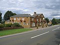
 Old Rectory Swerford Oxon Geograph-3001850-by-Michael-Dibb.jpg 4,320 × 3,240; 5.2 MB
-
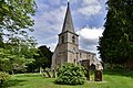
 Parish church - geograph.org.uk - 3001859.jpg 4,320 × 3,240; 5.06 MB
-
 Path leaves road - geograph.org.uk - 3001915.jpg 4,320 × 3,240; 4.75 MB
-
 Path meets road - geograph.org.uk - 3002337.jpg 4,320 × 3,240; 5.03 MB
-
 Pomfret Castle Farm (1) - geograph.org.uk - 3002415.jpg 4,320 × 3,240; 4.52 MB
-
 Pomfret Castle Farm (2) - geograph.org.uk - 3003432.jpg 4,320 × 3,240; 4.74 MB
-
 Ready for sowing - geograph.org.uk - 3011747.jpg 4,320 × 3,240; 4.8 MB
-
 St Mary's Lane - geograph.org.uk - 3001844.jpg 4,320 × 3,240; 5.08 MB
-
 Start of bridleway - geograph.org.uk - 3011790.jpg 4,320 × 3,240; 5.07 MB
-
 Start of path - geograph.org.uk - 2032792.jpg 4,288 × 3,216; 3.16 MB
-
 Start of path - geograph.org.uk - 3001907.jpg 4,320 × 3,240; 4.9 MB
-
-
 Swerford Castle - geograph.org.uk - 3001873.jpg 4,320 × 3,240; 4.87 MB
-
 Swerford Heath - geograph.org.uk - 5716397.jpg 1,600 × 1,200; 488 KB
-
 Swerford milestone.jpg 3,000 × 4,200; 5.86 MB
-

-
 Swerford, St. Mary's Church, c14th octagonal font - geograph.org.uk - 5424222.jpg 2,238 × 3,548; 4.1 MB
-
 Swerford, St. Mary's Church, c14th octagonal font - geograph.org.uk - 5424302.jpg 3,502 × 5,406; 7.22 MB
-
 Swerford, St. Mary's Church, Capital - geograph.org.uk - 5424261.jpg 3,600 × 2,328; 3.57 MB
-
 Swerford, St. Mary's Church, Roof corbel 1 - geograph.org.uk - 5424308.jpg 3,678 × 2,456; 3.95 MB
-
 Swerford, St. Mary's Church, Roof corbel 2 - geograph.org.uk - 5424310.jpg 3,678 × 2,455; 4.21 MB
-
 Swerford, St. Mary's Church, South western aspect - geograph.org.uk - 5424212.jpg 3,678 × 2,456; 5.81 MB
-
 Swerford, St. Mary's Church, The altar - geograph.org.uk - 5424234.jpg 2,450 × 3,680; 5.59 MB
-
 Swerford, St. Mary's Church, The Arnold memorial plaque - geograph.org.uk - 5424315.jpg 3,603 × 3,596; 6.98 MB
-
 Swerford, St. Mary's Church, The c14th south porch - geograph.org.uk - 5424339.jpg 3,678 × 2,456; 6.37 MB
-

-
 Swerford, St. Mary's Church, The John King memorial plaque - geograph.org.uk - 5424320.jpg 3,651 × 3,596; 7.19 MB
-
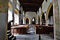
 Swerford, St. Mary's Church, The nave - geograph.org.uk - 5424230.jpg 5,314 × 3,342; 6.43 MB
-
 Swerford, St. Mary's Church, The nave from the chancel - geograph.org.uk - 5424240.jpg 5,086 × 3,380; 7.22 MB
-
 Swerford, St. Mary's Church, The nave from the chancel - geograph.org.uk - 5424247.jpg 3,428 × 5,362; 6.33 MB
-

-
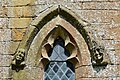 Swerford, St. Mary's Church, Two c14th label stops - geograph.org.uk - 5424333.jpg 3,678 × 2,455; 7.68 MB
-
-
 Swerford-Chapel End - geograph.org.uk - 5874202.jpg 1,600 × 1,293; 570 KB
-
 Swerford-Church End - geograph.org.uk - 5874204.jpg 1,600 × 1,200; 483 KB
-
 The Cartshed - geograph.org.uk - 3002394.jpg 4,320 × 3,240; 5.3 MB
-
 The footpath is blocked (1) - geograph.org.uk - 3002269.jpg 4,320 × 3,240; 4.74 MB
-
 The footpath is blocked (2) - geograph.org.uk - 3002278.jpg 4,320 × 3,240; 4.98 MB
-
 The Mason's Arms - geograph.org.uk - 215447.jpg 640 × 480; 52 KB
-
 The Masons Arms - geograph.org.uk - 3619507.jpg 4,320 × 3,240; 5.28 MB
-
 The view from the hill - geograph.org.uk - 3002231.jpg 4,320 × 3,240; 4.56 MB
-
 The way to Potato Town - geograph.org.uk - 3011729.jpg 4,320 × 3,240; 4.83 MB
-
 The way to the farm - geograph.org.uk - 3011719.jpg 4,320 × 3,240; 4.63 MB
-
 Towards Potato Town - geograph.org.uk - 3011755.jpg 4,320 × 3,240; 5.17 MB
-
 Track improvements (1) - geograph.org.uk - 3011664.jpg 4,320 × 3,240; 4.97 MB
-
 Track junction - geograph.org.uk - 3011707.jpg 4,320 × 3,240; 4.78 MB
-
 Track meets road - geograph.org.uk - 3011760.jpg 4,320 × 3,240; 4.75 MB
-
 Unnamed barn (1) - geograph.org.uk - 3002253.jpg 4,320 × 3,240; 4.5 MB
-
 Unnamed barn (2) - geograph.org.uk - 3011814.jpg 4,320 × 3,240; 4.55 MB
-
 View towards Ash Hill Farm - geograph.org.uk - 5429138.jpg 1,024 × 768; 274 KB
-
 Village green - geograph.org.uk - 3001893.jpg 4,320 × 3,240; 4.51 MB
-
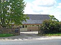
 Village Hall - geograph.org.uk - 5027573.jpg 1,600 × 900; 676 KB
-
 Water control at Swerford Park - geograph.org.uk - 236442.jpg 640 × 480; 98 KB
-
 Wheat field near Swerford - geograph.org.uk - 3038246.jpg 1,024 × 680; 307 KB
-
 Field boundary south of minor road - geograph.org.uk - 350612.jpg 640 × 427; 56 KB
-
 Frontage of Mason's Arms - geograph.org.uk - 238398.jpg 639 × 477; 61 KB
-
 Gatehouse for Swerford Park - geograph.org.uk - 215451.jpg 640 × 480; 73 KB
-
 Harvest time - geograph.org.uk - 238402.jpg 640 × 480; 74 KB
-
 Home Farm and radio mast - geograph.org.uk - 350618.jpg 640 × 427; 59 KB
-
 Ley's Field Barn - geograph.org.uk - 215443.jpg 640 × 480; 47 KB
-
 Line on pine trees near Showell Farm - geograph.org.uk - 350606.jpg 640 × 427; 109 KB
-
 Motte and Bailey, Swerford - geograph.org.uk - 215450.jpg 640 × 480; 79 KB
-
 Potato Town - geograph.org.uk - 238400.jpg 640 × 480; 57 KB
-
 Swerford Motte and Bailey - geograph.org.uk - 238409.jpg 640 × 480; 77 KB
-
 View south from the Banbury Road - geograph.org.uk - 215455.jpg 640 × 480; 62 KB
-
 View towards Highwood - geograph.org.uk - 215458.jpg 640 × 480; 64 KB


.jpg)


_-_geograph.org.uk_-_3011640.jpg)
_-_geograph.org.uk_-_3011654.jpg)
.jpg)


_-_geograph.org.uk_-_3002282.jpg)
_-_geograph.org.uk_-_3002294.jpg)
_-_geograph.org.uk_-_3002310.jpg)
_-_geograph.org.uk_-_3002320.jpg)


.jpg)


.jpg)


_-_geograph.org.uk_-_3002415.jpg)
_-_geograph.org.uk_-_3003432.jpg)


_-_geograph.org.uk_-_5424257.jpg)


_-_geograph.org.uk_-_3002269.jpg)
_-_geograph.org.uk_-_3002278.jpg)


_-_geograph.org.uk_-_3011664.jpg)


_-_geograph.org.uk_-_3002253.jpg)
_-_geograph.org.uk_-_3011814.jpg)


.jpg)