Category:Taching am See
municipality of Germany    | |||||
| Upload media | |||||
| Instance of |
| ||||
|---|---|---|---|---|---|
| Part of |
| ||||
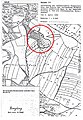
| Location | Traunstein, Upper Bavaria, Bavaria, Germany | ||||
| Head of government |
| ||||
| Population |
| ||||
| Area |
| ||||
| Elevation above sea level |
| ||||
| official website | |||||
 | |||||
Subcategories
This category has the following 3 subcategories, out of 3 total.
Media in category "Taching am See"
The following 18 files are in this category, out of 18 total.
-
 DEU Taching COA.svg 812 × 891; 8 KB
-
 Wappen Taching.png 150 × 160; 71 KB
-
 Amerang, RO - Bauernhausmuseum - Taching a S - Gessenhausen - Holzmannhof v S.jpg 4,608 × 3,456; 1.41 MB
-
 Coloman (Taching am See) Tachinger See 079.jpg 4,896 × 3,264; 13.99 MB
-
 Coloman (Taching am See) Tachinger See 080.jpg 4,896 × 3,264; 11.89 MB
-
 ND Hangquellmoor und Kalkflachmoor südöstlich Bermoos Amtsblatt.jpg 937 × 1,325; 392 KB
-
 ND Kalkquellmoor mit Bruchwaldstreifen nördlich Mühltal Amtsblatt.jpg 812 × 1,158; 326 KB
-
 ND Verlandeter Moränenweiher südöstlich Haus Amtsblatt.jpg 953 × 1,373; 541 KB
-
 Radweg zwischen Waging und Taching - geo.hlipp.de - 10534.jpg 640 × 480; 121 KB
-
 Seeufer bei Tettenhausen - geo.hlipp.de - 10402.jpg 640 × 480; 76 KB
-
 Taching a S - Gh Bergwirt - Tachinger See, Tettenhausen.JPG 4,000 × 2,248; 2.89 MB
-
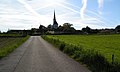
 Taching a S - Hucking - Taching v W.jpg 4,000 × 2,248; 3.05 MB
-
 Taching am See - geo.hlipp.de - 10537.jpg 640 × 382; 52 KB
-
 Taching am See in TS.svg 652 × 820; 1.35 MB
-
 TachingerSee.jpg 375 × 500; 33 KB
-
 Tafel Rundweg Petting Waginger See.jpg 2,995 × 2,143; 6.73 MB
-
 Waging a S - Tettenhausen westl - Tachinger See v S, SoUg.jpg 4,000 × 2,248; 1.6 MB
-
 Waging am See, Blick über den Waginger See nach Taching.jpg 2,551 × 1,701; 870 KB


_Tachinger_See_079.jpg)
_Tachinger_See_080.jpg)


