Category:Talaton
English: Talaton is a village and a civil parish in the English county of Devon. It lies approximately 6 miles to the west of Honiton, 3 miles to the north of Ottery St Mary, 2 miles to the west of Feniton and 2 miles to the east of Whimple. The parish of Talaton covers an area of 965 hectares (2,384 acres) . Its total population was estimated to be 522 in 2006.
village in the United Kingdom  | |||||
| Upload media | |||||
| Instance of | |||||
|---|---|---|---|---|---|
| Location | East Devon, Devon, South West England, England | ||||
| Population |
| ||||
| Area |
| ||||
 | |||||
Subcategories
This category has the following 8 subcategories, out of 8 total.
B
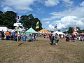
- Beautiful days festival (14 F)
E
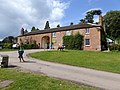
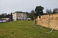
- Escot House (14 F)
F
H
- Harris's Farm, Talaton (3 F)
I
- The Talaton Inn (5 F)
L
- Larkbeare (1 F)
T
Media in category "Talaton"
The following 200 files are in this category, out of 374 total.
(previous page) (next page)-
 "English summer rain seems to last for ages..." (Beautiful Days '08) - panoramio.jpg 2,272 × 1,704; 1.93 MB
-
 A fine old English Oak in a field - geograph.org.uk - 246028.jpg 640 × 480; 151 KB
-
 A gnarled oak, Westcott - geograph.org.uk - 246047.jpg 480 × 640; 118 KB
-
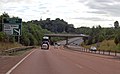
 A30 approaching Daisymount - geograph.org.uk - 3043618.jpg 640 × 325; 40 KB
-
 A30 approaching lay by near Big Wood - geograph.org.uk - 4744699.jpg 640 × 412; 112 KB
-

-
 A30 approaching Patteson's Cross - geograph.org.uk - 2256922.jpg 2,848 × 2,136; 1.4 MB
-
 A30 crossing the Tale - geograph.org.uk - 2351835.jpg 640 × 458; 75 KB
-
 A30 half mile to B3177 junction - geograph.org.uk - 3621081.jpg 1,614 × 999; 884 KB
-
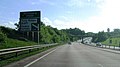
 A30 heading west - geograph.org.uk - 6262906.jpg 1,024 × 684; 201 KB
-
 A30 heading west - geograph.org.uk - 6262911.jpg 1,024 × 684; 153 KB
-
 A30 heading west - geograph.org.uk - 6262914.jpg 1,024 × 684; 140 KB
-
 A30 parking area ahead - geograph.org.uk - 3621058.jpg 1,956 × 1,129; 1.25 MB
-
 A30 passing Larkbeare Brake wood - geograph.org.uk - 2256384.jpg 2,848 × 2,136; 1.41 MB
-
 A30 south west of Patteson's Cross - geograph.org.uk - 2428096.jpg 640 × 357; 42 KB
-
 A30 west of Patteson's Cross - geograph.org.uk - 3016769.jpg 640 × 430; 45 KB
-
 A30, eastbound - geograph.org.uk - 4770145.jpg 640 × 371; 51 KB
-
 A30, westbound - geograph.org.uk - 3043616.jpg 640 × 377; 39 KB
-
 Animal feeder, Escot - geograph.org.uk - 2352399.jpg 640 × 457; 87 KB
-
 Another bridge over the River Tale - geograph.org.uk - 2092487.jpg 1,024 × 768; 160 KB
-
 Approach to Talaton - geograph.org.uk - 2136473.jpg 640 × 480; 66 KB
-
 Approaching Talaton from south-west - geograph.org.uk - 2240292.jpg 640 × 480; 229 KB
-
 Approaching Talaton, from the south - geograph.org.uk - 1811261.jpg 1,600 × 1,200; 826 KB
-

-
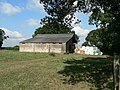 Barn and Bales, Talaton - geograph.org.uk - 245550.jpg 640 × 480; 114 KB
-
 Barns at Higher Westcott - geograph.org.uk - 2324939.jpg 640 × 428; 94 KB
-
 Beacon Cottages - geograph.org.uk - 1811338.jpg 1,024 × 795; 129 KB
-
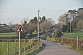
 Beacon Cross junction - geograph.org.uk - 1272218.jpg 640 × 480; 158 KB
-
 Beacon Cross, looking towards Talaton - geograph.org.uk - 1272217.jpg 640 × 480; 169 KB
-
 Beautiful Days music festival (5) - geograph.org.uk - 1480982.jpg 515 × 640; 192 KB
-
 Bittery Cross - geograph.org.uk - 2309939.jpg 640 × 414; 88 KB
-
 Bittery Cross - geograph.org.uk - 2609009.jpg 800 × 600; 446 KB
-
 Bittery Cross at dusk - geograph.org.uk - 245555.jpg 640 × 480; 47 KB
-
 Bittery Cross signpost with daffodils - geograph.org.uk - 2880135.jpg 800 × 600; 345 KB
-

-

-
 Bridge over Exeter-Honiton railway line - geograph.org.uk - 2608999.jpg 800 × 600; 332 KB
-
 Bridge over River Tale - Escot Park - geograph.org.uk - 2010806.jpg 800 × 600; 94 KB
-
 Bridge over River Tale at Talewater - geograph.org.uk - 2880137.jpg 800 × 598; 441 KB
-

-
 Bridge over the River Tale - geograph.org.uk - 2092485.jpg 1,024 × 768; 130 KB
-
 Bridge over the Tale, Escot - geograph.org.uk - 2351974.jpg 640 × 455; 92 KB
-
 Caravans in store, near Talaton Farm - geograph.org.uk - 1811387.jpg 1,024 × 768; 187 KB
-
 Cattle by Newtown Corner - geograph.org.uk - 253711.jpg 640 × 480; 103 KB
-
 Cattle in a field, Westcott - geograph.org.uk - 246087.jpg 640 × 480; 84 KB
-
 ChanonArms.png 926 × 1,064; 96 KB
-
 Coach house and stables at Escot Park - geograph.org.uk - 4120685.jpg 1,600 × 1,200; 1.56 MB
-

-
 Country house, near Beacon Cross - geograph.org.uk - 1811297.jpg 1,024 × 768; 182 KB
-
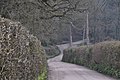
 Cyclist on the lane - geograph.org.uk - 3936307.jpg 640 × 480; 165 KB
-
 Dandelions near Sunny View - geograph.org.uk - 2353331.jpg 640 × 480; 143 KB
-
 Disused petrol pumps, Talaton - geograph.org.uk - 253836.jpg 480 × 640; 140 KB
-
 Ditch and oak, Westcott - geograph.org.uk - 2324949.jpg 640 × 480; 98 KB
-
 Diverted service on the old LSWR route - geograph.org.uk - 2309859.jpg 640 × 427; 100 KB
-
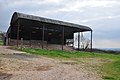 East Devon , Barn - geograph.org.uk - 4415370.jpg 4,288 × 2,848; 5.48 MB
-
 East Devon , Bittery Cross - geograph.org.uk - 5765916.jpg 6,000 × 4,000; 6.46 MB
-
 East Devon , Cattle Grazing - geograph.org.uk - 5765917.jpg 6,000 × 4,000; 7.45 MB
-
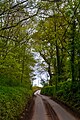
 East Devon , Country Lane - geograph.org.uk - 3881531.jpg 4,288 × 2,848; 6.48 MB
-
 East Devon , Country Lane - geograph.org.uk - 3881539.jpg 4,288 × 2,848; 6.29 MB
-
 East Devon , Country Lane - geograph.org.uk - 3881547.jpg 4,288 × 2,848; 6.06 MB
-
 East Devon , Country Lane - geograph.org.uk - 3885065.jpg 4,288 × 2,848; 4.65 MB
-
 East Devon , Country Lane - geograph.org.uk - 3885071.jpg 4,230 × 2,758; 3.87 MB
-
 East Devon , Country Lane - geograph.org.uk - 3885073.jpg 2,848 × 4,288; 6.58 MB
-
 East Devon , Country Lane - geograph.org.uk - 4415329.jpg 4,288 × 2,848; 5.93 MB
-
 East Devon , Country Lane - geograph.org.uk - 4415332.jpg 4,288 × 2,848; 6.29 MB
-
 East Devon , Country Lane - geograph.org.uk - 4415337.jpg 4,288 × 2,848; 5.89 MB
-
 East Devon , Country Lane - geograph.org.uk - 4415339.jpg 4,288 × 2,848; 6.36 MB
-
 East Devon , Country Lane - geograph.org.uk - 4415343.jpg 4,288 × 2,848; 6.3 MB
-
 East Devon , Country Lane - geograph.org.uk - 4415356.jpg 4,288 × 2,848; 6.72 MB
-
 East Devon , Country Lane - geograph.org.uk - 4415359.jpg 4,288 × 2,848; 6.65 MB
-
 East Devon , Country Lane - geograph.org.uk - 4415372.jpg 4,288 × 2,848; 6.3 MB
-
 East Devon , Country Lane - geograph.org.uk - 4415373.jpg 4,288 × 2,848; 6.36 MB
-
 East Devon , Country Lane - geograph.org.uk - 4415376.jpg 4,288 × 2,848; 6.29 MB
-
 East Devon , Country Lane - geograph.org.uk - 4415377.jpg 4,288 × 2,848; 6.3 MB
-
 East Devon , Country Lane - geograph.org.uk - 4415378.jpg 2,848 × 4,288; 5.97 MB
-
 East Devon , Country Lane - geograph.org.uk - 4415381.jpg 4,288 × 2,848; 6.13 MB
-
 East Devon , Country Lane - geograph.org.uk - 5765913.jpg 4,000 × 6,000; 5.77 MB
-
 East Devon , Country Lane - geograph.org.uk - 5766899.jpg 6,000 × 4,000; 5.99 MB
-
 East Devon , Country Lane - geograph.org.uk - 5766900.jpg 6,000 × 4,000; 7.07 MB
-
 East Devon , Country Lane - geograph.org.uk - 5766901.jpg 6,000 × 4,000; 5.37 MB
-
 East Devon , Country Lane - geograph.org.uk - 5767163.jpg 6,000 × 4,000; 7.42 MB
-
 East Devon , Country Lane - geograph.org.uk - 5767181.jpg 6,000 × 4,000; 6.78 MB
-
 East Devon , Country Lane - geograph.org.uk - 5767182.jpg 6,000 × 4,000; 5.89 MB
-
 East Devon , Country Lane - geograph.org.uk - 5767186.jpg 6,000 × 4,000; 7.46 MB
-
 East Devon , Country Lane - geograph.org.uk - 5767195.jpg 6,000 × 4,000; 6.43 MB
-
 East Devon , Country Lane - geograph.org.uk - 5767200.jpg 6,000 × 4,000; 6.29 MB
-
 East Devon , Country Road - geograph.org.uk - 3373462.jpg 3,976 × 2,220; 3.19 MB
-
 East Devon , Countryside Scenery - geograph.org.uk - 4415366.jpg 4,288 × 2,848; 7.84 MB
-
 East Devon , Countryside Scenery - geograph.org.uk - 4415374.jpg 4,288 × 2,848; 6.46 MB
-
 East Devon , Countryside Scenery - geograph.org.uk - 4415375.jpg 4,288 × 2,848; 4.81 MB
-
 East Devon , Countryside Scenery - geograph.org.uk - 5765914.jpg 6,000 × 4,000; 6.6 MB
-
 East Devon , Countryside Scenery - geograph.org.uk - 5766912.jpg 6,000 × 4,000; 6.09 MB
-
 East Devon , Escot Front Lodge - geograph.org.uk - 3373468.jpg 4,122 × 2,570; 3.47 MB
-
 East Devon , Escot Grounds - geograph.org.uk - 3373473.jpg 1,920 × 1,080; 296 KB
-
 East Devon , Escot Grounds - geograph.org.uk - 3373474.jpg 1,920 × 1,080; 301 KB
-
 East Devon , Escot House - geograph.org.uk - 3373471.jpg 4,288 × 2,848; 6.8 MB
-
 East Devon , Escot House - geograph.org.uk - 3610047.jpg 3,264 × 2,448; 3.68 MB
-
 East Devon , Escot House - geograph.org.uk - 3610050.jpg 3,264 × 2,448; 3.81 MB
-
 East Devon , Escot Park - Beautiful Days - geograph.org.uk - 3610035.jpg 3,264 × 2,448; 3.74 MB
-
 East Devon , Escot Park - Beautiful Days - geograph.org.uk - 3610036.jpg 2,448 × 3,264; 3.68 MB
-
 East Devon , Escot Park - Beautiful Days - geograph.org.uk - 3610037.jpg 3,264 × 2,448; 4.04 MB
-
 East Devon , Escot Park - Beautiful Days - geograph.org.uk - 3610048.jpg 3,264 × 2,448; 3.76 MB
-
 East Devon , Escot Park - Beautiful Days - geograph.org.uk - 3610786.jpg 3,264 × 2,448; 3.94 MB
-
 East Devon , Escot Park - Beautiful Days - geograph.org.uk - 3610806.jpg 3,264 × 2,448; 3.79 MB
-
 East Devon , Escot Park - Beautiful Days - geograph.org.uk - 3610811.jpg 3,264 × 2,448; 3.79 MB
-
 East Devon , Escot Park - Beautiful Days - geograph.org.uk - 3610813.jpg 3,264 × 2,448; 3.77 MB
-
 East Devon , Escot Park - Beautiful Days - geograph.org.uk - 3610819.jpg 3,264 × 2,448; 3.68 MB
-
 East Devon , Escot Park - Beautiful Days - geograph.org.uk - 3610826.jpg 3,264 × 2,448; 1.53 MB
-
 East Devon , Escot Park - Beautiful Days - geograph.org.uk - 3610835.jpg 3,264 × 2,448; 3.76 MB
-
 East Devon , Escot Park - Beautiful Days - geograph.org.uk - 3610838.jpg 2,048 × 1,536; 374 KB
-
 East Devon , Escot Park - Beautiful Days - geograph.org.uk - 3610841.jpg 3,264 × 2,448; 3.92 MB
-
 East Devon , Escot Park - Beautiful Days - geograph.org.uk - 3610844.jpg 3,264 × 2,448; 3.85 MB
-
 East Devon , Escot Park - Beautiful Days - geograph.org.uk - 3610846.jpg 3,264 × 2,448; 3.6 MB
-
 East Devon , Escot Park - geograph.org.uk - 3373472.jpg 4,288 × 2,848; 6.54 MB
-
 East Devon , Escot Park - geograph.org.uk - 3373476.jpg 4,288 × 2,848; 6.34 MB
-
 East Devon , Escot Park - geograph.org.uk - 3373477.jpg 4,288 × 2,848; 6.13 MB
-
 East Devon , Escot Park - geograph.org.uk - 3373478.jpg 4,288 × 2,848; 6.37 MB
-
 East Devon , Escot Park - geograph.org.uk - 3373479.jpg 4,288 × 2,848; 6.67 MB
-
 East Devon , Escot Park - geograph.org.uk - 3373480.jpg 4,288 × 2,848; 6.98 MB
-
 East Devon , Escot Park - geograph.org.uk - 3373483.jpg 4,288 × 2,848; 4.79 MB
-
 East Devon , Escot Park - Signpost - geograph.org.uk - 3610769.jpg 2,448 × 3,264; 4.03 MB
-
 East Devon , Escot Park - The River Tale - geograph.org.uk - 3373481.jpg 4,288 × 2,848; 6.26 MB
-
 East Devon , Escot Park - The River Tale - geograph.org.uk - 3373482.jpg 4,288 × 2,848; 6.37 MB
-
 East Devon , Garden Nursery - geograph.org.uk - 4415364.jpg 4,288 × 2,848; 6.21 MB
-
 East Devon , Gorilla Scarecrow - geograph.org.uk - 4415362.jpg 4,288 × 2,848; 6.41 MB
-
 East Devon , Grassy Field - geograph.org.uk - 4415342.jpg 4,288 × 2,848; 5.33 MB
-
 East Devon , Grassy Field - geograph.org.uk - 4415365.jpg 4,288 × 2,848; 5.55 MB
-
 East Devon , Grassy Field - geograph.org.uk - 4415367.jpg 4,288 × 2,848; 6.2 MB
-
 East Devon , Grassy Field - geograph.org.uk - 4415368.jpg 4,288 × 2,848; 6.44 MB
-
 East Devon , Grassy Field - geograph.org.uk - 4415371.jpg 4,288 × 2,848; 5.25 MB
-
 East Devon , Grassy Field - geograph.org.uk - 5761626.jpg 6,000 × 4,000; 6.62 MB
-
 East Devon , Grassy Field - geograph.org.uk - 5761627.jpg 6,000 × 4,000; 6.24 MB
-
 East Devon , Grassy Field - geograph.org.uk - 5761628.jpg 6,000 × 4,000; 5.66 MB
-
 East Devon , Grassy Field - geograph.org.uk - 5761629.jpg 6,000 × 4,000; 7.07 MB
-
 East Devon , Grassy Field - geograph.org.uk - 5761630.jpg 6,000 × 4,000; 6.99 MB
-
 East Devon , Grassy Field - geograph.org.uk - 5761631.jpg 6,000 × 4,000; 7.42 MB
-
 East Devon , Grassy Field - geograph.org.uk - 5761632.jpg 6,000 × 4,000; 5.74 MB
-
 East Devon , Grassy Field - geograph.org.uk - 5761633.jpg 4,000 × 6,000; 7.18 MB
-
 East Devon , Grassy Field - geograph.org.uk - 5765911.jpg 6,000 × 4,000; 5.77 MB
-
 East Devon , Grassy Field - geograph.org.uk - 5765912.jpg 6,000 × 4,000; 7.61 MB
-
 East Devon , Grassy Field - geograph.org.uk - 5766904.jpg 6,000 × 4,000; 6.65 MB
-
 East Devon , Grassy Field - geograph.org.uk - 5766905.jpg 6,000 × 4,000; 5.96 MB
-
 East Devon , Grassy Field - geograph.org.uk - 5766907.jpg 6,000 × 4,000; 6.82 MB
-
 East Devon , Grassy Field - geograph.org.uk - 5767154.jpg 6,000 × 4,000; 6.44 MB
-
 East Devon , Grassy Field - geograph.org.uk - 5767159.jpg 4,000 × 6,000; 6.75 MB
-
 East Devon , Grassy Field - geograph.org.uk - 5767197.jpg 6,000 × 4,000; 7.48 MB
-
 East Devon , Grassy Field - geograph.org.uk - 5767203.jpg 6,000 × 4,000; 5.39 MB
-
 East Devon , Grassy Field ^ Cattle - geograph.org.uk - 4415327.jpg 4,288 × 2,848; 6.96 MB
-
 East Devon , Grassy Field ^ Gate - geograph.org.uk - 4415383.jpg 4,288 × 2,848; 5.99 MB
-
 East Devon , Grassy Field ^ Pylon - geograph.org.uk - 5767157.jpg 4,000 × 6,000; 5.75 MB
-
 East Devon , Grassy Field ^ Sheep - geograph.org.uk - 5766920.jpg 6,000 × 4,000; 7.37 MB
-
 East Devon , Grassy Field ^ Sheep - geograph.org.uk - 5766922.jpg 6,000 × 4,000; 6.33 MB
-
 East Devon , Grassy Field ^ Sheep - geograph.org.uk - 5766923.jpg 6,000 × 4,000; 5.31 MB
-
 East Devon , Grassy Track - geograph.org.uk - 4415338.jpg 2,848 × 4,288; 6.53 MB
-
 East Devon , Higher Wescot - geograph.org.uk - 5767185.jpg 6,000 × 4,000; 5.71 MB
-
 East Devon , Holly Ball Cross - geograph.org.uk - 4415382.jpg 4,288 × 2,848; 6.32 MB
-
 East Devon , Ivy Cottages Drive - geograph.org.uk - 4415363.jpg 4,288 × 2,848; 6.06 MB
-
 East Devon , Ivy Cottages Garden - geograph.org.uk - 4415360.jpg 4,288 × 2,848; 6.33 MB
-
 East Devon , Ivy Cottages Garden - geograph.org.uk - 4415361.jpg 2,848 × 4,288; 5.12 MB
-
 East Devon , Larkbeare Cross - geograph.org.uk - 4415379.jpg 4,288 × 2,848; 6.22 MB
-
 East Devon , Larkbeare Grange - geograph.org.uk - 4415380.jpg 4,288 × 2,848; 6.25 MB
-
 East Devon , Lower Westcott Farm - geograph.org.uk - 5767167.jpg 6,000 × 4,000; 7.84 MB
-
 East Devon , Mast - geograph.org.uk - 4415358.jpg 2,848 × 4,288; 7.66 MB
-
 East Devon , New Barn Farm - geograph.org.uk - 4415369.jpg 4,288 × 2,848; 5.58 MB
-
 East Devon , Peacock - geograph.org.uk - 4415335.jpg 4,288 × 2,848; 5.49 MB
-
 East Devon , Ploughed Field - geograph.org.uk - 5765918.jpg 6,000 × 4,000; 7.46 MB
-
 East Devon , Railway Cottages ^ Bridge - geograph.org.uk - 4415331.jpg 4,288 × 2,848; 6.42 MB
-
 East Devon , Railway Track - geograph.org.uk - 4415333.jpg 2,848 × 4,288; 5.15 MB
-
 East Devon , Railway Track - geograph.org.uk - 4415334.jpg 4,288 × 2,848; 6.46 MB
-
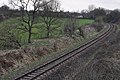 East Devon , Railway Track - geograph.org.uk - 4415357.jpg 4,288 × 2,848; 6.4 MB
-
 East Devon , Road Junction - geograph.org.uk - 3373461.jpg 4,288 × 2,848; 4.83 MB
-
 East Devon , Royston Farm - geograph.org.uk - 5766906.jpg 6,000 × 4,000; 7.42 MB
-
 East Devon , Talaton Sign - geograph.org.uk - 4415341.jpg 4,288 × 2,848; 5.09 MB
-
 East Devon , Talaton Wood - geograph.org.uk - 5765915.jpg 6,000 × 4,000; 7.71 MB
-
 East Devon , Talewater - geograph.org.uk - 5766918.jpg 6,000 × 4,000; 7.43 MB
-
 East Devon , The River Tale - geograph.org.uk - 3373484.jpg 4,288 × 2,848; 6.85 MB
-
 East Devon , Track - geograph.org.uk - 5761624.jpg 6,000 × 4,000; 5.78 MB
-
 East Devon , Track - geograph.org.uk - 5761625.jpg 4,000 × 6,000; 6.83 MB
-
 East Devon , Westcott Court - geograph.org.uk - 5767162.jpg 6,000 × 4,000; 6.19 MB
-
 East Devon - Country Lane (geograph 5766911).jpg 6,000 × 4,000; 6.19 MB
-

-
 Entering Talaton - geograph.org.uk - 1284424.jpg 640 × 480; 167 KB
-
 Entrance drive, Larkbeare House - geograph.org.uk - 1811427.jpg 1,024 × 768; 291 KB
-
 Entrance driveway, Larkbeare Grange - geograph.org.uk - 1811458.jpg 640 × 480; 88 KB
-
 Entrance lodge, Escot Park - geograph.org.uk - 1811409.jpg 1,024 × 778; 212 KB
-
 Entry to Talaton from north-west - geograph.org.uk - 2240271.jpg 640 × 480; 184 KB
-
 Escot House - geograph.org.uk - 5363503.jpg 640 × 480; 85 KB
-
 Escot Park - geograph.org.uk - 2352429.jpg 640 × 480; 95 KB
-
 Escot Park - geograph.org.uk - 4151512.jpg 1,536 × 2,048; 2.55 MB
-
 Escot Park, preparing for a music festival - geograph.org.uk - 4120698.jpg 1,600 × 1,200; 1.28 MB
-
 Estate road at Escot Park - geograph.org.uk - 2880158.jpg 600 × 800; 532 KB
-

-

-
 Fairmile , Road ^ Signpost - geograph.org.uk - 3881555.jpg 4,262 × 2,810; 4.38 MB
-
 Farm buildings at Lower Westcott - geograph.org.uk - 5451974.jpg 1,024 × 858; 169 KB
-
 Farm buildings at Westcott - geograph.org.uk - 246073.jpg 640 × 487; 92 KB
-
 Farm buildings, Lower Westcot Farm - geograph.org.uk - 246078.jpg 640 × 480; 76 KB
-
 Farm buildings, Lower Westcot Farm - geograph.org.uk - 246089.jpg 640 × 480; 70 KB
-
 Farm track north of Rydon Barton - geograph.org.uk - 2609021.jpg 800 × 600; 494 KB
-
 Farm track, alongside the railway, near Talaton - geograph.org.uk - 1811177.jpg 1,024 × 768; 271 KB
_-_panoramio.jpg)


_-_geograph.org.uk_-_1480982.jpg)


_line_-_geograph.org.uk_-_2880145.jpg)


.jpg)


