Category:Tansor
village and civil parish in Northamptonshire, United Kingdom  | |||||
| Upload media | |||||
| Instance of | |||||
|---|---|---|---|---|---|
| Location | North Northamptonshire, Northamptonshire, East Midlands, England | ||||
| Said to be the same as | Tansor (Wikimedia duplicated page, civil parish) | ||||
 | |||||
Subcategories
This category has the following 2 subcategories, out of 2 total.
M
- St Mary's Church, Tansor (2 F)
R
- The Riverside, Tansor (3 F)
Media in category "Tansor"
The following 72 files are in this category, out of 72 total.
-
 A Field of Wheat - geograph.org.uk - 191985.jpg 640 × 480; 75 KB
-
 A605 heading towards Warmington - geograph.org.uk - 4958088.jpg 800 × 613; 104 KB
-
 Barns - geograph.org.uk - 191979.jpg 640 × 502; 92 KB
-

-
 Bend in the road - geograph.org.uk - 3698816.jpg 800 × 450; 222 KB
-
 Byway to Tansor Manor - geograph.org.uk - 3698649.jpg 800 × 450; 235 KB
-
 Byway towards Ashton - geograph.org.uk - 1339306.jpg 640 × 480; 103 KB
-
 Classic car crossing the Nene - geograph.org.uk - 2872719.jpg 640 × 480; 82 KB
-
 Closed Road - geograph.org.uk - 877011.jpg 640 × 480; 94 KB
-
 Cottage near Tansor Wold Farm - geograph.org.uk - 4614122.jpg 4,320 × 3,240; 5.81 MB
-
 Country lane near Warmington - geograph.org.uk - 4614090.jpg 4,320 × 3,240; 5.52 MB
-
 Entrance to Tansor Court - geograph.org.uk - 4613795.jpg 3,240 × 4,320; 4.88 MB
-
 Farm building on the edge of Tansor - geograph.org.uk - 6250234.jpg 1,024 × 768; 124 KB
-
 Farmland in the Nene Valley - geograph.org.uk - 875424.jpg 640 × 480; 105 KB
-
 Field entrance and trees south of Tansor Grange - geograph.org.uk - 4614115.jpg 4,320 × 3,240; 5.42 MB
-
 Flooding on the Tansor Cotterstock road - geograph.org.uk - 3271373.jpg 2,560 × 1,920; 992 KB
-
 Footpath onto The Ashton Estate - geograph.org.uk - 4614740.jpg 4,320 × 3,240; 6.12 MB
-
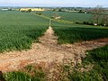
 Footpath through the wheat - geograph.org.uk - 3963149.jpg 800 × 600; 227 KB
-
 Footpath to Warmington - geograph.org.uk - 3963166.jpg 800 × 600; 183 KB
-
 Fotheringhay Road, Tansor - geograph.org.uk - 3698659.jpg 800 × 450; 223 KB
-

-
 Lane descending into the Nene Valley - geograph.org.uk - 4951572.jpg 800 × 541; 112 KB
-
 Lane near Tansor Wold Cottage - geograph.org.uk - 4951583.jpg 800 × 572; 107 KB
-
 Lane next to the River Nene in Tansor - geograph.org.uk - 4959768.jpg 800 × 560; 175 KB
-
 Linden Hall, Tansor - geograph.org.uk - 876438.jpg 640 × 480; 76 KB
-
 Main Street towards Tansor - geograph.org.uk - 4958085.jpg 800 × 600; 140 KB
-
 Main Street, Tansor - geograph.org.uk - 1285767.jpg 480 × 640; 83 KB
-
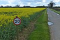 Oil seed rape next to the Nene Way - geograph.org.uk - 4951554.jpg 800 × 536; 161 KB
-
 Outside the church in Tansor, Northamptonshire - geograph.org.uk - 4613809.jpg 4,320 × 3,240; 5.93 MB
-
 Over grown gate in Miriam's Cover - geograph.org.uk - 3963130.jpg 600 × 800; 161 KB
-
 Public bridleway to Tansor Lodge - geograph.org.uk - 4958080.jpg 800 × 519; 130 KB
-
 Quiet Road - geograph.org.uk - 838335.jpg 640 × 480; 67 KB
-
 River Nene floodplain near Cotterstock - geograph.org.uk - 3272158.jpg 2,560 × 1,920; 1.02 MB
-
 River of the River Nene from a canoe - geograph.org.uk - 4553603.jpg 480 × 640; 65 KB
-
 River of the River Nene from a canoe - geograph.org.uk - 4553604.jpg 480 × 640; 64 KB
-
 River of the River Nene from a canoe - geograph.org.uk - 4553607.jpg 480 × 640; 63 KB
-
 River of the River Nene from a canoe - geograph.org.uk - 4553609.jpg 480 × 640; 54 KB
-
 River up the River Nene from a canoe - geograph.org.uk - 4553601.jpg 480 × 640; 56 KB
-

-
 Rolling Wheat Field - geograph.org.uk - 875414.jpg 640 × 480; 80 KB
-
 Rural retreat. - geograph.org.uk - 3963140.jpg 800 × 600; 199 KB
-
 Rusting trailer next to the Nene Way - geograph.org.uk - 4958083.jpg 800 × 549; 135 KB
-
 Smoke on the water - geograph.org.uk - 4613803.jpg 4,320 × 3,240; 5.72 MB
-
 Spinney in a pit near Tansor Wold Farm - geograph.org.uk - 4614138.jpg 4,320 × 3,240; 6.23 MB
-
 St Mary's Church in Tansor - geograph.org.uk - 4959758.jpg 800 × 587; 138 KB
-
 Stopped up road, Tansor - geograph.org.uk - 2883395.jpg 640 × 480; 97 KB
-
 Tansor Court (geograph 6916015).jpg 1,024 × 768; 190 KB
-
 Tansor Court - geograph.org.uk - 3698803.jpg 800 × 450; 232 KB
-
 Tansor Court, Tansor near Oundle - geograph.org.uk - 4613788.jpg 4,320 × 3,240; 5.51 MB
-
 Tansor Lodge - geograph.org.uk - 3272164.jpg 2,560 × 1,920; 1.12 MB
-
 Tansor Lodge Farm - geograph.org.uk - 3272211.jpg 640 × 480; 93 KB
-
 Tansor Village hall - geograph.org.uk - 876426.jpg 640 × 480; 77 KB
-
 Tansor, Northamptonshire - geograph.org.uk - 3698641.jpg 800 × 450; 239 KB
-
 Telephone box on the Main Street, Tansor - geograph.org.uk - 4959760.jpg 800 × 581; 119 KB
-
 Telephone Exchange, Tansor - geograph.org.uk - 802361.jpg 640 × 480; 93 KB
-
 The blocked off Main Street - geograph.org.uk - 4958093.jpg 800 × 589; 158 KB
-
 The Main Street in Tansor - geograph.org.uk - 4959700.jpg 800 × 602; 165 KB
-
 The Old Post Office in Tansor, Northamptonshire - geograph.org.uk - 4613817.jpg 4,170 × 2,591; 3.4 MB
-
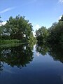
 The River Nene in Tansor near Oundle - geograph.org.uk - 4613812.jpg 4,320 × 3,240; 6.03 MB
-
 The River Nene, Tansor - geograph.org.uk - 4518525.jpg 3,340 × 2,452; 2.93 MB
-

-
 Bridleway - geograph.org.uk - 191981.jpg 640 × 480; 74 KB
-
 Closed Road at Tansor - geograph.org.uk - 321977.jpg 640 × 480; 122 KB
-
 Cottage at Tansor Wold near Oundle - geograph.org.uk - 93833.jpg 640 × 480; 47 KB
-
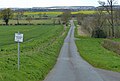
 Cotterstock Road towards Oundle - geograph.org.uk - 351724.jpg 640 × 480; 82 KB
-
 Early Crop Protection near Tansor - geograph.org.uk - 321344.jpg 640 × 480; 132 KB
-
 Oundle School Rifle Range - geograph.org.uk - 191974.jpg 640 × 480; 75 KB
-
 Rural Scene Near Tansor Village - geograph.org.uk - 321347.jpg 640 × 480; 155 KB
-
 Tansor - geograph.org.uk - 638863.jpg 640 × 480; 80 KB
-
 The Old Post Office in Tansor Village - geograph.org.uk - 321362.jpg 640 × 480; 123 KB
-
 Track towards High Holborn Lodge - geograph.org.uk - 351723.jpg 640 × 480; 74 KB
-
 View towards River Nene - geograph.org.uk - 351722.jpg 640 × 480; 90 KB


.jpg)


.jpg)


