Category:Te Raekaihau
rugged coastal landform in New Zealand  | |||||
| Upload media | |||||
| Instance of | |||||
|---|---|---|---|---|---|
| Location |
| ||||
 | |||||
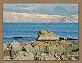
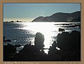
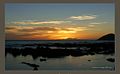
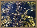
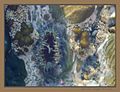
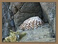
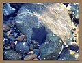
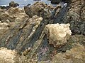
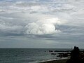
Te Raekaihau Point is a rugged coastal landform in Wellington, New Zealand, adjacent to Princess Bay, between Houghton Bay to the west and Lyall Bay to the east on the south coast. One meaning of the name is "the headland that eats the wind".
Media in category "Te Raekaihau"
The following 41 files are in this category, out of 41 total.
-
 Te Raekaihau 1.jpg 4,032 × 2,268; 2 MB
-
 Te Raekaihau 2.jpg 4,032 × 2,268; 1.87 MB
-
 TeRaekaihauChillin1.jpg 1,280 × 986; 145 KB
-
 TeRaekaihauDiver2.jpg 1,280 × 986; 156 KB
-
 TeRaekaihauDivers1.jpg 1,393 × 1,073; 128 KB
-
 TeRaekaihauLandforms.jpg 1,280 × 986; 167 KB
-
 TeRaekaihauLandforms2.jpg 1,280 × 986; 93 KB
-
 TeRaekaihauPaua.jpg 1,280 × 986; 101 KB
-
 TeRaekaihauPaua2.jpg 1,280 × 986; 168 KB
-
 TeRaekaihauPaua3.jpg 1,280 × 986; 177 KB
-
 TeRaekaihauPoint.jpg 1,118 × 692; 53 KB
-
 TeRaekaihauPointPICT9635.jpg 942 × 353; 117 KB
-
 TeRaekaihauPointPICT9691.jpg 1,024 × 768; 327 KB
-
 TeRaekaihauPointPICT9731.jpg 1,024 × 768; 554 KB
-
 TeRaekaihauPointPICT9737.jpg 1,024 × 768; 387 KB
-
 TeRaekaihauPointPICT9738.jpg 1,024 × 768; 619 KB
-
 TeRaekaihauPointPICT9739.jpg 1,024 × 768; 596 KB
-
 TeRaekaihauPointSaver.jpg 1,280 × 800; 104 KB
-
 TeRaekaihauRockPool1.jpg 1,280 × 986; 116 KB
-
 TeRaekaihauRockPool11.jpg 1,280 × 986; 105 KB
-
 TeRaekaihauRockPool12.jpg 1,280 × 986; 169 KB
-
 TeRaekaihauRockPool13.jpg 1,280 × 986; 157 KB
-
 TeRaekaihauRockPool14.jpg 1,280 × 986; 134 KB
-
 TeRaekaihauRockPool15.jpg 1,280 × 986; 161 KB
-
 TeRaekaihauRockPool16.jpg 1,280 × 986; 171 KB
-
 TeRaekaihauRockPool17.jpg 1,280 × 986; 159 KB
-
 TeRaekaihauRockPool18.jpg 1,280 × 986; 86 KB
-
 TeRaekaihauRockPool19.jpg 1,280 × 986; 120 KB
-
 TeRaekaihauRockPool2.jpg 1,280 × 986; 122 KB
-
 TeRaekaihauRockPool3.jpg 1,280 × 986; 108 KB
-
 TeRaekaihauRockPool4.jpg 1,280 × 986; 133 KB
-
 TeRaekaihauRockPool5.jpg 1,280 × 986; 147 KB
-
 TeRaekaihauRockPool6.jpg 1,280 × 986; 115 KB
-
 TeRaekaihauRockPool7.jpg 1,280 × 986; 96 KB
-
 TeRaekaihauRockPool8.jpg 1,280 × 986; 117 KB
-
 TeRaekaihauRockPool9.jpg 1,280 × 986; 136 KB
-
 TeRaekaihauRocksPICT9724.jpg 1,000 × 730; 254 KB
-
 TeRaekaihauRocksPICT9733.jpg 1,024 × 768; 475 KB
-
 TeRaekaihauTrickyLanding.jpg 1,280 × 986; 118 KB
-
 TeRaekaihauViewEastPICT9744.jpg 1,530 × 1,148; 121 KB
-
 TeRaekaihauWeather.jpg 800 × 600; 41 KB


