Category:Temple, Glasgow
district of Glasgow, in the north of the city, bounded by Anniesland to the south, Knightswood to the west and Kelvindale to the east  | |||||
| Upload media | |||||
| Instance of | |||||
|---|---|---|---|---|---|
| Location | Glasgow City, Scotland | ||||
 | |||||
Subcategories
This category has the following 4 subcategories, out of 4 total.
D
T
- Temple Anniesland Parish Church (23 F)
- Temple Bridge, Glasgow (4 F)
Media in category "Temple, Glasgow"
The following 14 files are in this category, out of 14 total.
-
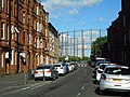
 Bearsden Road with railway bridge (geograph 6323093).jpg 1,024 × 768; 208 KB
-
 Gasholder, Temple Gasworks (geograph 5460120).jpg 1,600 × 1,200; 415 KB
-
 Gasometers at Kelvindale (geograph 6215270).jpg 1,024 × 768; 226 KB
-
 Glasgow wards 2017 no14 Drumchapel.png 2,000 × 2,040; 504 KB
-
 Lock 27 on the Forth and Clyde Canal - geograph.org.uk - 382665.jpg 640 × 480; 72 KB
-
 Lock 27, Forth and Clyde Canal (geograph 4935918).jpg 1,024 × 768; 200 KB
-
 Lock on the Forth and Clyde Canal (geograph 6215272).jpg 1,024 × 768; 290 KB
-
 Lower Clyde Valley (geograph 6695008).jpg 800 × 541; 106 KB
-
 NethertonCommunityCentre.JPG 2,816 × 2,112; 1.33 MB
-
 Next Generation Club, Temple - geograph.org.uk - 519934.jpg 640 × 480; 86 KB
-
 Railway bridge over the A739 Bearsden Road (geograph 5689295).jpg 1,024 × 683; 144 KB
-
 Sunset at the Old Gasworks - geograph.org.uk - 49200.jpg 640 × 480; 99 KB
-
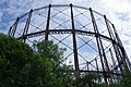 Temple Gas Works (geograph 6198742).jpg 1,280 × 851; 468 KB
-
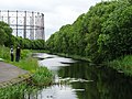 The Forth and Clyde Canal (geograph 6215256).jpg 1,024 × 768; 266 KB
.jpg)
.jpg)
.jpg)


.jpg)
.jpg)
.jpg)


.jpg)

.jpg)
.jpg)