Category:Temple et cure, Chêne-Pâquier
| Object location | | View all coordinates using: OpenStreetMap |
|---|
church buildings in Chêne-Pâquier in the canton of Vaud, Switzerland .JPG) | |||||
| Upload media | |||||
| Instance of | |||||
|---|---|---|---|---|---|
| Part of | |||||
| Location | |||||
| Street address |
| ||||
| Architectural style | |||||
| Architect | |||||
| Heritage designation | |||||
| Inception |
| ||||
| Religion or worldview | |||||
 | |||||
Media in category "Temple et cure, Chêne-Pâquier"
The following 15 files are in this category, out of 15 total.
-
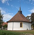 Chapelle de Chene Paquier.jpg 2,743 × 2,828; 1.19 MB
-
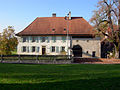 Chenepaquiercure.jpg 1,600 × 1,200; 1.82 MB
-
 Chenepaquiertemple.jpg 902 × 1,200; 730 KB
-
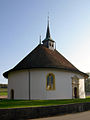
 Chêne-Pâquier Temple 1.jpg 5,202 × 3,465; 12.89 MB
-
 Chêne-Pâquier Temple 2.jpg 5,202 × 3,465; 12.38 MB
-
 Chêne-Pâquier Temple 3.jpg 5,202 × 3,465; 11.24 MB
-
 Chêne-Pâquier Temple 4.jpg 5,202 × 3,465; 12.64 MB
-
 Chêne-Pâquier Temple 5.jpg 4,564 × 3,039; 3.69 MB
-
 Chêne-Pâquier Temple 6.jpg 5,202 × 3,465; 12.64 MB
-
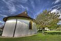
 KGS Chene-Paquier-Kirche-(18).JPG 2,560 × 1,920; 3.13 MB
-
 KGS Chene-Paquier-Kirche-(23).JPG 2,560 × 1,920; 3.27 MB
-
 KGS Chene-Paquier-Kirche-(25).JPG 2,560 × 1,920; 3.38 MB
-
 KGS-Nr 5985.JPG 4,896 × 3,672; 4.15 MB
-
 Temple de Chene Paquier.jpg 3,008 × 2,008; 2.53 MB
-
 Temple de Chêne-Pâquier.jpg 4,352 × 3,026; 5.82 MB


.JPG)
.JPG)


