Category:Territorial evolution of Peru
Media in category "Territorial evolution of Peru"
The following 24 files are in this category, out of 24 total.
-
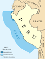
 Dominio Marítimo del Perú.svg 1,168 × 1,513; 187 KB
-
 Flag-map of Peru (before and now).svg 689 × 1,003; 1.21 MB
-
 Maritime Claims of Peru.svg 1,168 × 1,513; 181 KB
-
 MFPS-D-Mapa General del Peru, 1865.jpg 7,552 × 10,709; 17.1 MB
-
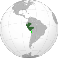
 Peru (1821–1851).svg 549 × 549; 259 KB
-
 Peru (1835–1836).svg 549 × 549; 360 KB
-
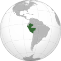
 Peru (1851–1883).svg 549 × 549; 226 KB
-
 Peru (1881).svg 549 × 549; 377 KB
-
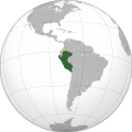
 Peru (1883–1909).svg 549 × 549; 303 KB
-
 Peru (1909–1922).svg 549 × 549; 147 KB
-
 Peru (1922–1929).svg 549 × 549; 129 KB
-
 Peru (1929–1936).svg 549 × 549; 111 KB
-
 Peru (1936–1942).svg 549 × 549; 123 KB
-
 PERU MAPA 1865.JPG 6,556 × 9,208; 3.31 MB
-
 PERU MAPA2800px 1865.JPG 2,800 × 3,933; 1.97 MB
-
 Peruvian territory during the Pacific War.png 342 × 415; 5 KB
-
 Peró - Evolucions territòrialas.png 593 × 954; 146 KB
-
 Perú 1821-1824.svg 867 × 1,184; 11 KB
-
 Perú 1821-1942.svg 867 × 1,184; 419 KB
-
 Protectorado de San Martín-Departamentos Libres del Perú.png 2,848 × 4,144; 220 KB
-
 Protectorate of Peru (orthographic projection).svg 549 × 549; 355 KB
-
 Republic of Peru 1824- 1836 (orthographic proyection).JPG 2,000 × 2,000; 243 KB
-
 Republic of Peru 1824- 1836 (orthographic proyection).png 2,000 × 2,000; 448 KB
-
 Two years in Peru - with exploration of its antiquities (1873) (14595989070).jpg 2,256 × 3,613; 733 KB

.svg)


.svg)
.svg)
.svg)
.svg)
.svg)
.svg)
.svg)
.svg)
.svg)


.svg)
.JPG)
.png)
_(14595989070).jpg)