Category:Teshie
| Object location | | View all coordinates using: OpenStreetMap |
|---|
town in Greater Accra Region, Ghana  | |||||
| Upload media | |||||
| Instance of | |||||
|---|---|---|---|---|---|
| Location | Ledzokuku-Krowor Municipal District, Greater Accra Region, Ghana | ||||
| Population |
| ||||
| Elevation above sea level |
| ||||
 | |||||
Teshie is a town in the Ledzokuku-Krowor Municipal District of the Greater Accra Region of Ghana and is categorized today as eastern suburb of Accra (Ghana). The core area of Teshie is located around of:
Subcategories
This category has the following 5 subcategories, out of 5 total.
Media in category "Teshie"
The following 15 files are in this category, out of 15 total.
-
 A neighborhood in Teshie in Accra.jpg 6,036 × 4,020; 7.2 MB
-
 A simple house in Teshie.jpg 6,036 × 4,020; 10.56 MB
-
 Course cycliste organisée à Teshie lors du festival Homowo 2009.jpg 2,048 × 1,536; 1.01 MB
-
 Lekma Hospital.jpg 4,160 × 3,120; 4.16 MB
-
 Local School.jpg 1,080 × 607; 158 KB
-
 Müll - panoramio.jpg 1,161 × 700; 563 KB
-
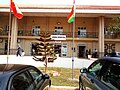
 Teshie Library 01.jpg 4,160 × 3,120; 2.99 MB
-
 Teshie Library 02.jpg 4,160 × 3,120; 2.95 MB
-
 Teshie Library 03.jpg 4,160 × 3,120; 2.54 MB
-
 Teshie Presby Sign Post 01.jpg 4,160 × 3,120; 3.67 MB
-
 Teshie Presby Sign Post.jpg 3,120 × 4,160; 3.73 MB
-
 Teshie Salem Square 01.jpg 4,160 × 3,120; 2.19 MB
-
 Teshie Salem Square 02.jpg 4,160 × 3,120; 2.86 MB
-
 Teshie Salem Square.jpg 4,160 × 3,120; 2.84 MB
-
 The National Archives UK - CO 1069-38-13.jpg 606 × 455; 89 KB


