Category:Thür
municipality of Germany    | |||||
| Upload media | |||||
| Instance of |
| ||||
|---|---|---|---|---|---|
| Location | Mendig, Mayen-Koblenz, Rhineland-Palatinate, Germany | ||||
| Population |
| ||||
| Area |
| ||||
| Elevation above sea level |
| ||||
| Different from | |||||
| official website | |||||
 | |||||
Subcategories
This category has the following 3 subcategories, out of 3 total.
N
- Naturschutzgebiet Thürer Wiesen (15 F)
S
Media in category "Thür"
The following 6 files are in this category, out of 6 total.
-
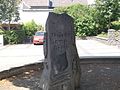
 GedenksteinJudenfriedhof Thür.JPG 2,736 × 3,648; 4.87 MB
-
 Thuerer Somporsch.jpg 2,048 × 1,536; 1.43 MB
-
 Thür in MYK.png 338 × 294; 9 KB
-
 Thür in MYK.svg 660 × 560; 230 KB
-
 Thür.JPG 1,600 × 1,200; 1.27 MB
-
 Thürer Wiesen.jpg 4,272 × 2,848; 972 KB


