Category:The Bridge Inn, Port Sunlight
| Object location | | View all coordinates using: OpenStreetMap |
|---|
pub in Wirral, Merseyside, UK  | |||||
| Upload media | |||||
| Instance of | |||||
|---|---|---|---|---|---|
| Location | Port Sunlight, Wirral, Merseyside, North West England, England | ||||
| Street address |
| ||||
| Architect |
| ||||
| Heritage designation |
| ||||
 | |||||
Media in category "The Bridge Inn, Port Sunlight"
The following 10 files are in this category, out of 10 total.
-
 Benchmark on The Bridge Inn, Port Sunlight.jpg 3,462 × 4,603; 17.47 MB
-
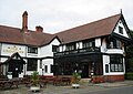 Bridge Inn, Port Sunlight.jpg 1,555 × 1,105; 1,012 KB
-
 The Bridge Inn at Port Sunlight - geograph.org.uk - 1492961.jpg 640 × 467; 69 KB
-
 The Bridge Inn, Bolton Road - geograph.org.uk - 1770802.jpg 2,048 × 1,536; 674 KB
-
 The Bridge Inn, Port Sunlight - 2013-05-19.jpg 4,608 × 3,456; 3.54 MB
-
 The Bridge Inn, Port Sunlight 2020-1.jpg 8,577 × 3,298; 28.37 MB
-
 The Bridge Inn, Port Sunlight 2020-2.jpg 4,387 × 2,340; 8.84 MB
-
 The Bridge Inn, Port Sunlight 2020-3.jpg 3,521 × 1,957; 7.74 MB
-
 The Bridge Inn, Port Sunlight 2020-4.jpg 4,394 × 3,391; 16.82 MB
-
 Window in The Bridge Inn, Port Sunlight.jpg 3,310 × 3,075; 13.4 MB


