Category:Theydon Garnon

village in United Kingdom  | |||||
| Upload media | |||||
| Instance of | |||||
|---|---|---|---|---|---|
| Location | Epping Forest, Essex, East of England, England | ||||
 | |||||
Subcategories
This category has the following 6 subcategories, out of 6 total.
G
- Garnish Hall, Epping Forest (2 F)
- Gaynes Park (4 F)
- Gernon Bushes Nature Reserve (29 F)
H
- Hobbs Cross, Theydon Garnon (3 F)
R
- Roughtalley's Wood (8 F)
Media in category "Theydon Garnon"
The following 178 files are in this category, out of 178 total.
-
 Coopersale and Theydon Garnon, Essex on 1805 Ordnance Survey map, annotated.png 1,376 × 1,032; 2.71 MB
-
 Coopersale, Essex on 1805 Ordnance Survey map.jpg 1,376 × 1,032; 1.35 MB
-
 A leafy pond in Gernon Bushes Nature Reserve - geograph.org.uk - 5306966.jpg 4,608 × 3,456; 6.57 MB
-
 A view of the M11 from Coopersale Lane Theydon Garnon Essex England 01.JPG 5,144 × 2,268; 6.21 MB
-
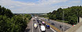 A view of the M11 from Coopersale Lane Theydon Garnon Essex England 02.JPG 5,164 × 2,012; 5.63 MB
-
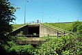
 Access bridge, M11 - geograph.org.uk - 3752901.jpg 640 × 430; 48 KB
-
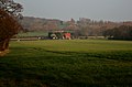
 Blunts Farm - geograph.org.uk - 2911334.jpg 3,456 × 2,304; 4.54 MB
-
 Bridge at North Weald - geograph.org.uk - 5003177.jpg 4,000 × 2,666; 7.58 MB
-
 Bridge over the M11 - geograph.org.uk - 2640204.jpg 640 × 428; 88 KB
-

-
 Bridleway 210 12 - geograph.org.uk - 6161383.jpg 678 × 1,024; 205 KB
-
 Bridleway in the woods - geograph.org.uk - 4618245.jpg 640 × 480; 196 KB
-
 Bridleway to Hobbs Cross Farm - geograph.org.uk - 3509003.jpg 4,320 × 3,240; 3.41 MB
-
 Bridleway to Mount Rd - geograph.org.uk - 6161394.jpg 678 × 1,024; 288 KB
-
 Busy M11 - geograph.org.uk - 2028268.jpg 640 × 303; 41 KB
-
 By the M25 - geograph.org.uk - 3746950.jpg 640 × 430; 37 KB
-
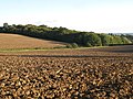
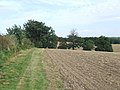
 Cereal crop near Searles Hall - geograph.org.uk - 6213834.jpg 800 × 599; 92 KB
-
 Clearing in Gernon Bushes - geograph.org.uk - 4247500.jpg 640 × 480; 146 KB
-
 Coopersale Lane - geograph.org.uk - 762422.jpg 640 × 480; 105 KB
-
 Coopersale Lane towards Hobbs Cross - geograph.org.uk - 6207288.jpg 800 × 600; 177 KB
-
 Dead red bus in a field - geograph.org.uk - 4247429.jpg 640 × 480; 109 KB
-
 Dead tree - geograph.org.uk - 3746949.jpg 640 × 430; 49 KB
-
 Double track across a muddy field - geograph.org.uk - 5306956.jpg 4,608 × 3,456; 4.05 MB
-
 Driveway to Gaynes Park, near Epping - geograph.org.uk - 2594227.jpg 640 × 480; 105 KB
-
 Epping Lane - geograph.org.uk - 3411857.jpg 640 × 480; 94 KB
-
 Epping Lane, near Abridge - geograph.org.uk - 6241279.jpg 1,024 × 768; 164 KB
-
 Epping Lane, near Abridge - geograph.org.uk - 6241331.jpg 1,024 × 768; 143 KB
-
 Essex Countryside near Abridge - geograph.org.uk - 1477191.jpg 640 × 316; 104 KB
-
 Essex Way Bridge over the M11 - geograph.org.uk - 3155361.jpg 3,648 × 2,255; 3.34 MB
-
 Essex Way footbridge over the M11 - geograph.org.uk - 5937259.jpg 3,776 × 2,520; 3.47 MB
-
 Essex Way heading North towards Gernon Bushes - geograph.org.uk - 5931232.jpg 5,184 × 3,456; 6.09 MB
-
 Essex Way in the Gernon Bushes Nature Reserve - geograph.org.uk - 5931242.jpg 5,184 × 3,456; 6.97 MB
-
 Essex Way West of Reydn's Wood - geograph.org.uk - 5931201.jpg 5,184 × 3,456; 7.28 MB
-
 Essex Way, from footbridge over M11 - geograph.org.uk - 3155387.jpg 3,648 × 2,736; 5.31 MB
-
 Farmland adjoining Gernon Bushes - geograph.org.uk - 3155410.jpg 3,648 × 1,972; 2.65 MB
-
 Farmland and (part of) Redyn's Wood - geograph.org.uk - 4253247.jpg 640 × 480; 96 KB
-
 Farmland and Gernon Bushes - geograph.org.uk - 4253235.jpg 640 × 480; 77 KB
-
 Farmland and Redyn's Wood - geograph.org.uk - 4252215.jpg 640 × 480; 117 KB
-
 Farmland and Roughtalley's Wood - geograph.org.uk - 4247373.jpg 640 × 480; 78 KB
-

-

-

-
 Farmland by the M11 - geograph.org.uk - 3770973.jpg 640 × 430; 52 KB
-
 Farmland by the M25 - geograph.org.uk - 3746958.jpg 640 × 430; 38 KB
-
 Farmland east of Coopersale House - geograph.org.uk - 4253291.jpg 640 × 480; 110 KB
-
 Farmland near Coopersale Street - geograph.org.uk - 4253920.jpg 640 × 480; 67 KB
-
 Farmland near Theydon Garnon - geograph.org.uk - 2585069.jpg 640 × 430; 58 KB
-
 Farmland north of Redyn's Wood - geograph.org.uk - 4252221.jpg 640 × 480; 116 KB
-

-

-
 Farmland south of Gernon Bushes - geograph.org.uk - 4253233.jpg 640 × 480; 90 KB
-
 Farmland south of Redyn's Wood - geograph.org.uk - 4253312.jpg 640 × 480; 94 KB
-
 Farmland south of Roughtalley's Wood - geograph.org.uk - 4247387.jpg 640 × 480; 97 KB
-
 Farmland southwest of Redyn's Wood - geograph.org.uk - 4253917.jpg 640 × 480; 88 KB
-
 Field east of Houblons Hill - geograph.org.uk - 4253283.jpg 640 × 480; 84 KB
-
 Fields north of M25 near Hill Hall - geograph.org.uk - 2420414.jpg 640 × 480; 57 KB
-
 Footbridge crossing the M11 - geograph.org.uk - 3752904.jpg 640 × 430; 44 KB
-
 Footbridge over small stream - geograph.org.uk - 3155403.jpg 3,648 × 2,736; 5.02 MB
-
 Footbridge over the M11 - geograph.org.uk - 2028272.jpg 640 × 323; 70 KB
-
 Footbridge over the M11 - geograph.org.uk - 2724538.jpg 640 × 381; 61 KB
-
 Footbridge over the M11 - geograph.org.uk - 3770975.jpg 640 × 430; 48 KB
-
 Footpath to Theydon Garnon - geograph.org.uk - 1873840.jpg 428 × 640; 117 KB
-
 Footpath Under the M11 - geograph.org.uk - 1873913.jpg 640 × 428; 93 KB
-
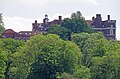
 Garnish Hall - geograph.org.uk - 2911094.jpg 1,600 × 1,067; 547 KB
-
 Gate near Epping - geograph.org.uk - 2594246.jpg 480 × 640; 150 KB
-
 Gaynes Park access road bridge, M11 - geograph.org.uk - 2724545.jpg 640 × 434; 69 KB
-
 Gernon Bushes information board - geograph.org.uk - 3155334.jpg 2,731 × 2,357; 1.55 MB
-
 Grassland off Coopersale Lane - geograph.org.uk - 6207285.jpg 800 × 600; 164 KB
-
 Hill Farm - geograph.org.uk - 5295418.jpg 640 × 480; 97 KB
-
 Hobbs Cross Cottage - geograph.org.uk - 2911616.jpg 2,999 × 1,977; 2.81 MB
-
 Hobbs Cross Golf Centre - geograph.org.uk - 6213828.jpg 800 × 600; 102 KB
-
 Hobbs Cross Golf Centre, M11 and pylons - geograph.org.uk - 3509053.jpg 4,320 × 3,240; 2.93 MB
-
 Hobbs Cross Road - geograph.org.uk - 6213830.jpg 800 × 600; 98 KB
-

-
 Hobbs Cross Road towards Epping - geograph.org.uk - 6207292.jpg 800 × 600; 129 KB
-
 Hobbs Cross Road, near Abridge - geograph.org.uk - 6241288.jpg 1,024 × 768; 139 KB
-
 Hornbeam pollards - geograph.org.uk - 3154603.jpg 3,382 × 1,902; 3.32 MB
-
 Houses on Mount Road - geograph.org.uk - 6213831.jpg 800 × 501; 85 KB
-
 Houses, Hobbs Cross - geograph.org.uk - 6207289.jpg 800 × 520; 87 KB
-
 Hydes Farm - geograph.org.uk - 2911632.jpg 3,456 × 2,304; 2.91 MB
-
 Hydes Lane - geograph.org.uk - 2911581.jpg 3,456 × 2,304; 5.1 MB
-
 Hydes Lane Public Footpath - geograph.org.uk - 2911623.jpg 2,303 × 1,537; 2.55 MB
-
 Joining the M25 - geograph.org.uk - 2724550.jpg 640 × 423; 65 KB
-
 Joining the M25 - geograph.org.uk - 3746956.jpg 640 × 430; 51 KB
-

-
 Looking north over the M25 - geograph.org.uk - 3155369.jpg 3,386 × 2,093; 1.75 MB
-
 Looking south over the M25 - geograph.org.uk - 3155375.jpg 3,648 × 2,255; 1.97 MB
-
 Looking uphill - geograph.org.uk - 3155397.jpg 3,648 × 2,736; 5.42 MB
-
 M11 - geograph.org.uk - 5002558.jpg 4,000 × 2,666; 7.97 MB
-
 M11 - geograph.org.uk - 5002572.jpg 4,000 × 2,666; 7.28 MB
-
 M11 approaching Junction 6 - geograph.org.uk - 3770989.jpg 640 × 513; 50 KB
-
 M11 approaching junction with M25 - geograph.org.uk - 3452510.jpg 1,809 × 1,096; 860 KB
-
 M11 bridge over Mount Road - geograph.org.uk - 6213838.jpg 800 × 513; 73 KB
-

-
 M11 looking north from the M25 - geograph.org.uk - 2420377.jpg 640 × 480; 74 KB
-
 M11 motorway seen from the road bridge near Blunt's Farm - geograph.org.uk - 3508990.jpg 4,320 × 3,240; 2.88 MB
-
 M11 northbound - geograph.org.uk - 2640221.jpg 640 × 428; 77 KB
-
 M11 northbound near Epping - geograph.org.uk - 3546300.jpg 2,403 × 1,377; 1.61 MB
-
 M11 northbound passing through woodland - geograph.org.uk - 3546306.jpg 2,127 × 1,215; 1.31 MB
-
 M11 northeast of Coopersale - geograph.org.uk - 3537472.jpg 3,481 × 2,545; 1.11 MB
-
 M11 towards London - geograph.org.uk - 6207284.jpg 800 × 600; 94 KB
-
 M11, looking south - geograph.org.uk - 3752894.jpg 640 × 430; 52 KB
-
 M11, northbound - geograph.org.uk - 3752903.jpg 640 × 430; 59 KB
-
 M11, southbound - geograph.org.uk - 3770986.jpg 640 × 430; 52 KB
-
 M25 - gantry for junction 27 - geograph.org.uk - 2640066.jpg 640 × 428; 85 KB
-
 M25 - M11 junction - geograph.org.uk - 6018703.jpg 1,024 × 681; 90 KB
-
 M25 and M11 interchange seen from Hobbs Cross Road (Bridge) - geograph.org.uk - 3509011.jpg 4,320 × 3,240; 2.81 MB
-
 M25 and M11 motorways from the air - geograph.org.uk - 3201443.jpg 640 × 480; 155 KB
-
 M25 anticlockwise - geograph.org.uk - 4226086.jpg 640 × 480; 36 KB
-
 M25 anticlockwise - geograph.org.uk - 4226093.jpg 640 × 480; 42 KB
-

-
 M25 at J27 - geograph.org.uk - 3746953.jpg 640 × 359; 37 KB
-
 M25 at junction 27 - geograph.org.uk - 3605417.jpg 3,857 × 2,340; 1.78 MB
-
 M25 at Theydon Garnon - geograph.org.uk - 52222.jpg 640 × 422; 44 KB
-
 M25 dropping down towards the M11 junction - geograph.org.uk - 3452483.jpg 1,668 × 940; 759 KB
-
 M25 junction 27 - geograph.org.uk - 2640093.jpg 640 × 428; 84 KB
-
 M25 near Hobbs Cross - geograph.org.uk - 5582224.jpg 1,024 × 732; 96 KB
-
 M25 towards junction 27 - geograph.org.uk - 4075285.jpg 1,600 × 942; 1.05 MB
-
 M25 westbound slip road for M11 - geograph.org.uk - 3452490.jpg 1,707 × 1,021; 874 KB
-
 M25, J27 - geograph.org.uk - 3828955.jpg 640 × 361; 24 KB
-
 M25, Junction 27 - geograph.org.uk - 6207293.jpg 800 × 600; 93 KB
-
 Minor road east of Coopersale Common - geograph.org.uk - 4247396.jpg 640 × 480; 70 KB
-
 Motorway access road off Coopersale Lane - geograph.org.uk - 6207287.jpg 800 × 600; 158 KB
-
 Mount Road towards Theydon Mount - geograph.org.uk - 6213833.jpg 800 × 600; 82 KB
-
 Mount Road towards Theydon Mount - geograph.org.uk - 6213836.jpg 800 × 600; 93 KB
-
 Part of Hornes Farm - geograph.org.uk - 763402.jpg 640 × 480; 87 KB
-
 Path in Birching Coppice (2) - geograph.org.uk - 4245688.jpg 640 × 480; 137 KB
-
 Path in Birching Coppice (2) - geograph.org.uk - 4245695.jpg 640 × 480; 137 KB
-
 Path in Birching Coppice (3) - geograph.org.uk - 4245705.jpg 480 × 640; 149 KB
-
 Path in Birching Coppice (4) - geograph.org.uk - 4245707.jpg 480 × 640; 143 KB
-
 Path in Birching Coppice - geograph.org.uk - 4245685.jpg 480 × 640; 157 KB
-
 Path in Birching Coppice - geograph.org.uk - 4245693.jpg 480 × 640; 157 KB
-
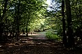
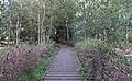
 Path in Gernon Bushes - geograph.org.uk - 4247408.jpg 640 × 480; 140 KB
-
 Path in Gernon Bushes - geograph.org.uk - 4247474.jpg 640 × 480; 137 KB
-
 Path near the edge of the wood - geograph.org.uk - 3154597.jpg 3,648 × 2,736; 5.4 MB
-
 Path through Birching Coppice, Epping Forest - geograph.org.uk - 5943358.jpg 3,776 × 2,520; 4.24 MB
-
 Path Through Gernon Bushes - geograph.org.uk - 5002496.jpg 4,000 × 2,666; 7.85 MB
-
 Power lines across a wheat field - geograph.org.uk - 2724546.jpg 640 × 430; 67 KB
-
 Private road to Hyde Farm - geograph.org.uk - 5296279.jpg 640 × 428; 116 KB
-
 Public bridleway near Epping - geograph.org.uk - 4518656.jpg 640 × 480; 128 KB
-
 Public footpath near Epping - geograph.org.uk - 2594243.jpg 640 × 480; 89 KB
-
 Pylon by the M25 - M11 Junction - geograph.org.uk - 2724549.jpg 472 × 640; 54 KB
-
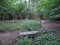
 Raised walkway - geograph.org.uk - 3155346.jpg 3,648 × 2,255; 5.43 MB
-
 Rear of Hill House - geograph.org.uk - 6161387.jpg 1,024 × 678; 178 KB
-
 Road junction near Epping - geograph.org.uk - 4518667.jpg 640 × 480; 119 KB
-
-
 Roman Driveway - geograph.org.uk - 1873826.jpg 640 × 428; 72 KB
-
 Roman Road - geograph.org.uk - 2724551.jpg 640 × 430; 70 KB
-
 Route of Roman Road - geograph.org.uk - 218610.jpg 640 × 480; 47 KB
-
 Route of the Roman Road - geograph.org.uk - 3746951.jpg 640 × 430; 52 KB
-
 Sheep grazing - geograph.org.uk - 3752905.jpg 640 × 430; 41 KB
-
 Sheep grazing by the M11 - geograph.org.uk - 2585096.jpg 417 × 640; 61 KB
-
 Slip road junction 27 (M25 - M11) - geograph.org.uk - 2585084.jpg 640 × 430; 70 KB
-
 Slip road off the M11 - geograph.org.uk - 3746955.jpg 640 × 461; 48 KB
-
 Slip road to the M11 - geograph.org.uk - 3752896.jpg 640 × 430; 60 KB
-

-
 Stream in Barber's Wood - geograph.org.uk - 6161385.jpg 678 × 1,024; 292 KB
-
 Teasel (Dipsacus) in Gernon Bushes - geograph.org.uk - 4247495.jpg 480 × 640; 82 KB
-
 The entrance to Hydes Farm, Theydon Garnon - geograph.org.uk - 5713306.jpg 2,048 × 1,536; 1.54 MB
-
 The Essex Way heading towards Gernon Bushes SSSI - geograph.org.uk - 5937245.jpg 3,776 × 2,520; 4.11 MB
-

-
 The farmhouse at Hill Farm - geograph.org.uk - 730503.jpg 640 × 438; 69 KB
-
 The M11 south of junction 6 - geograph.org.uk - 2976943.jpg 800 × 600; 70 KB
-
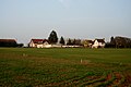
 Theydon Garnon - geograph.org.uk - 2911566.jpg 1,067 × 1,600; 562 KB
-
 Track heading North towards Roughtalley's Wood - geograph.org.uk - 5931251.jpg 5,184 × 3,456; 7.57 MB
-
 Track to Searles Hall - geograph.org.uk - 6213835.jpg 800 × 600; 158 KB
-
 Tree silhouettes on the skyline - geograph.org.uk - 5306961.jpg 4,608 × 3,456; 2.79 MB
-

-
 View from church carpark - geograph.org.uk - 374404.jpg 640 × 479; 113 KB
-
 View From the Essex Way - geograph.org.uk - 5003131.jpg 4,000 × 2,666; 6.12 MB
-
 View from the M25 near Hobbs Cross - geograph.org.uk - 4401479.jpg 1,600 × 1,038; 173 KB
-
 View Towards the M11 - geograph.org.uk - 5003130.jpg 4,000 × 2,666; 7.23 MB
-
 Westward path - geograph.org.uk - 3154610.jpg 3,648 × 2,736; 5.4 MB
-
 Wheat field and Mount Rd - geograph.org.uk - 2724547.jpg 640 × 317; 54 KB
-
 Woodland in Gernon Bushes (2) - geograph.org.uk - 4248366.jpg 640 × 480; 150 KB
-
 Woodland in Gernon Bushes - geograph.org.uk - 4248362.jpg 640 × 480; 140 KB
-
 Woodland near Hill Hall - geograph.org.uk - 3747066.jpg 640 × 430; 40 KB
-
 Woodland pathway - geograph.org.uk - 3154586.jpg 2,461 × 2,461; 3.66 MB


_Redyn%27s_Wood_-_geograph.org.uk_-_4253247.jpg)


_-_geograph.org.uk_-_279118.jpg)


_-_geograph.org.uk_-_3509011.jpg)


_-_geograph.org.uk_-_4245688.jpg)
_-_geograph.org.uk_-_4245695.jpg)
_-_geograph.org.uk_-_4245705.jpg)
_-_geograph.org.uk_-_4245707.jpg)


_-_geograph.org.uk_-_2585084.jpg)


_in_Gernon_Bushes_-_geograph.org.uk_-_4247495.jpg)


_-_geograph.org.uk_-_4248366.jpg)


