Category:Thomas's Path, Clatterbridge
| Object location | | View all coordinates using: OpenStreetMap |
|---|
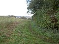
Designated FP4, this path runs easterly from Rocklands Lane (BR47) to Clatterbridge Hospital on the B5151. It is 740m long.

Media in category "Thomas's Path, Clatterbridge"
The following 2 files are in this category, out of 2 total.
-
 Footpath to Clatterbridge Hospital - geograph.org.uk - 1029189.jpg 640 × 480; 111 KB
-
 Sign on Rocklands Lane, Thornton Hough.jpg 3,346 × 5,190; 21.39 MB

