Category:Thornton, Leicestershire
English: Thornton is a village in Leicestershire, England. The village is within the civil parish of Bagworth and Thornton. It is a linear village lying along a scarp overlooking Thornton Reservoir.
village in Leicestershire, United Kingdom  | |||||
| Upload media | |||||
| Instance of | |||||
|---|---|---|---|---|---|
| Location | Bagworth and Thornton, Hinckley and Bosworth, Leicestershire, East Midlands, England | ||||
 | |||||
Subcategories
This category has the following 2 subcategories, out of 2 total.
T
- Thornton Reservoir (24 F)
Media in category "Thornton, Leicestershire"
The following 42 files are in this category, out of 42 total.
-
 From the end of Thornton Reservoir - geograph.org.uk - 316085.jpg 640 × 480; 104 KB
-
 Minor road through Ratby Burroughs - geograph.org.uk - 318188.jpg 640 × 480; 173 KB
-

-
 St Peter's Church and Thornton Reservoir - geograph.org.uk - 5697437.jpg 800 × 509; 105 KB
-
 The Bricklayers Arms - geograph.org.uk - 513381.jpg 640 × 401; 92 KB
-
 The Tipsy Fisherman - geograph.org.uk - 513376.jpg 640 × 479; 86 KB
-
 View towards Thornton - geograph.org.uk - 1201835.jpg 640 × 386; 57 KB
-
 Woodland off Thornton Lane - geograph.org.uk - 513393.jpg 640 × 480; 120 KB
-
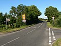
 Approaching Botcheston - geograph.org.uk - 514879.jpg 640 × 480; 127 KB
-
 Burroughs Road, west of Ratby - geograph.org.uk - 490823.jpg 480 × 640; 103 KB
-
 Busky Farm - geograph.org.uk - 514940.jpg 480 × 640; 138 KB
-
 Busky Farm Entrance - geograph.org.uk - 174874.jpg 640 × 320; 58 KB
-
 End of Markfield Lane - geograph.org.uk - 240271.jpg 640 × 480; 71 KB
-
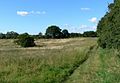
 Farmland and New Trees near Markfield - geograph.org.uk - 158702.jpg 640 × 427; 111 KB
-
 Farmland near Thornton Reservoir - geograph.org.uk - 514946.jpg 640 × 480; 110 KB
-
 Forest Hill Golf Club - geograph.org.uk - 514041.jpg 640 × 416; 83 KB
-
 Ivanhoe Trail - geograph.org.uk - 240276.jpg 640 × 421; 108 KB
-
 Ivanhoe Trail - geograph.org.uk - 490820.jpg 640 × 591; 120 KB
-
 Ivanhoe Trail sign - geograph.org.uk - 240277.jpg 313 × 640; 55 KB
-

-

-
 Lindridge Lane - geograph.org.uk - 253801.jpg 640 × 427; 75 KB
-
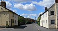 Main Street, Thornton - geograph.org.uk - 513383.jpg 640 × 349; 80 KB
-
 Markfield Lane - geograph.org.uk - 239895.jpg 640 × 480; 76 KB
-
 Markfield Lane near Botcheston - geograph.org.uk - 514882.jpg 640 × 480; 96 KB
-
 Markfield Lane near Thornton - geograph.org.uk - 513387.jpg 640 × 476; 130 KB
-
 Markfield Lane near Thornton - geograph.org.uk - 513390.jpg 640 × 517; 98 KB
-
 Markfield Lane near Thornton - geograph.org.uk - 514042.jpg 640 × 480; 97 KB
-
 Markfield Lane north of Thornton - geograph.org.uk - 513401.jpg 640 × 510; 100 KB
-
 Markfield Lane to the north - geograph.org.uk - 240274.jpg 640 × 402; 98 KB
-
 Markfield Lane to the south - geograph.org.uk - 240273.jpg 640 × 464; 79 KB
-
 Markfield Lane, Leicestershire - geograph.org.uk - 514866.jpg 640 × 450; 115 KB
-
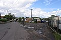 Merry Lees Industrial Area - geograph.org.uk - 174871.jpg 640 × 422; 59 KB
-
 Merrylees Road junction - geograph.org.uk - 514918.jpg 640 × 480; 88 KB
-
 Merrylees Road near Botcheston - geograph.org.uk - 514905.jpg 640 × 480; 101 KB
-
 Merrylees Road, Lindridge Lane junction - geograph.org.uk - 514924.jpg 640 × 493; 116 KB
-
 Merrylees Road, Thornton - geograph.org.uk - 514947.jpg 640 × 443; 116 KB
-
 Private Farm Track - geograph.org.uk - 240275.jpg 640 × 480; 110 KB
-
 Public Footpath in the Ratby Burroughs - geograph.org.uk - 514038.jpg 640 × 444; 108 KB
-
 Reservoir Road, Thornton - geograph.org.uk - 513369.jpg 614 × 640; 144 KB
-

-
 Track towards Whittington Rough - geograph.org.uk - 240290.jpg 640 × 396; 72 KB


