Category:Thorpe, Derbyshire
village and civil parish in Derbyshire Dales district, Derbyshire, England  | |||||
| Upload media | |||||
| Instance of | |||||
|---|---|---|---|---|---|
| Location | Derbyshire Dales, Derbyshire, East Midlands, England | ||||
| Population |
| ||||
 | |||||
Subcategories
This category has the following 5 subcategories, out of 5 total.
C
- Coldwall Bridge (6 F)
D
- Dovedale Stepping Stones (36 F)
I
- Izaak Walton Gauging Station (6 F)
T
- Thorpe Cloud (15 F)
Media in category "Thorpe, Derbyshire"
The following 200 files are in this category, out of 281 total.
(previous page) (next page)-
 "There's Life in the Old Dog Yet" - geograph.org.uk - 3564624.jpg 3,906 × 2,870; 1.71 MB
-
 "There's Life in the Old Dog Yet" - geograph.org.uk - 4775915.jpg 800 × 534; 98 KB
-
 A muddy path beside the River Dove - geograph.org.uk - 3829535.jpg 4,000 × 2,248; 7.44 MB
-
 A survivor - geograph.org.uk - 645055.jpg 427 × 640; 137 KB
-

-
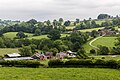 Alders Farm - geograph.org.uk - 5007750.jpg 5,086 × 3,391; 1.84 MB
-
 Alders Farm, Fenny Bentley - geograph.org.uk - 2367977.jpg 3,648 × 2,736; 5.98 MB
-
 Another cottage in Thorpe - geograph.org.uk - 3542371.jpg 3,441 × 2,581; 1.65 MB
-
 Another tree down - geograph.org.uk - 3829666.jpg 4,000 × 2,248; 7.32 MB
-
 Ashes Farm - geograph.org.uk - 5007748.jpg 5,183 × 3,203; 1.49 MB
-

-
 Bank Holiday Monday at the Stepping Stones - geograph.org.uk - 5101864.jpg 1,616 × 1,232; 1.07 MB
-
 Barn near Dove Farm - geograph.org.uk - 4214156.jpg 1,920 × 1,440; 1.21 MB
-
 Bentley Brook Inn - Ashbourne - geograph.org.uk - 1454770.jpg 640 × 416; 57 KB
-
 Bin day in Thorpe - geograph.org.uk - 6020224.jpg 2,000 × 1,333; 2.58 MB
-
 Bluebells and wild garlic - geograph.org.uk - 2369030.jpg 3,648 × 2,736; 6.3 MB
-
 Bridge over the Tissington Trail - geograph.org.uk - 4591458.jpg 6,000 × 4,000; 5.51 MB
-
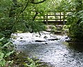
 Bridging the river - geograph.org.uk - 5847090.jpg 3,933 × 2,949; 4.57 MB
-
 Bunster Hill - geograph.org.uk - 3704395.jpg 1,920 × 931; 406 KB
-
 Buttercup field by the Tissington Trail - geograph.org.uk - 4591472.jpg 6,000 × 4,000; 5.5 MB
-
 Campervan weekenders at Pike House - geograph.org.uk - 3542363.jpg 640 × 512; 78 KB
-
 Car Park at The Narlows on Tissington Trail - geograph.org.uk - 3829281.jpg 3,986 × 2,222; 7.06 MB
-
 Car Park, Thorpe, Derbyshire - geograph.org.uk - 2169168.jpg 2,640 × 1,980; 888 KB
-
 Caravan Club site near Pike House - geograph.org.uk - 5408061.jpg 640 × 427; 99 KB
-
 Cattle grid - geograph.org.uk - 3691703.jpg 1,600 × 1,064; 707 KB
-
 Cattle grid, west of Thorpe - geograph.org.uk - 2835471.jpg 640 × 426; 95 KB
-
 Cattle near Thorpe Mill Farm - geograph.org.uk - 3542388.jpg 2,186 × 2,732; 1.2 MB
-
 Church Lane - geograph.org.uk - 4919658.jpg 5,184 × 3,888; 6.77 MB
-
 Coach at Peveril of the Peak - geograph.org.uk - 3367403.jpg 640 × 427; 223 KB
-
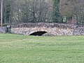
 Coldwall Bridge - geograph.org.uk - 2481861.jpg 640 × 480; 129 KB
-
 Coldwall Bridge - geograph.org.uk - 3766896.jpg 4,912 × 3,264; 7.03 MB
-
 Coldwall Bridge - geograph.org.uk - 4562176.jpg 6,000 × 4,000; 4.86 MB
-
 Coldwall Bridge, SW of Thorpe, Derbyshire - geograph.org.uk - 3291118.jpg 1,024 × 768; 304 KB
-
 Cottage in Thorpe, Derbyshire - geograph.org.uk - 3542369.jpg 3,548 × 2,535; 1.78 MB
-
 Cottages by the Dog and Partridge - geograph.org.uk - 1940379.jpg 480 × 640; 98 KB
-
 Country Barn near Thorpe, Derbyshire - geograph.org.uk - 5436038.jpg 3,281 × 2,187; 3.64 MB
-
 Crossing the Dove in pink wellies - geograph.org.uk - 2314416.jpg 640 × 427; 110 KB
-
 Damaged stepping stones - geograph.org.uk - 3018035.jpg 2,272 × 1,704; 2.85 MB
-
 Derbyshire UK parish map highlighting Thorpe.svg 888 × 1,308; 2.34 MB
-
 Digmire Lane and Church Lane, Thorpe - geograph.org.uk - 1879746.jpg 3,648 × 2,736; 2.31 MB
-
 Dog and Partridge - geograph.org.uk - 1830089.jpg 640 × 480; 71 KB
-
 Dog and Partridge, Thorpe - geograph.org.uk - 127624.jpg 640 × 480; 123 KB
-
 Dog ^ Partridge and Dovedale Garage, Thorpe - geograph.org.uk - 3640293.jpg 3,932 × 1,792; 3.9 MB
-
 Dove Dale - geograph.org.uk - 2542085.jpg 1,200 × 1,600; 643 KB
-
 Dove Dale c1930 - geograph.org.uk - 3249768.jpg 433 × 653; 59 KB
-
 Dove Dale, Derbys. - geograph.org.uk - 5794984.jpg 3,890 × 2,503; 3.04 MB
-
 Dove valley - geograph.org.uk - 2481805.jpg 640 × 423; 79 KB
-
 Dove valley - geograph.org.uk - 2481827.jpg 640 × 465; 81 KB
-
 Dove valley - geograph.org.uk - 2539450.jpg 640 × 469; 76 KB
-
 Dove valley - geograph.org.uk - 2539470.jpg 640 × 452; 78 KB
-
 Dovedale - geograph.org.uk - 4798488.jpg 6,000 × 4,000; 5.29 MB
-
 Dovedale 007443 1d799daa.jpg 640 × 480; 147 KB
-
 Dovedale and Thorpe Cloud - geograph.org.uk - 5897269.jpg 4,000 × 3,000; 4.47 MB
-
 Dovedale from Thorpe Cloud - geograph.org.uk - 1879719.jpg 3,648 × 2,736; 1.93 MB
-
 Dovedale weir - geograph.org.uk - 701841.jpg 466 × 640; 156 KB
-
 Dovedale, gateway section - geograph.org.uk - 2216488.jpg 1,024 × 681; 217 KB
-

-

-
 East bank path - geograph.org.uk - 5847052.jpg 4,320 × 3,240; 5.57 MB
-
 Elders in flower near Thorpe - geograph.org.uk - 2481769.jpg 640 × 454; 96 KB
-
 Eroding bank, River Dove - geograph.org.uk - 2562628.jpg 640 × 454; 106 KB
-
 Farm buildings ^ cattle grid - geograph.org.uk - 2032705.jpg 640 × 480; 86 KB
-
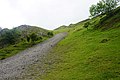
 Farm track - geograph.org.uk - 3024023.jpg 2,272 × 1,704; 3.05 MB
-
 Farm track near the River Dove - geograph.org.uk - 4562209.jpg 6,000 × 4,000; 4.79 MB
-
 Farmland by the Tissington Trail - geograph.org.uk - 4591481.jpg 6,000 × 4,000; 4.47 MB
-
 Fenny Bentley cutting. - geograph.org.uk - 3946045.jpg 640 × 480; 127 KB
-
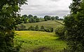
 Field at Thorpe - geograph.org.uk - 2481570.jpg 640 × 407; 60 KB
-
 Fields above Alders Farm - geograph.org.uk - 4590384.jpg 6,000 × 4,000; 4.94 MB
-
 Fields at the southern end of Dove Dale - geograph.org.uk - 4778970.jpg 800 × 625; 148 KB
-
 Fields near The Tissington Trail - geograph.org.uk - 1876320.jpg 2,816 × 4,224; 4.87 MB
-
 Fields, trees, blue sky and distant farm - geograph.org.uk - 2369020.jpg 3,648 × 2,736; 5.77 MB
-
 Flowering river - geograph.org.uk - 5847080.jpg 3,675 × 2,757; 2.71 MB
-
 Footbridge across the River Dove - geograph.org.uk - 4779086.jpg 800 × 646; 238 KB
-
 Footbridge over Wash Brook - geograph.org.uk - 4855109.jpg 3,888 × 5,184; 5.87 MB
-
 Footbridge over Wash Brook - geograph.org.uk - 645100.jpg 640 × 427; 148 KB
-
 Footpath and Grassland by the River Dove - geograph.org.uk - 3564508.jpg 4,000 × 3,000; 2.44 MB
-
 Footpath by the Dove - geograph.org.uk - 2561742.jpg 640 × 480; 119 KB
-
 Footpath by the Dove - geograph.org.uk - 4520259.jpg 1,920 × 1,403; 838 KB
-
 Footpath by the River Dove - geograph.org.uk - 3564609.jpg 4,000 × 3,000; 3.42 MB
-

-
 Footpath to Dove Dale - geograph.org.uk - 4561932.jpg 6,000 × 4,000; 5.7 MB
-
 Footpath to Dovedale - geograph.org.uk - 4911965.jpg 1,280 × 960; 630 KB
-
 Footpath to Fenny Bentley - geograph.org.uk - 1918036.jpg 640 × 480; 168 KB
-
 Footpath to Fenny Bentley - geograph.org.uk - 4590389.jpg 6,000 × 4,000; 6.13 MB
-
 Footpath to Fenny Bentley - geograph.org.uk - 4591498.jpg 6,000 × 4,000; 6.17 MB
-
 Footpath to Hollington End Farm - geograph.org.uk - 1918038.jpg 640 × 480; 166 KB
-
 Garden at Peveril of the Peak - geograph.org.uk - 3330727.jpg 640 × 427; 178 KB
-

-
 Gate to a private field - geograph.org.uk - 4562191.jpg 6,000 × 4,000; 4.78 MB
-

-
 Gateway to Thorpe - geograph.org.uk - 3542378.jpg 2,616 × 3,488; 1.93 MB
-
 Gateway to Thorpe Pastures - geograph.org.uk - 2032711.jpg 640 × 480; 95 KB
-
 Gathering hay while the sun shines - geograph.org.uk - 5453834.jpg 3,584 × 2,015; 2.15 MB
-
 Gauging station (1) - geograph.org.uk - 5848066.jpg 4,320 × 3,240; 3.41 MB
-
 Gauging station (2) - geograph.org.uk - 5848067.jpg 2,846 × 2,135; 1,022 KB
-

-
 Grazing land by the Tissington Trail - geograph.org.uk - 4591491.jpg 6,000 × 4,000; 4.77 MB
-
 Green Croft, Green Gables, Green Lea 01.jpg 4,000 × 3,000; 4.51 MB
-
 Green Croft, Green Gables, Green Lea 02.jpg 4,000 × 3,000; 5.09 MB
-
 Hamston Hill towards Thorpe - geograph.org.uk - 1951592.jpg 640 × 480; 142 KB
-
 Hedgerows wild and clipped - geograph.org.uk - 2369027.jpg 3,648 × 2,736; 5.58 MB
-
 Hollington End Farm - geograph.org.uk - 3022378.jpg 2,272 × 1,704; 1.77 MB
-
 Hollington End Farm - geograph.org.uk - 3831308.jpg 800 × 533; 98 KB
-
 Homeward bound - geograph.org.uk - 2542119.jpg 1,600 × 1,200; 664 KB
-
 Ilam Village - panoramio (8).jpg 2,048 × 1,360; 1.82 MB
-
 In Dovedale - geograph.org.uk - 5222345.jpg 427 × 640; 111 KB
-
 Installing a new fish ladder on River Dove - geograph.org.uk - 5082567.jpg 3,072 × 1,728; 2.19 MB
-
 Is this where they bury the bodies in Dovedale^ - geograph.org.uk - 4900493.jpg 2,511 × 1,687; 3.49 MB
-

-
 Lane towards Broadlowash - geograph.org.uk - 3331561.jpg 640 × 401; 240 KB
-
 Large driftwood - geograph.org.uk - 5847069.jpg 4,320 × 3,240; 4.41 MB
-
 Limestone Way - geograph.org.uk - 2481844.jpg 640 × 480; 83 KB
-

-
 Lin Dale - geograph.org.uk - 3680230.jpg 995 × 718; 801 KB
-
 Lin Dale from Thorpe Cloud - geograph.org.uk - 1879693.jpg 3,648 × 2,736; 1.51 MB
-

-
 Lin Dale looking towards Dovedale - geograph.org.uk - 1879653.jpg 3,648 × 2,736; 1.37 MB
-
 Lindale - geograph.org.uk - 3366462.jpg 640 × 427; 210 KB
-

-

-
 Meadow below Thorpe Cloud - geograph.org.uk - 4561915.jpg 6,000 × 4,000; 4.58 MB
-
 Meadow near Broadlowash - geograph.org.uk - 2539437.jpg 640 × 480; 97 KB
-
 Meadows below Thorpe Cloud - geograph.org.uk - 1879736.jpg 3,648 × 2,736; 1.31 MB
-
 Narlows Lane car park - geograph.org.uk - 3022376.jpg 2,272 × 1,704; 2.62 MB
-
 Narlows Lane car park - geograph.org.uk - 4775871.jpg 800 × 505; 117 KB
-
 National Trust Sign - geograph.org.uk - 5222313.jpg 1,599 × 2,399; 636 KB
-
 National Trust sign at gate - geograph.org.uk - 1940359.jpg 640 × 480; 62 KB
-
 Nettles by the Dove - geograph.org.uk - 2481884.jpg 640 × 480; 146 KB
-
 Newly fenced footpath beside the River Dove - geograph.org.uk - 3829530.jpg 4,000 × 2,248; 5.84 MB
-
 Northern entrance to Thorpe Pastures - geograph.org.uk - 3542361.jpg 3,648 × 2,736; 2.31 MB
-
 Old barn near Pike House - geograph.org.uk - 3542366.jpg 3,418 × 2,734; 2.06 MB
-
 Old Milestone in Coldwall Lane, east of Coldwall Bridge (geograph 5623759).jpg 890 × 1,211; 173 KB
-
 Old railway goods wagon at Thorpe Mill Farm - geograph.org.uk - 4912018.jpg 1,280 × 960; 522 KB
-
 On the Tissington Trail - geograph.org.uk - 3831288.jpg 800 × 533; 167 KB
-
 On the Tissington Trail - geograph.org.uk - 3831289.jpg 800 × 533; 163 KB
-
 On Thorpe Cloud - view to Bunster Hill - geograph.org.uk - 5621940.jpg 5,184 × 2,920; 5.46 MB
-
 Over bridge across Tissington Trail - geograph.org.uk - 3829286.jpg 3,990 × 2,230; 7.17 MB
-
 Paddock at Narlows Lane - geograph.org.uk - 3517368.jpg 640 × 431; 226 KB
-
 Pasture at Thorpe - geograph.org.uk - 3331568.jpg 640 × 427; 239 KB
-
 Path into Dove Dale - geograph.org.uk - 4561904.jpg 6,000 × 4,000; 4.74 MB
-
 Path into Lin Dale from the River Dove - geograph.org.uk - 5897263.jpg 4,000 × 3,000; 4.66 MB
-

-
 Peveril of the Peak hotel - geograph.org.uk - 1565528.jpg 640 × 480; 131 KB
-
 Post box in Thorpe near Ashbourne - geograph.org.uk - 5621939.jpg 5,184 × 2,920; 6.5 MB
-
 Public Footpath to Fenny Bentley - geograph.org.uk - 2367961.jpg 3,648 × 2,736; 6.25 MB
-
 Recently rebuilt drystone wall with top wiring - geograph.org.uk - 3829707.jpg 4,000 × 2,248; 4.93 MB
-
 Resting cows by Thorpe Mill Farm - geograph.org.uk - 4561953.jpg 6,000 × 4,000; 5.61 MB
-
 Ridge and furrow by the Tissington Trail - geograph.org.uk - 4815099.jpg 1,280 × 960; 350 KB
-
 Ridge and furrow field with a remnant of a hedge - geograph.org.uk - 4815118.jpg 1,280 × 960; 504 KB
-
 Ridge and furrow near Broadlowash - geograph.org.uk - 2539426.jpg 640 × 480; 101 KB
-
 River Dove - geograph.org.uk - 2029263.jpg 3,648 × 2,736; 2.42 MB
-
 River Dove - geograph.org.uk - 2397234.jpg 1,408 × 976; 435 KB
-
 River Dove - geograph.org.uk - 2481907.jpg 640 × 436; 93 KB
-
 River Dove - geograph.org.uk - 5720679.jpg 640 × 427; 113 KB
-
 River Dove - geograph.org.uk - 5897272.jpg 4,000 × 3,000; 4.56 MB
-
 River Dove - geograph.org.uk - 5897275.jpg 4,000 × 3,000; 4.67 MB
-
 River Dove in Dovedale - geograph.org.uk - 2920082.jpg 4,000 × 3,000; 2.52 MB
-
 Road from Thorpe to Dovedale - geograph.org.uk - 1082258.jpg 640 × 427; 96 KB
-
 Road from Thorpe to Dovedale - geograph.org.uk - 1082259.jpg 640 × 427; 82 KB
-
 Road junction on Spend Lane - geograph.org.uk - 2834787.jpg 640 × 426; 71 KB
-
 Rough grazing land by the Tissington Trail - geograph.org.uk - 2367934.jpg 3,648 × 2,736; 6.21 MB
-
 Royal Mail van at Thorpe Mill Farm - geograph.org.uk - 4779018.jpg 800 × 538; 130 KB
-
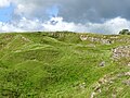
 Scree on the side of Thorpe Cloud - geograph.org.uk - 4561894.jpg 6,000 × 4,000; 4.48 MB
-
 Scree slope on Thorpe Cloud - geograph.org.uk - 4781715.jpg 800 × 600; 160 KB
-

-
 Sheep grazing in Dovedale - geograph.org.uk - 3831301.jpg 800 × 533; 78 KB
-
 Sheep in the shade - geograph.org.uk - 1940363.jpg 640 × 480; 131 KB
-
 Sheep on the steep slopes of Dovedale - geograph.org.uk - 4779097.jpg 800 × 590; 130 KB
-
 Small weir on the River Dove - geograph.org.uk - 4781740.jpg 800 × 600; 205 KB
-
 Snow near Thorpe - geograph.org.uk - 5366245.jpg 1,333 × 2,000; 1.69 MB
-
 Souvenir from when the Trail was a Track - geograph.org.uk - 944485.jpg 640 × 480; 117 KB
-

-
 St Leonard's Church - geograph.org.uk - 3831305.jpg 800 × 533; 152 KB
-
 St Leonard's Church, Thorpe - geograph.org.uk - 6355868.jpg 2,592 × 1,944; 1.67 MB
-
 St Leonard's parish church, Thorpe - geograph.org.uk - 3829689.jpg 3,988 × 2,226; 6.6 MB
-
 St Leonards church. - geograph.org.uk - 5408065.jpg 640 × 427; 105 KB
-
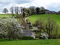
 St Mary's Bridge and Thorpe Mill Farm - geograph.org.uk - 4168445.jpg 4,000 × 3,000; 2.7 MB
-
 St Mary's Bridge and Thorpe Mill Farm - geograph.org.uk - 4779037.jpg 800 × 609; 128 KB
-
 St Marys Bridge (East), Thorpe 01.jpg 4,000 × 3,000; 5.26 MB
-
 St Marys Bridge (East), Thorpe 02.jpg 4,000 × 3,000; 4.6 MB
-
 St Marys Bridge (West), Thorpe.jpg 4,000 × 3,000; 4.64 MB
-
 Stepping stones (1) - geograph.org.uk - 5847037.jpg 4,320 × 3,240; 5 MB
-
 Stepping stones (2) - geograph.org.uk - 5847041.jpg 4,320 × 3,240; 4.99 MB
-
 Stepping stones (3) - geograph.org.uk - 5847045.jpg 4,320 × 3,240; 5.05 MB
-
 Stepping stones in Dovedale - geograph.org.uk - 3875084.jpg 1,500 × 1,125; 2.04 MB
-
 Stepping stones in Dovedale - geograph.org.uk - 4561882.jpg 6,000 × 4,000; 4.96 MB
-
 Stepping Stones, Dovedale - geograph.org.uk - 2029276.jpg 3,648 × 2,736; 3.56 MB
-
 Stoney Lane and Broadlowash - geograph.org.uk - 4919644.jpg 1,280 × 960; 545 KB
-
 Telephone Exchange, Thorpe - geograph.org.uk - 4286737.jpg 3,072 × 2,304; 1.79 MB
-
 The Dog and Partridge at Thorpe - geograph.org.uk - 2834791.jpg 640 × 426; 55 KB
-
 The Dog ^ Partridge - geograph.org.uk - 2032714.jpg 640 × 480; 74 KB
-
 The Dove valley - geograph.org.uk - 2369044.jpg 3,648 × 2,736; 5.51 MB
-
-
 The Izaak Walton Gauging Station - geograph.org.uk - 4779079.jpg 670 × 800; 195 KB
-
 The lane to Dovedale - geograph.org.uk - 4777351.jpg 800 × 600; 137 KB
-
 The Limestone Way near Thorpe - geograph.org.uk - 3564787.jpg 4,000 × 3,000; 2.47 MB
-
 The Lin Dale Well - geograph.org.uk - 4919583.jpg 1,280 × 960; 682 KB
-
 The Old Dog Pub - geograph.org.uk - 6020225.jpg 2,000 × 1,333; 2.58 MB
-
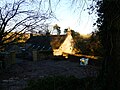 The Old House, Thorpe.jpg 4,000 × 3,000; 4.89 MB
-
 The Peveril of the Peak Hotel, Thorpe - geograph.org.uk - 146475.jpg 640 × 480; 163 KB


_-_geograph.org.uk_-_5848066.jpg)
_-_geograph.org.uk_-_5848067.jpg)


.jpg)


.jpg)


,_Thorpe_01.jpg)
,_Thorpe_02.jpg)
,_Thorpe.jpg)
_-_geograph.org.uk_-_5847037.jpg)
_-_geograph.org.uk_-_5847041.jpg)
_-_geograph.org.uk_-_5847045.jpg)


