Category:Timsbury, Somerset
English: Timsbury is a village and civil parish in the Bath and North East Somerset Unitary Authority of the county of Somerset, south-west of Bath. The parish has a population of 2,581.
village and civil parish in Bath and North East Somerset, Somerset, England _St_Mary%27s_Church_-_geograph.org.uk_-_67849.jpg) | |||||
| Upload media | |||||
| Instance of | |||||
|---|---|---|---|---|---|
| Location | Bath and North East Somerset, Somerset, South West England, England | ||||
 | |||||
Subcategories
This category has the following 2 subcategories, out of 2 total.
P
- Parish's House (2 F)
Media in category "Timsbury, Somerset"
The following 73 files are in this category, out of 73 total.
-

-
 A certain stile - geograph.org.uk - 4345200.jpg 1,704 × 2,304; 1.68 MB
-
 A crocus by the colliery - geograph.org.uk - 4345289.jpg 2,304 × 1,704; 1.67 MB
-
 A landscape whilst waiting - geograph.org.uk - 4342603.jpg 2,304 × 1,704; 1.74 MB
-
 A look into Timsbury Bottom - geograph.org.uk - 1629231.jpg 640 × 494; 171 KB
-
 An early showing - geograph.org.uk - 4344320.jpg 1,704 × 2,304; 1.97 MB
-
 At the top of Bungay's Hill - geograph.org.uk - 1634319.jpg 640 × 485; 126 KB
-

-
 B3115 at Meadgate West near Timsbury - geograph.org.uk - 1629215.jpg 640 × 482; 156 KB
-
 Benchmark on the old pub - geograph.org.uk - 4344284.jpg 1,704 × 2,304; 1.96 MB
-
 Big Blue Bus - geograph.org.uk - 4342549.jpg 2,304 × 1,704; 1.61 MB
-
 Bloomfield Road - geograph.org.uk - 1162872.jpg 640 × 473; 175 KB
-
 Bloomfield Road, possibly - geograph.org.uk - 1170442.jpg 640 × 504; 175 KB
-
 Bridleway sign on Parkway Lane - geograph.org.uk - 3088782.jpg 3,648 × 2,736; 4.66 MB
-
 Calling a new sort of time - geograph.org.uk - 4344298.jpg 2,304 × 1,704; 1.69 MB
-
 Chapel Walk - geograph.org.uk - 4345302.jpg 2,304 × 1,704; 1.64 MB
-
 Church Hill Timsbury - geograph.org.uk - 1634243.jpg 640 × 485; 180 KB
-
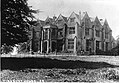
 Conygre Hall - geograph.org.uk - 4342599.jpg 2,304 × 1,704; 1.33 MB
-
 Down Radford Hill - geograph.org.uk - 4344282.jpg 2,304 × 1,704; 1.66 MB
-
 East on the B3115 - geograph.org.uk - 1170517.jpg 640 × 461; 282 KB
-
 High Street, Timsbury.jpg 640 × 427; 76 KB
-

-
 Houses on High Street, Timsbury (geograph 6574598).jpg 4,030 × 2,524; 1.15 MB
-
 Houses on Priorshill - geograph.org.uk - 2861006.jpg 640 × 480; 82 KB
-
 Ice on Bungay's Hill - geograph.org.uk - 1634331.jpg 640 × 501; 176 KB
-
 Looking toward Bloomfield - geograph.org.uk - 400717.jpg 640 × 442; 52 KB
-
 Mill Lane - geograph.org.uk - 2574599.jpg 2,592 × 1,944; 2.14 MB
-
 Mill Lane - geograph.org.uk - 3088864.jpg 2,592 × 1,944; 2.18 MB
-
 Mill Lane BOAT - geograph.org.uk - 2574623.jpg 2,592 × 1,944; 2.05 MB
-
 Near Timsbury - geograph.org.uk - 490822.jpg 640 × 433; 70 KB
-
 Old and new mains supply - geograph.org.uk - 4344268.jpg 1,704 × 2,304; 1.69 MB
-
 Over a pasture to Timsbury - geograph.org.uk - 1634242.jpg 640 × 494; 143 KB
-
 Parkway Lane - geograph.org.uk - 3088794.jpg 3,648 × 2,736; 3.98 MB
-
 Public sheep path - geograph.org.uk - 4342626.jpg 2,187 × 1,704; 2.06 MB
-
 Radford Hill Timsbury - geograph.org.uk - 1634249.jpg 640 × 463; 198 KB
-
 Radford Mill - geograph.org.uk - 2190114.jpg 640 × 426; 360 KB
-
 Reading room with a view - geograph.org.uk - 4344275.jpg 2,304 × 1,704; 1.38 MB
-
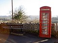
 Sign of the "Guss and Crook" - geograph.org.uk - 1634304.jpg 640 × 565; 207 KB
-
 Site of Demolished Works - geograph.org.uk - 2860753.jpg 640 × 480; 111 KB
-
 Sleight2009.jpg 1,586 × 709; 321 KB
-
 Somerset Folly - geograph.org.uk - 2860701.jpg 640 × 480; 81 KB
-
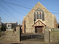
 South Road Methodist Church - geograph.org.uk - 4344257.jpg 2,304 × 1,704; 1.68 MB
-
 South Road Timsbury - geograph.org.uk - 1634248.jpg 640 × 502; 181 KB
-
 St Mary's in Spring sunshine - geograph.org.uk - 4344334.jpg 1,704 × 2,304; 2.29 MB
-
 St Mary's tower - geograph.org.uk - 4344331.jpg 1,704 × 2,304; 2.3 MB
-
 St Mary's, Timsbury - geograph.org.uk - 4344316.jpg 2,304 × 1,704; 1.72 MB
-
 Tabor benchmark - geograph.org.uk - 4344117.jpg 1,704 × 2,304; 1.97 MB
-
 The cross of St John - geograph.org.uk - 4344172.jpg 2,304 × 1,704; 1.64 MB
-
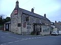 The Guss and Crook, Timsbury.jpg 640 × 474; 62 KB
-
 The old Christadelphian Church - geograph.org.uk - 4344265.jpg 1,704 × 2,304; 1.74 MB
-
 The old Temperance Hall - geograph.org.uk - 4344384.jpg 2,304 × 1,704; 1.89 MB
-
 The Sleight - geograph.org.uk - 4345246.jpg 2,304 × 1,704; 1.55 MB
-
 TIMS HSE.jpg 1,982 × 1,367; 772 KB
-
 Timsbury burial ground - geograph.org.uk - 4345240.jpg 2,304 × 1,704; 1.72 MB
-
 Timsbury burials - geograph.org.uk - 4345233.jpg 2,304 × 1,704; 1.56 MB
-
 Timsbury Congregational Church - geograph.org.uk - 4344086.jpg 2,304 × 1,704; 1.58 MB
-
 Timsbury Cricket Club - geograph.org.uk - 4342578.jpg 2,304 × 1,704; 1.73 MB
-
 Timsbury Legion - geograph.org.uk - 4341577.jpg 2,304 × 1,704; 1.34 MB
-
 Timsbury Tabor church - geograph.org.uk - 4344114.jpg 2,304 × 1,704; 1.57 MB
-
 Timsbury's fallen - geograph.org.uk - 4341588.jpg 2,196 × 1,704; 1.76 MB
-
 Toposcopic sheepfield - geograph.org.uk - 4344239.jpg 1,704 × 2,304; 1.92 MB
-
 Tunnel on footpath - geograph.org.uk - 4689929.jpg 1,067 × 1,600; 867 KB
-
 Valley between Wall Mead and Northfield - geograph.org.uk - 1898518.jpg 2,304 × 1,704; 1.61 MB
-
 Valley between Wall Mead and Northfield - geograph.org.uk - 1898530.jpg 2,304 × 1,704; 1.73 MB
-
 Valley between Wall Mead and Northfield - geograph.org.uk - 1898542.jpg 2,304 × 1,704; 1.64 MB
-
 Valley between Wall Mead and Northfield - geograph.org.uk - 1898549.jpg 2,304 × 1,704; 1.53 MB
-
 Valley between Wall Mead and Northfield - geograph.org.uk - 1898555.jpg 2,304 × 1,704; 1.61 MB
-
 Valley between Wall Mead and Northfield - geograph.org.uk - 1898568.jpg 2,304 × 1,704; 1.72 MB
-
 View towards Withy Mills - geograph.org.uk - 2190113.jpg 640 × 424; 271 KB
-
 Well-watered benchmark - geograph.org.uk - 4344325.jpg 1,704 × 2,304; 1.98 MB
-

-
 West of south from Bloomfield Road - geograph.org.uk - 1170449.jpg 640 × 470; 165 KB
-
 Y.M.C.A. for village people - geograph.org.uk - 4344158.jpg 2,304 × 1,704; 1.45 MB
.jpg)


.jpg)


_-_geograph.org.uk_-_1170435.jpg)

