Category:Topographic maps of Lozère
Subcategories
This category has the following 2 subcategories, out of 2 total.
Media in category "Topographic maps of Lozère"
The following 7 files are in this category, out of 7 total.
-
 48 Lozere Carte R 407x483.jpg 407 × 483; 67 KB
-
 Altier (Lozère) OSM 02.png 286 × 421; 162 KB
-
 La Canourgue OSM 02.png 365 × 609; 599 KB
-
 Lozere carte topo.svg 744 × 1,052; 5.58 MB
-
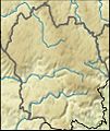
 Lozere department relief location map.svg 695 × 809; 4.31 MB
-
 Mont Mimat OSM.png 1,368 × 1,160; 3.05 MB
-
 Montagne du Goulet OSM.png 722 × 516; 331 KB

_OSM_02.png)


