Category:Topographic maps of the Moon
Media in category "Topographic maps of the Moon"
The following 119 files are in this category, out of 119 total.
-
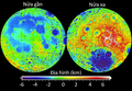
 2 hemisphere Clementine fullsize lmb cat.jpg 676 × 465; 114 KB
-
 2 hemisphere Clementine fullsize lmb.jpg 676 × 465; 162 KB
-
 LRO eastern limb lunar topographic map.jpg 1,920 × 1,440; 2.05 MB
-
 451121main VandeGraaff lg.jpg 461 × 578; 64 KB
-
 461093main humboldt lg.jpg 512 × 563; 115 KB
-
 A Colorful Look at the Birt E Crater on the Moon (14677604185).png 952 × 952; 1.56 MB
-
 A Digital Terrain Model of the Orientale Basin (LROC35).png 1,000 × 1,000; 1.64 MB
-
 A Tortuous Path in Posidonius (LROC796).tiff 3,415 × 15,249; 149.11 MB
-
 A “Secondary” View of Copernicus (LROC1228).jpg 1,100 × 259; 95 KB
-
 A “Secondary” View of Copernicus (LROC1228).tiff 3,249 × 13,795; 128.34 MB
-
 An Impact Melt Veneer in the Highlands (LROC500 - King Crater WAC Shaded Relief).png 1,212 × 1,212; 2.21 MB
-
 Another New Crater! (LROC810 - content sept11 context color).png 952 × 942; 1.47 MB
-
-
 Apollo basin topo.jpg 500 × 500; 57 KB
-
 Barnstorming Linné crater (LROC305 - linne shade scaleb).png 860 × 860; 1.26 MB
-
 Barnstorming Linné crater (LROC305).tiff 2,307 × 3,725; 24.61 MB
-
 Birt E (LROC794).tiff 3,227 × 14,550; 134.35 MB
-
 Birt E LROC.jpg 340 × 473; 72 KB
-
 Bullialdus Central Peak Oblique (LROC603 - bullialdus topo edit).png 1,130 × 1,000; 534 KB
-
 Carta deis altituds de la Luna.jpg 802 × 553; 103 KB
-
 Cinder Cone, Impact Crater, or Something Else? (LROC668 - Cone DEM).png 943 × 943; 756 KB
-
 Color of the Lassell Massif (LROC941 - content clementine-lassell).png 952 × 493; 659 KB
-
 Cool Cold Spots (LROC1010 - content moon coldspot figure einthoven 2).png 1,100 × 986; 1.51 MB
-
 Cool Cold Spots (LROC1010 - content moon coldspot figure einthoven).png 1,100 × 866; 892 KB
-
 Crater in 3D! (LROC487 - NAC DTM FRESH1 COLOR thumb).png 1,600 × 1,600; 2.83 MB
-
 Crater in 3D! (LROC487 - NAC DTM).tiff 2,799 × 16,813; 134.66 MB
-
 Dark Splash? (LROC463 - M1133662942L context).png 804 × 857; 661 KB
-
 Dark Splotches (LROC819 - content m123812230r context).png 801 × 714; 707 KB
-
 Dark streaks in Diophantus crater (LROC295 - M124797072L background).png 1,115 × 1,062; 1.79 MB
-
 Descartes region topographic map.jpg 980 × 1,480; 716 KB
-
 Down the Mountain (LROC741 - M186077208R context1).png 853 × 815; 780 KB
-
 Dynamic Moon! (LROC943).tiff 2,361 × 3,105; 21 MB
-
 Fecunditatis basin topo.jpg 550 × 550; 54 KB
-
 Freundlich-Sharonov Basin topo.jpg 680 × 680; 266 KB
-
 Geo Moon 2014 B (18652335350).jpg 3,867 × 3,377; 3.57 MB
-
 Great Wall! (LROC898 - content wac cshade spa anotated crop floor).png 952 × 952; 1.83 MB
-
 Grimaldi basin topo.jpg 400 × 400; 31 KB
-
 Hertzsprung basin topo.jpg 450 × 450; 54 KB
-
 Hortensius Domes - Constellation Region of Interest (LROC3 - BradenDEM).png 1,000 × 1,047; 597 KB
-
 How Young is Young? (LROC496 - NorthRay contour).png 1,000 × 1,000; 930 KB
-
 Humorum basin topo.jpg 600 × 600; 60 KB
-
 Hunting for Ancient Lunar Impact Basins (LROC185 - Fig2 Nubium).png 1,875 × 914; 897 KB
-
 Hunting for Ancient Lunar Impact Basins (LROC185 - Fig3 Marginis).png 880 × 923; 529 KB
-
 Icarus (LROC567 - icarus topo1).png 1,956 × 1,536; 1.67 MB
-
 Imbrium basin topo.jpg 1,100 × 950; 124 KB
-
 Korolev basin topo.jpg 400 × 399; 40 KB
-
 Linne csh (656313485000).jpg 600 × 638; 379 KB
-
 Linné crater color coded shaded relief map detail.png 860 × 860; 1.27 MB
-
 LOLA Peary Crater.jpg 2,152 × 2,196; 3.58 MB
-
 Longjiang-2 Impact Site Found! (LROC1132 - content Lj2 shaded relief arrow).png 1,100 × 1,100; 2.07 MB
-
 Lopsided La Pérouse A (LROC421 - example3 small).png 1,025 × 800; 563 KB
-
 LRO Linné crater color coded shaded relief map.png 2,307 × 3,725; 8.51 MB
-
 LROC WAC Tycho crater stereo digital terrain model.png 1,300 × 1,300; 1.32 MB
-
 LROtopography.jpg 1,000 × 750; 530 KB
-
 Lunar Topography - As Never Seen Before! (LROC451 - dem fig3).png 1,200 × 1,200; 1.75 MB
-
 Lunar Topography - As Never Seen Before! (LROC451 - WAC CSHADE O000N1800 1000).png 1,000 × 1,000; 1.71 MB
-
 Lunar Topography - As Never Seen Before! (LROC451).tiff 14,668 × 14,668; 615.58 MB
-
 Mare Anguis (GLD100).png 3,932 × 3,336; 5.98 MB
-
 Mare Fecunditatis (GLD100).png 2,534 × 2,534; 5.19 MB
-
 Mare Pit Topography! (LROC802 - content fecundpit thumb).png 952 × 952; 813 KB
-
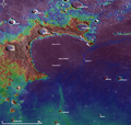
 Moon clementine lidar.jpg 2,882 × 1,441; 4.1 MB
-
 Moon elevation 2.stl 5,120 × 2,880; 20.74 MB
-
 Moon elevation.stl 5,120 × 2,880; 25.07 MB
-
 Moon worldwind (cropped).jpg 936 × 935; 217 KB
-
 Moon worldwind.jpg 1,280 × 948; 220 KB
-
 Moon-TwoHemispheres-Clementine.gif 450 × 267; 76 KB
-
 MoonLanderLola16.jpg 3,650 × 2,626; 4.68 MB
-
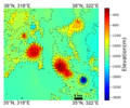
 MoonTopoGeoidUSGS se.png 800 × 595; 526 KB
-
 MoonTopoGeoidUSGS-fr.jpg 800 × 595; 299 KB
-
 MoonTopoGeoidUSGS-ru.jpg 800 × 595; 394 KB
-
 MoonTopoGeoidUSGS.jpg 800 × 595; 346 KB
-
 MoonTopoLOLA it.png 800 × 551; 621 KB
-
 MoonTopoLOLA-vi.png 742 × 516; 562 KB
-
 MoonTopoLOLA.png 800 × 551; 697 KB
-
 Mottled Mound (LROC820 - content m187506567r context).png 784 × 715; 668 KB
-
 Mounds in a melt pond (LROC296 - M129466485R background).png 1,115 × 1,062; 1.81 MB
-
 Mount Marilyn- A Lunar Love Story (LROC1312 - content DTM 2m mt mar merged 1100pixel).png 1,100 × 2,719; 2.97 MB
-

-
 NASA's LOLA Captures Goddard Crater.jpg 590 × 612; 302 KB
-

-

-
 Nectaris basin topo.jpg 600 × 600; 70 KB
-
 New View of Rare Volcanism on the Moon (LROC971 - content fig3).png 827 × 689; 853 KB
-
 New Views of the Gruithuisen Domes (LROC626 - Gruithuisen topo contours edit1).png 1,200 × 1,000; 677 KB
-
 Old and New (LROC780 - content m1128031686l context2).png 844 × 848; 927 KB
-
 Orientale basin topo.jpg 695 × 695; 86 KB
-
 Resolved Hapke Parameter Maps (LROC801 - content parammap).png 952 × 1,796; 2.24 MB
-
 Rock avalanche in Robinson crater (LROC266 - M114259768R context).png 1,032 × 1,149; 1.22 MB
-
 Ryder Spectacular! (LROC503 - ryder mos).png 904 × 1,218; 1,015 KB
-

-

-

-
 Source Vent for Rima Prinz I (LROC564 - NAC DTM PRINZVENT CLRSHADE thumb).png 1,000 × 1,000; 1.1 MB
-
 Source Vent for Rima Prinz I (LROC564).tiff 3,047 × 13,817; 120.56 MB
-
 Swept Slopes of Herigonius (LROC742 - herigonius wacslope anno).png 500 × 500; 245 KB
-
 Tadpole and Lava Tube (LROC804 - content tadpole vent thumb).png 952 × 952; 1.14 MB
-
 That's a Relief (LROC690 - NAC DTM MRINGENII1 CLRSHADE thumb).png 1,000 × 1,023; 1.25 MB
-
 That's a Relief (LROC690 - NAC DTM MRINGENII1 SLOPE thumb).png 1,000 × 1,002; 1.81 MB
-
 That's a Relief (LROC690).tiff 2,166 × 14,723; 91.35 MB
-

-

-
 The Highs and Lows of Ryder Crater (LROC1141 - content RyderCrater shaded relief).png 1,100 × 1,062; 2.63 MB
-
 The Highs and Lows of Ryder Crater (LROC1141 - content SPA Ryder).png 1,100 × 1,081; 1.28 MB
-
 The History of Volcanism in the Moon's Largest Basin (LROC985).tiff 4,720 × 4,720; 63.77 MB
-
 Thousands of Thrust Faults! (LROC1253 - content Figure 1 Final).jpg 1,039 × 1,474; 1.36 MB
-
 Three Impact Events (LROC1275 - content topo context arrow copy).png 1,100 × 1,100; 2 MB
-
 Topographic Map of the Chang'e 4 Site (LROCcontent color disc with scale 1100p).png 1,100 × 1,100; 731 KB
-

-

-

-
 Topography of the Taurus-Littrow Valley (LROC1112).png 1,100 × 1,278; 1.6 MB
-
 Towering Peak (LROC996 - content quickmap profile).png 810 × 782; 513 KB
-
 Tranquillitatis basin topo.jpg 500 × 500; 39 KB
-
 Tycho- A Model Central Peak (LROC1290 - content TYCHOPK FIheader noannotation).png 1,100 × 1,023; 2.02 MB
-
 Tycho- A Model Central Peak (LROC1290 - content TYCHOPK FIheader).png 1,100 × 1,023; 1.87 MB
-
 Tycho- A Model Central Peak (LROC1290).tiff 12,240 × 30,892; 1.06 GB
-
 Wrinkle Ridge vs Impact Crater (LROC627 - featured contours).png 1,002 × 800; 363 KB
-
 Wrinkled Reiner Gamma (LROC679 - NACDTMREINER4CLRSHADE thumb).png 500 × 500; 291 KB
-
 Wrinkled Reiner Gamma (LROC679).tiff 2,618 × 14,300; 107.13 MB


.png)
.png)
.png)
.png)
.png)

.png)

.png)

.png)
.png)
.png)
.png)
.png)
.png)
.png)
.png)

.png)


.jpg)
.png)


.png)
.png)

.png)
.png)
.png)


.jpg)


.png)
.png)


.png)
.png)
.png)
.png)
.png)

.jpg)


.png)
.png)
.png)

.jpg)
_(6353364913).jpg)

.png)
.png)
.png)

.png)
.png)
.png)
.png)
.png)
.png)
.png)
.png)
.png)
.png)
.png)
.png)
.png)
.png)
.png)
.jpg)
.png)
.png)
.png)
.png)

.png)
.png)
.png)
.png)
.jpg)
.png)
.png)