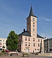
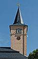
Category:Town hall in Radków
| Object location | | View all coordinates using: OpenStreetMap |
|---|
 | |||||
| Upload media | |||||
| Instance of | |||||
|---|---|---|---|---|---|
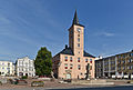
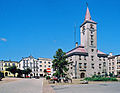
| Location | Radków, Gmina Radków, Kłodzko County, Lower Silesian Voivodeship, Poland | ||||
| Architectural style | |||||
| Heritage designation |
| ||||
 | |||||
Polski: Radków - ratusz z 1543 r przeb. w XIX w.
Media in category "Town hall in Radków"
The following 30 files are in this category, out of 30 total.
-
 2014 Radków, ratusz 01.JPG 3,807 × 2,840; 6.45 MB
-
 2014 Radków, ratusz 03.JPG 2,696 × 2,826; 4.17 MB
-
 2014 Radków, ratusz 05.JPG 2,634 × 3,085; 4.64 MB
-
 2014 Radków, ratusz 06.JPG 2,584 × 2,859; 4.38 MB
-
 2014 Radków, ratusz 07.JPG 2,563 × 3,968; 4.94 MB
-
 2014 Radków, ratusz 08.JPG 2,028 × 3,668; 5.2 MB
-
 2014 Radków, ratusz 09.JPG 2,631 × 3,810; 5.77 MB
-
 2014 Radków, ratusz 10.JPG 4,076 × 2,573; 6.92 MB
-
 2014 Radków, ratusz 11.JPG 2,796 × 3,456; 7.65 MB
-
 2014 Radków, ratusz 12.JPG 2,532 × 3,810; 6.27 MB
-
 2014 Radków, ratusz 13.JPG 1,819 × 2,347; 3.1 MB
-
 2014 Radków, ratusz i kolumna maryjna 06.jpg 3,838 × 2,648; 5.62 MB
-
 2014 Radków, rynek 03.JPG 3,888 × 2,614; 5.91 MB
-
 2014 Radków, rynek 04.JPG 3,552 × 2,632; 5.67 MB
-
 2014 Radków, rynek 04a.JPG 3,552 × 2,632; 3.58 MB
-
 2014 Radków, rynek 05.JPG 3,684 × 2,656; 5.44 MB
-
 2014 Radków, rynek 06.JPG 3,504 × 2,594; 5.31 MB
-
 2014 Ratusz w Radkowie 01.jpg 2,542 × 2,004; 2.65 MB
-
 2014 Ratusz w Radkowie 02.jpg 3,742 × 2,516; 4.71 MB
-
 593040 Radków Ratusz 01.JPG 2,848 × 4,272; 5.93 MB
-
 593040 Radków Ratusz 02.JPG 4,272 × 2,848; 5.71 MB
-
 593040 Radków Ratusz 03.JPG 4,272 × 2,848; 8.22 MB
-
 593040 Radków Ratusz 04.JPG 4,272 × 2,848; 7.79 MB
-
 Front budynku ratusza w Radkowie z fontanną.jpg 2,582 × 1,953; 4.34 MB
-
 Radkow rynek.jpg 2,274 × 1,755; 3.51 MB
-
 Radków radnnice - panoramio.jpg 4,928 × 3,264; 3.62 MB
-
 Radków ratusz 29.07.2011 p.jpg 2,010 × 2,426; 2.65 MB
-
 Radków ratusz 29.07.2011 p2.jpg 1,928 × 2,910; 2.79 MB
-
 Radków, pow. kłodzki. Ratusz (siedziba Urzędu Miasta i Gminy) i rynek.jpg 4,608 × 3,456; 9.92 MB
-
 Ratusz w Radkowie.jpg 1,748 × 2,498; 2.72 MB


_i_rynek.jpg)
