Category:Town hall of La Chapelle-du-Mont-de-France
| Object location | | View all coordinates using: OpenStreetMap |
|---|
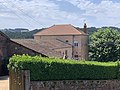
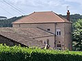
town hall located in Saône-et-Loire department, France  | |||||
| Upload media | |||||
| Instance of |
| ||||
|---|---|---|---|---|---|
| Location | La Chapelle-du-Mont-de-France, canton of Matour | ||||
| Street address |
| ||||
| Has use | |||||
| Owned by | |||||
| Operator | |||||
 | |||||
Media in category "Town hall of La Chapelle-du-Mont-de-France"
The following 4 files are in this category, out of 4 total.
-
 Mairie Chapelle Mont France 1.jpg 4,032 × 3,024; 5.03 MB
-
 Mairie Chapelle Mont France 2.jpg 4,032 × 3,024; 3.37 MB
-
 Mairie Chapelle Mont France 3.jpg 4,032 × 3,024; 4.48 MB
-
 Église St Vincent Mairie Chapelle Mont France 1.jpg 4,032 × 3,024; 1.84 MB


