Category:Trail signs in Canada
Media in category "Trail signs in Canada"
The following 47 files are in this category, out of 47 total.
-
 CarmanahTrailSign1.jpg 3,648 × 5,472; 6.74 MB
-
 Chain of Lakes Trail in Halifax, Nova Scotia, 2019.jpg 3,024 × 2,724; 5.45 MB
-
 Charlottetown, PEI (27313959535).jpg 2,791 × 1,861; 887 KB
-
 ChesterSpurRailTrail Halifax.jpg 3,000 × 3,000; 4.31 MB
-
 Confederation Trail near St. Louis, PEI (27170900303).jpg 4,608 × 3,456; 4.66 MB
-
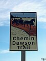 Dawson Trail sign.jpg 1,200 × 1,600; 411 KB
-
 Day256eannej.JPG 1,280 × 960; 643 KB
-
 East Coast Trail Marker - panoramio (1).jpg 2,736 × 3,648; 3.84 MB
-
 East Coast Trail Marker - panoramio (2).jpg 2,736 × 3,648; 4.18 MB
-
 East Coast Trail Marker - panoramio (3).jpg 2,736 × 3,648; 3.55 MB
-
 East Coast Trail Marker - panoramio (4).jpg 2,736 × 3,648; 3.87 MB
-
 East Coast Trail Marker - panoramio (5).jpg 2,736 × 3,648; 3.6 MB
-
 East Coast Trail Marker - panoramio.jpg 2,736 × 3,648; 3.99 MB
-
 ECT Start.jpg 3,006 × 1,832; 3.16 MB
-
 EramosaTrailSign.jpg 512 × 384; 144 KB
-
 Fort Amherst entrance to the East Coast trail - panoramio.jpg 3,264 × 2,448; 3.23 MB
-
 Fort Creek trail map.JPG 3,264 × 2,448; 3.72 MB
-
 Frehwater Bay trail entrance (part of the East Coast trail) - panoramio.jpg 3,648 × 2,736; 3.65 MB
-
 Glen Major Trail in East Duffins Headwaters - 01.jpg 4,032 × 3,024; 6.15 MB
-
 Glen Major Trail in East Duffins Headwaters - 05.jpg 3,024 × 4,032; 3.96 MB
-
 Glen Major Trail in East Duffins Headwaters - 09.jpg 3,024 × 4,032; 7.04 MB
-
 Glen Major Trail in East Duffins Headwaters - 10.jpg 4,032 × 3,024; 6.71 MB
-
 Greenbelt marker.jpg 1,467 × 1,448; 2.26 MB
-
 Hidden Lake Hike Alberta Canada July 2017 (35816285331).jpg 6,000 × 4,000; 10.54 MB
-
 Hidden Lake Territorial Park - Yellowknife, Canada (5325743816).jpg 3,888 × 2,592; 2.76 MB
-
 Icy patches (6304159795).jpg 2,112 × 2,816; 1.71 MB
-
 Ingraham Trail - panoramio.jpg 3,072 × 2,304; 2.05 MB
-
 Jardins des Floralies 04.JPG 4,608 × 3,456; 1.38 MB
-
 Lookout Trail - Algonquin Park.jpg 4,000 × 2,664; 3.11 MB
-
 Lynde Shores Conservation Area IMG 0107 (19183687631).jpg 5,472 × 3,648; 5.55 MB
-
 Mile Zero KM - Trans Canada Trail.jpg 1,024 × 768; 196 KB
-
 Moss on building (93373946).jpg 2,048 × 1,536; 630 KB
-
 Omemee Rail Trail - panoramio.jpg 3,008 × 2,000; 3.08 MB
-
 Ranney Hill Trail.jpg 4,912 × 3,264; 5.86 MB
-
 Road sign (31791339773).jpg 3,260 × 2,447; 11.27 MB
-
 Sign for Haunted Wood, Green Gables (3640384842).jpg 3,872 × 2,592; 4.76 MB
-
 Sign for Poets Path walking trail, Makkovik, Labrador.jpg 4,032 × 3,024; 3.13 MB
-
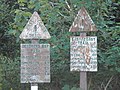
 Southwold Earthworks Local Area Map.jpg 2,592 × 1,944; 1.8 MB
-
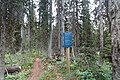
 Start of Ted Mosquin Highland Trail Purdon CA DSCN0497r.jpg 1,000 × 750; 819 KB
-
 Stiles Cove Path on the East Coast Trail.jpg 4,160 × 2,340; 3.21 MB
-
 Terraces Trail, Fitzroy.jpg 2,937 × 1,956; 1.15 MB
-
 The Waterfront Trail, Sign in Toronto.JPG 800 × 600; 128 KB
-
 Upper Kananaskis lake Alberta Canada December 2014 (15845952457).jpg 5,184 × 3,456; 7.69 MB
-
 Vancouver 2018-20180425-2269 (42138308034).jpg 1,920 × 1,280; 2.57 MB
-
 Waterfront Trail - Access Signage At Spencer Smith Park, Burlington, Ontario, Canada.jpg 5,152 × 3,864; 7.72 MB
-
 Waterfront Trail - Access Signage.jpg 6,000 × 4,000; 5.19 MB
-
 Waterfront Trail - Southern Landmark at Hamilton, Ontario, Canada.jpg 6,000 × 4,000; 7.78 MB


.jpg)

.jpg)


.jpg)
.jpg)
.jpg)
.jpg)
.jpg)


_-_panoramio.jpg)


.jpg)
.jpg)
.jpg)


.jpg)
.jpg)


.jpg)
.jpg)


.jpg)
.jpg)


