Category:Trails in Germany
Countries of Europe: Albania · Andorra · Armenia‡ · Austria · Belgium · Bosnia and Herzegovina · Bulgaria · Croatia · Cyprus‡ · Czech Republic · Denmark · Estonia · Finland · France‡ · Georgia‡ · Germany · Greece · Hungary · Iceland · Republic of Ireland · Italy · Latvia · Lithuania · Luxembourg · Malta · Montenegro · Netherlands‡ · North Macedonia · Norway · Poland · Portugal‡ · Romania · Russia‡ · Slovakia · Slovenia · Spain‡ · Sweden · Switzerland · Turkey‡ · Ukraine · United Kingdom
‡: partly located in Europe
‡: partly located in Europe
Subcategories
This category has the following 14 subcategories, out of 14 total.
Media in category "Trails in Germany"
The following 58 files are in this category, out of 58 total.
-
 Wanderweg bei Bad Wilhelmshöhe - panoramio.jpg 4,608 × 3,456; 9.04 MB
-
 Cottaer Spitzberg.JPG 3,888 × 2,592; 4.8 MB
-
 Ehrenbach valley, along forest.jpg 4,000 × 3,000; 3.14 MB
-
 Ehrenbach valley, bench, Ehrenbach.jpg 4,000 × 3,000; 4.47 MB
-
 Ehrenbach, trail to west.jpg 4,000 × 3,000; 4.36 MB
-
 Eisenstraße to East.jpg 3,852 × 2,889; 3.07 MB
-
 Eisenstraße to North.jpg 3,667 × 2,750; 4.52 MB
-
 Eissenstraße to Northwest.jpg 4,000 × 3,000; 4.09 MB
-
 Eselspfad, Schlangenbad.jpg 3,179 × 2,384; 2.72 MB
-
 Fagus sylvatica 010.jpg 2,592 × 1,944; 1.46 MB
-
 Falterbach valley, Niederlibbach.jpg 4,000 × 3,000; 4.89 MB
-
 Falterbach valley, Orlen.jpg 4,000 × 3,000; 4.09 MB
-
 Flötenweg, down to Hallgarten.jpg 3,271 × 2,453; 2.09 MB
-
 Flötenweg, Hallgarten.jpg 3,680 × 2,760; 3.15 MB
-
 Fritz-Rosenfeld-Wanderweg.jpg 3,648 × 2,736; 3.1 MB
-
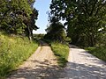
 GAR Feldweg.jpg 2,576 × 1,932; 1.1 MB
-

-

-
 HootzemonnWeg.jpg 4,000 × 2,248; 123 KB
-
 In vino veritas, Lorch in Rhine valley, Lorch.jpg 4,000 × 3,000; 4.69 MB
-
 In vino veritas, meadow, Lorch.jpg 4,000 × 3,000; 4.3 MB
-
 In vino veritas, old larch tree sprouting, Lorch.jpg 3,747 × 2,810; 3.09 MB
-
 In vino veritas, trail sign, Lorch.jpg 3,722 × 2,791; 5.48 MB
-
 In vino veritas, view to Lorch across wildflowers.jpg 4,000 × 3,000; 4.28 MB
-
 In vino veritas, view to Rhine, Lorch.jpg 3,583 × 2,687; 3.06 MB
-
 Leichhardt-Rundwanderweg Trebatsch 02.jpg 2,522 × 1,696; 2.51 MB
-
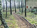 Offlumer See Finnenbahn.jpg 2,272 × 1,704; 935 KB
-
 Path forking south of Orlen.jpg 4,000 × 3,000; 5.47 MB
-
 Philosophenweg, Stephanshausen.jpg 4,000 × 3,000; 5.32 MB
-
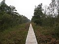 Pietzmoor 005.jpg 2,592 × 1,944; 1.22 MB
-
 Rauenthal, trail 1.jpg 4,000 × 3,000; 6.12 MB
-
 Rauenthal, trail 2.jpg 3,786 × 2,840; 4.5 MB
-
 Rauenthal, trail 3.jpg 3,692 × 2,769; 4.38 MB
-
 Rauenthal, trail 4.jpg 3,819 × 2,864; 5.47 MB
-
 ReichardtswerbenN.JPG 2,864 × 2,144; 1,010 KB
-
 Schranke auf.jpg 667 × 996; 105 KB
-
 Schwesnitz2.jpg 2,816 × 2,112; 2.81 MB
-
 Trail between Lorch and Aßmannshausen.jpg 3,730 × 2,798; 4.15 MB
-
 Trail from Ehrenach to Niederauroff.jpg 3,479 × 2,610; 1.98 MB
-
 Trail from Würges north to Taunus.jpg 3,888 × 2,916; 5.98 MB
-
 Trail Gebück, Hausen vor der Höhe.jpg 4,000 × 3,000; 6.21 MB
-
 Trail in forest near Siedlung Platte.jpg 4,000 × 3,000; 4.14 MB
-
 Trail on former railroad, Neu-Bamberg.jpg 3,840 × 2,880; 4.09 MB
-
 Trail, Ehrenbach.jpg 4,000 × 3,000; 4.64 MB
-
 View from Engenhahn-Wildpark to trail below Hohe Kanzel.jpg 4,000 × 3,000; 3.15 MB
-
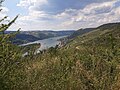
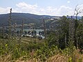
 View from trail to Tegernsee.jpg 4,000 × 3,000; 3.83 MB
-
 Viewpoint on trail In vino veritas, Lorch.jpg 4,000 × 3,000; 4.05 MB
-
 Vogelsang 25 DB.jpg 1,704 × 2,272; 633 KB
-
 Wallrabenstein valley.jpg 4,000 × 3,000; 2.72 MB
-
 Wanderweg des Naturparks Neckartal-Odenwald, Ausschilderung in Eschelbronn.jpg 4,032 × 2,268; 4.96 MB
-
 Wanderweg Innerstetalbahn harz.JPG 768 × 1,024; 321 KB
-
 Wanderweg nach Dänischenhagen.jpg 3,648 × 2,736; 2.54 MB
-
 Werderfliess 03.jpg 3,533 × 2,650; 5.18 MB
-
 Werderfliess 04.jpg 3,533 × 2,650; 5.09 MB
-
 Werderfliess 05.jpg 3,533 × 2,650; 4.89 MB
-
 Werderfliess 06.jpg 3,533 × 2,650; 3.91 MB
-
 Werderfliess 07.jpg 3,533 × 2,650; 4.89 MB
-
 ZehmitzW.JPG 2,864 × 2,144; 1.21 MB


