Category:Travel maps of New Orleans
Media in category "Travel maps of New Orleans"
The following 29 files are in this category, out of 29 total.
-
 7th, 8th, and Upper 9th Wards map.png 3,008 × 1,709; 1.85 MB
-
 7th, 8th, and Upper 9th Wards map.svg 936 × 974; 1.53 MB
-
 Algiers NOLA map.png 3,008 × 1,709; 1.74 MB
-
 Algiers NOLA map.svg 2,066 × 1,788; 2.32 MB
-
 Bywater map.png 3,008 × 1,709; 1,004 KB
-
 Bywater map.svg 2,171 × 1,268; 925 KB
-
 Central City map.png 1,709 × 3,008; 1.63 MB
-
 Central City map.svg 1,173 × 1,139; 753 KB
-
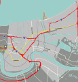
 Eastern New Orleans expanded map.png 3,008 × 1,709; 1.77 MB
-
 Eastern New Orleans expanded map.svg 468 × 266; 6.98 MB
-
 Eastern New Orleans map.png 3,008 × 1,709; 1.58 MB
-
 Eastern New Orleans map.svg 762 × 434; 1,000 KB
-
 French Quarter map.svg 1,070 × 1,708; 2.56 MB
-
 Lakeview and Lakefront map.png 3,008 × 1,709; 1.92 MB
-
 Lakeview and Lakefront map.svg 651 × 461; 1.62 MB
-
 Lower Ninth Ward map.png 1,709 × 3,008; 1.36 MB
-
 Lower Ninth Ward map.svg 963 × 1,200; 674 KB
-
 Marigny map.svg 1,980 × 1,118; 1 MB
-
 Mid-City New Orleans map.png 3,008 × 1,709; 3.09 MB
-
 Mid-City New Orleans map.svg 558 × 318; 2.2 MB
-
 New Orleans districts map grouped.svg 936 × 974; 3.64 MB
-
 New Orleans districts map.svg 936 × 974; 3.54 MB
-
 New Orleans map.svg 936 × 974; 3.85 MB
-
 St Roch-Florida map.png 3,008 × 1,709; 1.74 MB
-
 St Roch-Florida map.svg 936 × 974; 1.51 MB
-
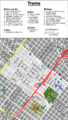 Treme map.png 1,709 × 3,008; 1.55 MB
-
 Treme map.svg 1,385 × 1,446; 761 KB
-
 Uptown New Orleans map.png 2,458 × 1,709; 1.99 MB
-
 Uptown New Orleans map.svg 1,759 × 1,131; 1.16 MB


