Category:Travel maps of the United Kingdom
Countries of Europe: Albania · Andorra · Armenia‡ · Austria · Azerbaijan‡ · Belarus · Belgium · Bosnia and Herzegovina · Bulgaria · Croatia · Czech Republic · Denmark · Estonia · Finland · France‡ · Georgia‡ · Germany · Greece · Hungary · Iceland · Republic of Ireland · Italy · Kazakhstan‡ · Latvia · Liechtenstein · Lithuania · Luxembourg · Malta · Moldova · Monaco · Montenegro · Netherlands‡ · North Macedonia · Norway · Poland · Portugal‡ · Romania · Russia‡ · Serbia · Slovakia · Spain‡ · Sweden · Switzerland · Turkey‡ · Ukraine · United Kingdom · Vatican City
Specific status: Faroe Islands · Gibraltar – Limited recognition: Abkhazia‡ · Kosovo
‡: partly located in Europe
Specific status: Faroe Islands · Gibraltar – Limited recognition: Abkhazia‡ · Kosovo
‡: partly located in Europe
Subcategories
This category has the following 7 subcategories, out of 7 total.
Media in category "Travel maps of the United Kingdom"
The following 33 files are in this category, out of 33 total.
-

-
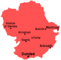 Angus map.png 1,175 × 1,152; 31 KB
-
 Bedfordshire map.png 730 × 1,111; 23 KB
-
 Buckinghamshire map.png 726 × 1,246; 30 KB
-
 Cambridgeshire map.png 905 × 1,011; 25 KB
-
 Carmarthenshire map.png 975 × 679; 21 KB
-
 Clackmannan map.png 715 × 639; 10 KB
-
 Cumbria map.png 1,308 × 1,687; 118 KB
-
 Derbyshire map.png 719 × 1,174; 75 KB
-
 England Regions map.png 2,000 × 2,201; 1.39 MB
-
 Glasgow districts draft1.png 1,950 × 2,200; 5.3 MB
-
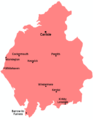
 Glasgow districts map draft.svg 744 × 1,052; 29 KB
-

-
 Isles of Scilly map.png 2,000 × 2,374; 937 KB
-
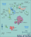
 Isles of Scilly map.svg 1,130 × 1,224; 1.97 MB
-
 Maps illustrating cruises of John Paul Jones in British waters (10175546456).jpg 4,029 × 5,175; 3.86 MB
-
 North Yorkshire map.png 2,388 × 1,649; 38 KB
-
 Northamptonshire map.png 1,034 × 1,126; 82 KB
-
 Nottinghamshire map.png 583 × 1,001; 48 KB
-
 Oxfordshire map.png 912 × 1,246; 30 KB
-
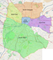
 Perth and Kinross map.png 966 × 856; 20 KB
-
 Shropshire map.png 1,077 × 1,232; 31 KB
-
 South Yorkshire map.png 1,033 × 652; 16 KB
-
 Staffordshire map.png 754 × 1,134; 23 KB
-
 Tyne and Wear map.png 1,131 × 828; 25 KB
-
 UK get in map.png 1,113 × 2,040; 134 KB
-
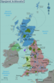
 United Kingdom map.png 1,973 × 3,023; 1.72 MB
-
 United Kingdom regions map (cs).png 6,250 × 9,576; 14.06 MB
-
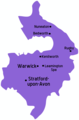 Warwickshire map.png 682 × 1,034; 23 KB
-
 West Sussex map.png 1,231 × 801; 30 KB
-
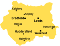 West Yorkshire map.png 1,022 × 790; 25 KB
-
 Worcestershire map.png 1,131 × 1,021; 34 KB
-
 不列颠群岛概图.png 1,547 × 2,704; 856 KB
.jpg)


.jpg)


.png)


%27_(16590096065).jpg)