Category:Trees in Buckinghamshire
Ceremonial counties of England: Bedfordshire · Berkshire · Buckinghamshire · Cambridgeshire · Cheshire · Cornwall · Cumbria · Derbyshire · Devon · Dorset · Durham · East Riding of Yorkshire · East Sussex · Essex · Gloucestershire · Greater London · Greater Manchester · Hampshire · Herefordshire · Hertfordshire · Isle of Wight · Kent · Lancashire · Leicestershire · Lincolnshire · Merseyside · Norfolk · North Yorkshire · Northamptonshire · Northumberland · Nottinghamshire · Oxfordshire · Rutland · Shropshire · Somerset · South Yorkshire · Staffordshire · Suffolk · Surrey · Warwickshire · West Midlands · West Sussex · West Yorkshire · Wiltshire · Worcestershire
City-counties: Bristol · City of London
Former historic counties:
Other former counties:
City-counties: Bristol · City of London
Former historic counties:
Other former counties:
Subcategories
This category has the following 8 subcategories, out of 8 total.
Media in category "Trees in Buckinghamshire"
The following 200 files are in this category, out of 328 total.
(previous page) (next page)-
 A droopy tree, Cholesbury Common - geograph.org.uk - 106853.jpg 480 × 640; 101 KB
-
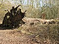
 A Fallen Giant in Cobblers Pits - geograph.org.uk - 1311636.jpg 640 × 480; 300 KB
-
 A Fine Stand of Fir Trees - geograph.org.uk - 1205384.jpg 640 × 480; 133 KB
-
 A Flooded Willow Tree - geograph.org.uk - 1233475.jpg 2,448 × 3,264; 5.71 MB
-
 A Kinky Tree - geograph.org.uk - 1237187.jpg 480 × 640; 105 KB
-
 A Leaning Tree by the Thames - geograph.org.uk - 795744.jpg 640 × 471; 111 KB
-

-

-
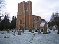
 All Saints Church, Middle Claydon, Bucks, England - from the east.jpg 4,608 × 3,456; 17.69 MB
-
 All Saints Church, Middle Claydon, Bucks, England - north steps and door.jpg 4,608 × 3,456; 21.27 MB
-
 Ancient tree Burnham Beeches - geograph.org.uk - 1464275.jpg 640 × 426; 115 KB
-
 Approaching Martin Top Farm - geograph.org.uk - 1150783.jpg 425 × 640; 202 KB
-
 Ash tree just in leaf, Bierton - geograph.org.uk - 428350.jpg 480 × 640; 299 KB
-
 Autumn Berries - geograph.org.uk - 272283.jpg 480 × 640; 130 KB
-
 Autumn in Burnham Beeches - geograph.org.uk - 600945.jpg 640 × 480; 174 KB
-
 Autumn tints, Bradenham - geograph.org.uk - 1460035.jpg 427 × 640; 87 KB
-
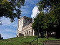
 St Mary's Church, Aylesbury - panoramio.jpg 5,184 × 3,456; 10.33 MB
-
 Bare trees south of Coxlease Farm - geograph.org.uk - 1573663.jpg 640 × 435; 69 KB
-
 Bark on Old Silver Birch tree - geograph.org.uk - 1185122.jpg 480 × 640; 167 KB
-
 St Michael and All Angels Church, Beaconsfield, Buckinghamshire.jpg 2,716 × 1,528; 1.84 MB
-
 Beautiful Tree - geograph.org.uk - 1001320.jpg 503 × 640; 84 KB
-

-

-
 Beeches in Burton's Wood - geograph.org.uk - 754783.jpg 480 × 640; 167 KB
-
 Beeches near Winchmore Hill - geograph.org.uk - 149946.jpg 640 × 480; 127 KB
-
 Behind the trees Windyhaugh House - geograph.org.uk - 843474.jpg 640 × 480; 65 KB
-
 Below Idlecombe Wood - geograph.org.uk - 295260.jpg 640 × 480; 145 KB
-
 Below Northend - geograph.org.uk - 114700.jpg 640 × 480; 83 KB
-
 StOsythsWellBierton.jpg 640 × 480; 87 KB
-
 Bissomhall Shaw, Stokenchurch - geograph.org.uk - 743511.jpg 640 × 480; 100 KB
-
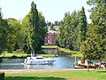
 Black Park Lake - geograph.org.uk - 1443995.jpg 640 × 480; 87 KB
-
 Black Poplars and Cow Parsley - geograph.org.uk - 169257.jpg 480 × 640; 139 KB
-
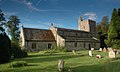
 St Paul Church, Bledlow Ridge - geograph.org.uk - 100957.jpg 640 × 480; 146 KB
-
 St Pauls, Bledlow Ridge (geograph 3926555).jpg 4,320 × 3,240; 3.87 MB
-
 Borstal, Buckinghamshire.JPG 1,536 × 1,024; 373 KB
-
 St Mary Magdalene Church, Boveney - geograph.org.uk - 1464281.jpg 640 × 427; 78 KB
-

-

-
 BradwellAqueduct-GUC.JPG 1,024 × 768; 147 KB
-
 Building, Tyringham Riverside - geograph.org.uk - 492863.jpg 453 × 604; 82 KB
-
 Cedar Trees - geograph.org.uk - 649598.jpg 640 × 480; 106 KB
-

-
 Chenies Baptist Chapel Geograph-3430699-by-N-Chadwick.jpg 640 × 430; 74 KB
-
 Cherry Blossom in the Chilterns - geograph.org.uk - 1690513.jpg 1,159 × 770; 1.25 MB
-
 Chestnut tree, Rassler Wood - geograph.org.uk - 605773.jpg 480 × 640; 196 KB
-
 Chicheley - geograph.org.uk - 237095.jpg 640 × 480; 88 KB
-
 Chilly Scene, Stewkley Road - geograph.org.uk - 296469.jpg 640 × 489; 77 KB
-
 Chorleywood, Old Shire Lane - geograph.org.uk - 566497.jpg 640 × 480; 138 KB
-
 Church above the trees, Great Missenden (geograph 3745746).jpg 2,048 × 1,536; 860 KB
-
 Church of the Holy Cross, Two Mile Ash.jpg 3,264 × 2,448; 2.17 MB
-

-
 Cop Grove - geograph.org.uk - 675879.jpg 640 × 480; 183 KB
-
 Coppiced hazel in Piddington Wood - geograph.org.uk - 182545.jpg 480 × 640; 180 KB
-

-
 Copse - geograph.org.uk - 235894.jpg 640 × 480; 106 KB
-
 Cornfield and row of trees - geograph.org.uk - 201772.jpg 640 × 427; 119 KB
-
 Midday Christmas 2009 Cublington Church - geograph.org.uk - 1635175.jpg 640 × 480; 124 KB
-
 Dead Tree and Hedgerow - geograph.org.uk - 397642.jpg 640 × 480; 116 KB
-

-
 Tree shelter, East Claydon - geograph.org.uk - 410040.jpg 640 × 480; 197 KB
-
 St Michael and All Angels - geograph.org.uk - 816141.jpg 640 × 425; 96 KB
-
-
 Edlesborough Church across the fields - geograph.org.uk - 204822.jpg 640 × 356; 55 KB
-
 Edlesborough Church St Mary the Virgin - geograph.org.uk - 149674.jpg 640 × 480; 118 KB
-
 Entrance to Placehouse Copse - geograph.org.uk - 1150806.jpg 640 × 426; 177 KB
-
 Eythrope - geograph.org.uk - 183590.jpg 640 × 480; 110 KB
-
-
 Fallen tree blocking track, Chesham Vale - geograph.org.uk - 189721.jpg 480 × 640; 165 KB
-
 Farmland and tree near Winchmore Hill - geograph.org.uk - 150443.jpg 640 × 480; 110 KB
-
 Farmland, Naphill - geograph.org.uk - 1066595.jpg 640 × 480; 161 KB
-
 Fawley Court from Remenham - geograph.org.uk - 536432.jpg 640 × 480; 145 KB
-
 Field and Copse - geograph.org.uk - 709012.jpg 640 × 425; 72 KB
-
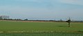 Field with a Lone Tree - geograph.org.uk - 272843.jpg 640 × 278; 24 KB
-

-
 Fine specimen conifers - geograph.org.uk - 988811.jpg 640 × 480; 106 KB
-
 FleetMarston StMary SE.jpg 1,280 × 720; 630 KB
-
 Floodlit Trees, Waddesdon Manor, Buckinghamshire (geograph 3770108).jpg 1,024 × 683; 1.17 MB
-
 Footpath to Olney from Clifton Pastures - geograph.org.uk - 324704.jpg 640 × 480; 114 KB
-
 Footpath to Pugh's Wood - geograph.org.uk - 1765755.jpg 640 × 480; 71 KB
-
 Fox Covert - Aston Abbotts - geograph.org.uk - 296368.jpg 640 × 427; 44 KB
-
 Gateway to Churchyard, Gawcott - geograph.org.uk - 1046292.jpg 640 × 480; 90 KB
-
 Small Cemetery, Gawcott - geograph.org.uk - 1046231.jpg 640 × 480; 126 KB
-
 St James Church, Gerrards Cross - geograph.org.uk - 21046.jpg 640 × 480; 124 KB
-
 Grafton Street Aqueduct - geograph.org.uk - 532925.jpg 640 × 428; 75 KB
-
 Granborough to Botolph Claydon lane - geograph.org.uk - 612261.jpg 480 × 640; 187 KB
-
 St Andrew's Church Great Linford - geograph.org.uk - 1152424.jpg 640 × 480; 105 KB
-
 Former Methodist Chapel, Great Missenden - geograph.org.uk - 1251903.jpg 640 × 480; 107 KB
-
 Church of St Leonard, Grendon Underwood - geograph.org.uk - 62172.jpg 640 × 480; 124 KB
-
 St. Leonards from the churchyard - geograph.org.uk - 658111.jpg 640 × 301; 185 KB
-
 St. Leonards, Grendon Underwood - geograph.org.uk - 658098.jpg 640 × 458; 202 KB
-
 Grendon Underwood Church - geograph.org.uk - 717061.jpg 640 × 425; 70 KB
-
 Grey poplars at Shipton Bridge - geograph.org.uk - 433594.jpg 480 × 640; 308 KB
-
 Grove of trees, Waddesdon Manor - geograph.org.uk - 775644.jpg 640 × 355; 181 KB
-
 Pond at Haddenham-geograph-4232824-by-Bikeboy.jpg 4,320 × 3,240; 4.35 MB
-
 Skittles Green, Haddenham, Buckinghamshire-geograph-4577124-by-Oswald-Bertram.jpg 5,753 × 3,838; 7.26 MB
-
 Village Duck Pond, Haddenham-geograph-2110126-by-Richard-Rogerson.jpg 3,072 × 2,304; 3.56 MB
-
 Haddenham duck pond-geograph-3230599-by-Michael-Trolove.jpg 2,560 × 1,920; 1.06 MB
-
 Haddenham, Church End - geograph.org.uk - 883119.jpg 640 × 430; 89 KB
-
 Haddenham, pollarded tree pathway-geograph-4061963-by-Rob-Farrow.jpg 1,000 × 1,333; 1.24 MB
-
 Hambleden Lock - geograph.org.uk - 1036996.jpg 640 × 428; 70 KB
-
 St James the Great, Hanslope, Bucks - geograph.org.uk - 333065.jpg 425 × 640; 75 KB
-
 Hanslope Church - geograph.org.uk - 112591.jpg 227 × 640; 21 KB
-
 Hanslope Church - geograph.org.uk - 1596188.jpg 640 × 480; 54 KB
-
 Hanslope Church - geograph.org.uk - 38747.jpg 450 × 604; 131 KB
-
 St Mary's Hardwick - geograph.org.uk - 904434.jpg 640 × 426; 62 KB
-

-
 Haws in the hedge - geograph.org.uk - 234795.jpg 640 × 480; 119 KB
-
 Hawthorn Tree in marshy field - geograph.org.uk - 326087.jpg 640 × 527; 117 KB
-
 Church of St Mary the Virgin, Hedgerley (geograph 3877570).jpg 4,320 × 3,240; 2.86 MB
-
 Church of St Mary the Virgin, Hedgerley (geograph 3877573).jpg 4,320 × 3,240; 3 MB
-
 Church of St Mary the Virgin, Hedgerley (geograph 3877578).jpg 3,240 × 4,320; 4.14 MB
-
 Church of St Mary the Virgin, Hedgerley (geograph 3877579).jpg 3,240 × 4,320; 4.84 MB
-
 St Mary the Virgin's, Hedgerley - geograph.org.uk - 149870.jpg 640 × 480; 122 KB
-
 Hedgerley Church.JPG 2,800 × 2,128; 2.67 MB
-
 St Nicholas's, Hedsor - geograph.org.uk - 103124.jpg 640 × 480; 75 KB
-

-

-
 All Saints, Hillesden, Bucks - geograph.org.uk - 333945.jpg 640 × 439; 113 KB
-
 All Saints, Hillesden, Bucks - geograph.org.uk - 333946.jpg 457 × 640; 131 KB
-
 All Saints, Hillesden.jpg 696 × 478; 65 KB
-
 Hoar-frosted Tree - geograph.org.uk - 304342.jpg 640 × 480; 146 KB
-

-
 Hoar-frosted Trees, Mentmore - geograph.org.uk - 296476.jpg 640 × 480; 94 KB
-
 Horse chestnut in flower - geograph.org.uk - 429673.jpg 640 × 480; 101 KB
-
 Uplands - geograph.org.uk - 146708.jpg 640 × 480; 119 KB
-

-
 Ivy-covered trees by the Road - geograph.org.uk - 1201940.jpg 640 × 480; 161 KB
-
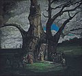 James Ferrier Pryde Queen Elizabeth's Tree.jpg 3,200 × 2,972; 2.01 MB
-
 St James Church, New Bradwell-geograph.org.uk-2315637.jpg 1,280 × 960; 484 KB
-
 Lane between Berryfield and Whitesfield - geograph.org.uk - 610559.jpg 640 × 480; 200 KB
-
 St. Mary's church, Langley - geograph.org.uk - 855774.jpg 640 × 480; 137 KB
-
 Langley Park arboretum - geograph.org.uk - 107645.jpg 638 × 640; 155 KB
-

-

-
 Leafless trees - geograph.org.uk - 1346680.jpg 640 × 475; 133 KB
-
 St Mary the Virgin, Leckhampstead - geograph.org.uk - 1047480.jpg 640 × 480; 109 KB
-
-

-
 Former Church, Foscote - geograph.org.uk - 1001338.jpg 640 × 466; 116 KB
-
 Lillingstone Lovell - geograph.org.uk - 454398.jpg 640 × 480; 156 KB
-
-
 St. Nicholas' church, Little Horwood - geograph.org.uk - 791275.jpg 640 × 480; 98 KB
-
 St. Nicholas' tower, Little Horwood - geograph.org.uk - 791280.jpg 480 × 640; 93 KB
-
 The Church, Little Missenden - geograph.org.uk - 46800.jpg 640 × 445; 109 KB
-
 LittleBrickhill ParishChurch01.JPG 2,304 × 1,536; 854 KB
-
 Lodge Hill, Waddesdon Manor (geograph 3641869).jpg 1,024 × 680; 272 KB
-
 Lonely - geograph.org.uk - 246155.jpg 640 × 480; 42 KB
-
 Maids Moreton Church.JPG 2,272 × 1,704; 418 KB
-
 Market Place - geograph.org.uk - 569863.jpg 640 × 427; 77 KB
-
 Marlow Bypass Bridge.JPG 2,272 × 1,704; 1.59 MB
-
 Marsh Gibbon Church.jpg 640 × 511; 72 KB
-
 All Saints Church at Marsworth - geograph.org.uk - 1516367.jpg 640 × 480; 99 KB
-
 All Saints Church at Marsworth - geograph.org.uk - 1516399.jpg 458 × 640; 128 KB
-

-
 Menacing ivy-clad tree - geograph.org.uk - 719398.jpg 480 × 640; 218 KB
-
 Mentmore Church and frosty trees - geograph.org.uk - 296477.jpg 640 × 480; 100 KB
-
 Mentmore, The Church of St Mary the Virgin - geograph.org.uk - 97118.jpg 640 × 480; 104 KB
-
 All Saints Church, Middle Claydon, Bucks, England - nave from NW.jpg 3,818 × 3,054; 12.37 MB
-
 All Saints Church, Middle Claydon, Bucks, England - tower from NE.jpg 3,456 × 3,456; 12.41 MB
-
 All Saints Church, Middle Claydon, Bucks, England - tower from NW.jpg 3,158 × 3,948; 13.2 MB
-
 All Saints Church, Middle Claydon, Bucks, England - tower from south.jpg 3,456 × 4,608; 17.6 MB
-
 All Saints Church, Middle Claydon, Bucks, England - tower from west.jpg 3,233 × 4,313; 14.11 MB
-
 Church at Claydon House - geograph.org.uk - 59208.jpg 640 × 480; 122 KB
-
 AlexanderDennis Enviro200 E8 RRT MiltonKeynes right.jpg 1,235 × 1,280; 761 KB
-
 AlexanderDennis Enviro200 E8 RRT MiltonKeynes.jpg 962 × 1,280; 664 KB
-
 AlexanderDennis Enviro200 MMC YX17 NPN MiltonKeynes.jpg 1,144 × 1,280; 750 KB
-
 AlexanderDennis Enviro200 MMC YX17 NPO MiltonKeynes.jpg 1,097 × 1,280; 831 KB
-
 AlexanderDennis Enviro200 MX11 CZK MiltonKeynes.jpg 1,280 × 649; 470 KB
-
 AlexanderDennis Enviro200 YX61 FZH MiltonKeynes right.jpg 1,156 × 1,280; 589 KB
-
 AlexanderDennis Enviro200 YX61 FZH MiltonKeynes.jpg 1,254 × 1,280; 858 KB
-
 Bus img 5266 (15662211673).jpg 3,072 × 2,304; 2.33 MB
-
 Bus img 5299 (16094746180).jpg 3,072 × 2,304; 2.32 MB
-
 Bus img 5306 (16094752800).jpg 3,072 × 2,304; 2.68 MB
-
 DAF Wright Cadet BU03 HRF MiltonKeynes right.jpg 1,280 × 1,280; 758 KB
-
 DAF Wright Cadet BU03 HRF MiltonKeynes.jpg 1,132 × 1,280; 855 KB
-
 DAF Wright Cadet KE03 OUM MiltonKeynes.jpg 1,134 × 1,280; 756 KB
-
 DAF Wright Pulsar2 MX12 KWW MiltonKeynes.jpg 1,144 × 1,280; 750 KB
-
 DAF Wright Pulsar2 MX12 KWZ MiltonKeynes.jpg 1,139 × 1,280; 756 KB
-
 DAF Wright Pulsar2 MX12 KXA MiltonKeynes.jpg 1,280 × 1,144; 741 KB
-
 DAF Wright Pulsar2 MX13 ALO MiltonKeynes.jpg 1,027 × 1,280; 796 KB
-
 Midsummer Boulevard, Milton Keynes - geograph.org.uk - 1145909.jpg 640 × 480; 104 KB
-
 Scania AlexanderDennis Enviro300 KX12 ANF MiltonKeynes.jpg 1,276 × 1,280; 724 KB
-
 Scania AlexanderDennis Enviro400 KX61 DLZ MiltonKeynes.jpg 1,128 × 1,280; 799 KB
-
 Scania Wright EclipseUrban YN06 JXJ MiltonKeynes.jpg 1,247 × 1,280; 721 KB
-
 Scania Wright EclipseUrban YN06 JXM MiltonKeynes right.jpg 1,280 × 653; 530 KB
-
 Scania Wright EclipseUrban YN55 PZY MiltonKeynes.jpg 1,280 × 1,280; 792 KB
-
 Volvo B11R Plaxton Elite YX64 WCD MiltonKeynes.jpg 1,132 × 1,280; 742 KB
-
 Wright StreetLite FJ64 ETU MiltonKeynes right.jpg 1,280 × 654; 444 KB
-
 Wright StreetLite FJ64 ETV MiltonKeynes.jpg 1,130 × 1,280; 688 KB
-
 Wright StreetLite FJ64 EUM MiltonKeynes.jpg 1,114 × 1,280; 800 KB
-
 Wright StreetLite HRZ 6498 MiltonKeynes.jpg 1,178 × 1,280; 1,008 KB
-
 Wright StreetLite LM64 JNX MiltonKeynes.jpg 1,023 × 1,280; 806 KB
-
 Wright StreetLiteWF KP63 TDX MiltonKeynes.jpg 1,022 × 1,280; 636 KB
-
 Church of St. Mary the Virgin, Mursley - geograph.org.uk - 235276.jpg 640 × 480; 117 KB
-
 Mursley Church - geograph.org.uk - 210615.jpg 640 × 480; 138 KB
-

-
 Churchyard at Newton Blossomville - geograph.org.uk - 812116.jpg 640 × 480; 144 KB
-

-
 Oakley ChandosArms.jpg 1,024 × 614; 218 KB
-
 Oakley StMary NE.jpg 1,024 × 614; 245 KB


.jpg)


.jpg)


.jpg)


.jpg)
.jpg)
.jpg)
.jpg)


.jpg)


.jpg)
.jpg)
.jpg)


