Category:Trig points in New Zealand
Subcategories
This category has the following 3 subcategories, out of 3 total.
Media in category "Trig points in New Zealand"
The following 33 files are in this category, out of 33 total.
-
 Along State Highway 6 from Franz Josef to Hokitika 21.jpg 3,888 × 2,592; 10.25 MB
-
 Along State Highway 6 from Franz Josef to Hokitika 25.jpg 3,888 × 2,592; 10.11 MB
-
 Belmont trig, Wellington.jpg 3,008 × 2,000; 2.03 MB
-
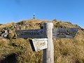 Fingerpost at Mt Holdsworth.jpg 2,048 × 1,536; 702 KB
-
 Mayan graffiti on Harbour Cone.jpg 531 × 800; 131 KB
-
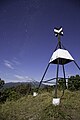 Moonlit stars at patuha trig.jpg 3,648 × 5,472; 7.7 MB
-
 Mount Arthur (New Zealand) 062.jpg 3,648 × 5,472; 7.69 MB
-
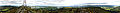 Mount Cargill.jpg 15,537 × 1,726; 4.74 MB
-
 Mount Isobel 019.JPG 5,472 × 3,648; 3.71 MB
-
 Mount Isobel 022.JPG 5,472 × 3,648; 3.99 MB
-
 Mount Isobel 404.jpg 5,472 × 3,648; 5.26 MB
-
 Mount Maunganui triangulation station.jpg 4,608 × 3,456; 1.63 MB
-
 Mount Sunday - panoramio (4).jpg 10,000 × 2,483; 8.83 MB
-
 Mt Cargill trig.jpg 800 × 531; 75 KB
-
 Mt Holdsworth.jpg 2,048 × 1,536; 728 KB
-
 Mt Tahua.jpg 4,713 × 3,142; 3.13 MB
-
 Napier Hill trig.jpg 1,704 × 2,272; 684 KB
-
 New Zealand, Great Walk Lake Waikaremoana (37).JPG 3,141 × 4,553; 3.84 MB
-
 New Zealand, Tararua Mountains - around Mt. Holdsworth (11).jpg 5,184 × 3,456; 6.47 MB
-
 Paritutu 396.jpg 1,024 × 681; 141 KB
-
 Paritutu 407.jpg 1,024 × 683; 106 KB
-
 Remutaka Trig with trig station (trig point).jpg 4,896 × 3,264; 6.24 MB
-
 Sugar Loaf Hill, Taradale - 6752382633.jpg 3,888 × 2,592; 5.3 MB
-
 Sugar Loaf Hill, Taradale - 6752544107.jpg 4,592 × 3,056; 3.04 MB
-
 Sugar Loaf Hill, Taradale.jpg 3,888 × 2,592; 2.35 MB
-
 Sugarloaf in Christchurch, New Zealand 001.jpg 4,718 × 2,835; 6.51 MB
-
 Sugarloaf in Christchurch, New Zealand 02.jpg 3,326 × 4,950; 8 MB
-
 Top of Mt Fyffe, Kaikoura Ranges, New Zealand 05.jpg 5,466 × 3,515; 12.41 MB
-
 Top of Mt Thomas, Mount Thomas Forest Conservation Area, Canterbury, New Zealand 06.jpg 3,454 × 4,598; 5.84 MB
-
 Top of Mt Thomas, Mount Thomas Forest Conservation Area, Canterbury, New Zealand 07.jpg 5,404 × 3,603; 11.37 MB
-
 Trig on top of Te Mata Peak.jpg 4,896 × 3,264; 3.65 MB
-
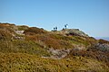
 Trig Point on Mount Iron.jpg 3,888 × 2,592; 3.95 MB
-
 Twin Peak memorial beacon.jpg 1,536 × 2,048; 680 KB


_062.jpg)


.JPG)
.jpg)


.jpg)


.jpg)