Category:Tuttington
English: Tuttington is a village is located in the civil parish of Burgh and Tuttington, in the English county of Norfolk. The village is 11.1 miles south of Cromer, 15 miles north of Norwich and 129 miles north-east of London. The village lies 3 miles east of the nearby town of Aylsham. The nearest railway station is at North Walsham for the Bittern Line which runs between Sheringham, Cromer and Norwich. The nearest airport is Norwich International Airport.
village in English county of Norfolk  | |||||
| Upload media | |||||
| Instance of |
| ||||
|---|---|---|---|---|---|
| Location | Burgh and Tuttington, Broadland, Norfolk, East of England, England | ||||
 | |||||
Subcategories
This category has the following 6 subcategories, out of 6 total.
Media in category "Tuttington"
The following 75 files are in this category, out of 75 total.
-

-
 A converted Wesleyan Chapel - plaque - geograph.org.uk - 1077720.jpg 480 × 640; 106 KB
-
 A former Wesleyan Chapel - geograph.org.uk - 1077715.jpg 640 × 480; 83 KB
-
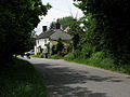
 Approach to Tuttington from the south - geograph.org.uk - 722903.jpg 640 × 454; 108 KB
-

-

-
 Cottage, Tuttington, Norfolk - geograph.org.uk - 1637973.jpg 640 × 480; 111 KB
-
 Cottage, Tuttington, Norfolk - geograph.org.uk - 1637978.jpg 640 × 480; 108 KB
-
-
 Junction of Church Road - geograph.org.uk - 734590.jpg 640 × 480; 137 KB
-
 New houses - geograph.org.uk - 1077727.jpg 640 × 466; 97 KB
-
 Oak Cottage - geograph.org.uk - 515394.jpg 640 × 480; 85 KB
-
 South past Meadows Farm - geograph.org.uk - 683923.jpg 620 × 451; 114 KB
-
 Taking home some firewood - geograph.org.uk - 683981.jpg 480 × 640; 172 KB
-
 Tuttington, Norfolk - geograph.org.uk - 1637970.jpg 640 × 480; 104 KB
-
 Tuttington, Norfolk - geograph.org.uk - 1637971.jpg 640 × 480; 111 KB
-
 Tuttington, Norfolk - geograph.org.uk - 1637975.jpg 640 × 480; 91 KB
-
 A blustery November day - geograph.org.uk - 609604.jpg 640 × 480; 85 KB
-
 A change of direction - geograph.org.uk - 984181.jpg 480 × 640; 154 KB
-
 A crop of maize - geograph.org.uk - 1114221.jpg 640 × 449; 141 KB
-
 A crop of maize beside the Weavers Way - geograph.org.uk - 984085.jpg 640 × 480; 149 KB
-
 A crop of peas - geograph.org.uk - 1004517.jpg 640 × 480; 167 KB
-
 A disused railway bridge - geograph.org.uk - 1062573.jpg 640 × 480; 139 KB
-
 A heap of rubble - geograph.org.uk - 683960.jpg 640 × 480; 129 KB
-
 A hilltop view - geograph.org.uk - 1114287.jpg 640 × 480; 139 KB
-
 A home on the hill - geograph.org.uk - 1114284.jpg 640 × 544; 175 KB
-
 A narrow and very wet track - geograph.org.uk - 1077712.jpg 640 × 480; 149 KB
-
 A stubble field - geograph.org.uk - 1140992.jpg 640 × 523; 116 KB
-
 A variety of poles - geograph.org.uk - 684002.jpg 480 × 640; 142 KB
-
 A well-established hedge - geograph.org.uk - 1140988.jpg 640 × 480; 111 KB
-
 A wintry Church Road - geograph.org.uk - 1056300.jpg 480 × 640; 118 KB
-
 A wintry Easter Sunday - geograph.org.uk - 734579.jpg 640 × 480; 189 KB
-
 An ancient burial site - geograph.org.uk - 747039.jpg 640 × 480; 187 KB
-
 Approaching Laurel Farm - geograph.org.uk - 1140994.jpg 640 × 480; 95 KB
-
 Attractive cottage - geograph.org.uk - 451523.jpg 640 × 480; 69 KB
-
 Big puddle - geograph.org.uk - 735632.jpg 480 × 640; 170 KB
-
 Bridge, Beck Lane, Tuttington - geograph.org.uk - 455384.jpg 640 × 480; 72 KB
-
 End of track (almost) - geograph.org.uk - 735698.jpg 480 × 640; 156 KB
-
 Entrance to Hall Road - geograph.org.uk - 455411.jpg 640 × 480; 85 KB
-
 Farm shed in wheat field - geograph.org.uk - 455397.jpg 640 × 480; 57 KB
-
 Farm track to Long Road - geograph.org.uk - 734581.jpg 480 × 640; 187 KB
-
 Feed bins - geograph.org.uk - 735657.jpg 640 × 480; 153 KB
-
 Felmingham Hall - geograph.org.uk - 455415.jpg 640 × 480; 66 KB
-
 Field boundary - geograph.org.uk - 683943.jpg 480 × 640; 181 KB
-
 Field by the roadside - geograph.org.uk - 456370.jpg 640 × 480; 61 KB
-
 Fields beside Aylsham Road - geograph.org.uk - 223499.jpg 640 × 480; 68 KB
-
 Fields beside Banningham Road - geograph.org.uk - 683997.jpg 480 × 640; 190 KB
-

-
 Hall Cottages, Wood Lane - geograph.org.uk - 455566.jpg 640 × 480; 60 KB
-
 Hall Farm - geograph.org.uk - 456368.jpg 640 × 480; 47 KB
-
 Hall Road, exit - geograph.org.uk - 455413.jpg 480 × 640; 91 KB
-
 Heath Farm, viewed from Aylsham Road - geograph.org.uk - 455373.jpg 640 × 480; 59 KB
-
-
-
 Keeper's Cottage, Tuttington Road - geograph.org.uk - 455369.jpg 640 × 480; 77 KB
-
 Looking east across fields - geograph.org.uk - 683984.jpg 640 × 480; 161 KB
-
 Looking north along Banningham Road - geograph.org.uk - 683965.jpg 640 × 480; 134 KB
-
 Looking northwest along Mill Road - geograph.org.uk - 683954.jpg 640 × 480; 153 KB
-
 Looking south along Banningham Road - geograph.org.uk - 683993.jpg 640 × 480; 132 KB
-
 Road to Hyltons Crossways - geograph.org.uk - 683929.jpg 640 × 480; 194 KB
-

-
 The B1145 past Brick Kiln Farm - geograph.org.uk - 684015.jpg 640 × 480; 180 KB
-
 The Lodge - geograph.org.uk - 455402.jpg 640 × 480; 89 KB
-
 The Old Chapel - geograph.org.uk - 684005.jpg 640 × 480; 194 KB
-
 The Old Rectory - geograph.org.uk - 451527.jpg 640 × 480; 74 KB
-
 The Old Rectory - geograph.org.uk - 451529.jpg 640 × 480; 79 KB
-
 Track past large farm shed - geograph.org.uk - 684027.jpg 480 × 640; 147 KB
-
 Undulating farmland - geograph.org.uk - 683957.jpg 640 × 480; 165 KB
-

-
 View across The Carr from Common Road - geograph.org.uk - 458306.jpg 640 × 480; 163 KB
-
 Wayside Cottages, Banningham Road - geograph.org.uk - 455440.jpg 640 × 480; 67 KB
-
 Where Mill Road ends - geograph.org.uk - 683950.jpg 480 × 640; 124 KB
-
 Which way now^ - geograph.org.uk - 455400.jpg 640 × 480; 71 KB
-
 Whitwell Hall Farm - geograph.org.uk - 451510.jpg 640 × 480; 75 KB
-
 Willow Farm - geograph.org.uk - 453858.jpg 640 × 480; 68 KB


_-_geograph.org.uk_-_735698.jpg)


