Category:Tuxford
town and civil parish in Nottinghamshire, UK  | |||||
| Upload media | |||||
| Instance of | |||||
|---|---|---|---|---|---|
| Location | Bassetlaw, Nottinghamshire, East Midlands, England | ||||
| official website | |||||
 | |||||
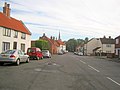
English: Tuxford is a village and a civil parish on the southern edge of the Bassetlaw district of Nottinghamshire, England. It may also be considered a small town as it was historically a market town. Nearby larger towns are Retford and Newark-on-Trent. The southern boundary of the parish is also the boundary of Bassetlaw. To the south, in Newark and Sherwood, is Egmanton, and to the north are East and West Markham. To the east is Fledborough.
Subcategories
This category has the following 8 subcategories, out of 8 total.
L
- Tuxford Library (6 F)
- Longvillers arms (2 F)
N
- The Newcastle Arms, Tuxford (5 F)
T
- Tuxford Academy (2 F)
- Tuxford lock-up (6 F)
- Tuxford War Memorial (1 F)
- Tuxford Windmill (8 F)
Media in category "Tuxford"
The following 200 files are in this category, out of 315 total.
(previous page) (next page)-
 12 Ollerton Road, Tuxford - geograph.org.uk - 4126902.jpg 1,280 × 960; 236 KB
-
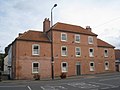
 14 to 18 Newcastle Street - geograph.org.uk - 4126856.jpg 1,280 × 960; 187 KB
-
 14-18 Eldon Street, Tuxford - geograph.org.uk - 4126834.jpg 1,280 × 960; 202 KB
-
 25kv electrification poles, Egmanton Crossing - geograph.org.uk - 3156374.jpg 768 × 1,024; 116 KB
-
 4-8 Ollerton Road, Tuxford - geograph.org.uk - 4126904.jpg 1,280 × 960; 272 KB
-
 5 and 7 Eldon Street, Tuxford - geograph.org.uk - 4126848.jpg 1,280 × 960; 181 KB
-
 8 and 10 Market Place, Tuxford - geograph.org.uk - 3155229.jpg 1,024 × 768; 162 KB
-
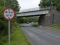
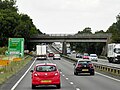
 A1 - Markham Road overbridge - geograph.org.uk - 2642805.jpg 640 × 428; 108 KB
-
 A1 approaching Tuxford - geograph.org.uk - 2642817.jpg 640 × 428; 102 KB
-

-
 A1 southbound - geograph.org.uk - 4035210.jpg 1,600 × 1,100; 275 KB
-
 A1 Southbound near to Tuxford - geograph.org.uk - 4922759.jpg 640 × 480; 377 KB
-
 A6075 towards Tuxford - geograph.org.uk - 4396455.jpg 640 × 480; 54 KB
-
 Allotments at Tuxford - geograph.org.uk - 2233508.jpg 1,024 × 768; 180 KB
-
 Bang - geograph.org.uk - 4056967.jpg 1,024 × 823; 101 KB
-
 Barrier on Bevercotes Road - geograph.org.uk - 4313931.jpg 1,024 × 768; 218 KB
-
 Bellcote on Charles Read's School - geograph.org.uk - 4126807.jpg 938 × 1,280; 225 KB
-
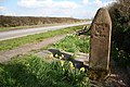
 Bench mark, Great North Road, Tuxford - geograph.org.uk - 4117702.jpg 1,253 × 1,280; 309 KB
-
 Blue Bell Yard - geograph.org.uk - 4128374.jpg 960 × 1,280; 161 KB
-
 Brickyard House - geograph.org.uk - 2351918.jpg 640 × 430; 37 KB
-
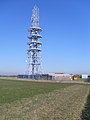
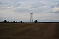
 BT Communications Mast - geograph.org.uk - 2632334.jpg 768 × 1,024; 152 KB
-
 BT Communications Mast - geograph.org.uk - 4396426.jpg 478 × 640; 46 KB
-
 BT Radio Station, Tuxford - geograph.org.uk - 1750964.jpg 2,304 × 3,072; 1.77 MB
-

-

-
 Chantry Walk - geograph.org.uk - 4126837.jpg 960 × 1,280; 247 KB
-
 Coal for High Marnham Power station - geograph.org.uk - 2155168.jpg 640 × 402; 57 KB
-
 Communications tower, Willoughby Hill - geograph.org.uk - 6259398.jpg 1,024 × 768; 132 KB
-
 Countryside near Stone Road End Farm - geograph.org.uk - 2351914.jpg 640 × 430; 30 KB
-
 Crops along the farm track - geograph.org.uk - 1587935.jpg 640 × 453; 63 KB
-

-
 Darlton Road (A6075) - geograph.org.uk - 2691331.jpg 640 × 480; 55 KB
-
 Darlton Road - geograph.org.uk - 2272131.jpg 640 × 427; 78 KB
-

-
 Direction Sign - Signpost in Tuxford - geograph.org.uk - 6102344.jpg 209 × 314; 68 KB
-
 Dukeries Junction (High Level) station site geograph-3422104-by-Ben-Brooksbank.jpg 2,376 × 1,452; 6.22 MB
-
 Dukeries Junction site geograph-3430718-by-Ben-Brooksbank.jpg 2,395 × 1,557; 2.9 MB
-
 Easi-edge office. - geograph.org.uk - 511710.jpg 640 × 480; 91 KB
-
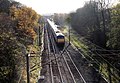
 East Coast Main Line - geograph.org.uk - 4353226.jpg 1,024 × 686; 268 KB
-
 Egmanton Crossing - geograph.org.uk - 4105630.jpg 1,280 × 942; 325 KB
-
 Egmanton Level Crossing - geograph.org.uk - 4920972.jpg 3,696 × 2,448; 1.98 MB
-

-
 Egmanton Road - geograph.org.uk - 1898137.jpg 640 × 426; 95 KB
-
 Egmanton Road leaving Tuxford - geograph.org.uk - 5259082.jpg 640 × 427; 74 KB
-
 Eldon Street, Tuxford - geograph.org.uk - 4126842.jpg 960 × 1,280; 242 KB
-

-
 Entrance to Tuxford Business Park - geograph.org.uk - 679774.jpg 640 × 480; 83 KB
-
 Farm track and woodland near Westwood Farm - geograph.org.uk - 6259205.jpg 1,024 × 768; 195 KB
-
 Farm Track near Tuxford - geograph.org.uk - 801408.jpg 640 × 379; 76 KB
-
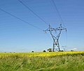
 Farmland and pylon - geograph.org.uk - 4396418.jpg 640 × 480; 36 KB
-
 Farmland between two windmills - geograph.org.uk - 3514240.jpg 1,024 × 768; 268 KB
-
 Farmland near Eastfield Farm - geograph.org.uk - 2659019.jpg 1,024 × 776; 82 KB
-
 Farmland near Egmanton Crossing - geograph.org.uk - 2659235.jpg 1,600 × 1,200; 266 KB
-
 Farmland near Lodge Farm - geograph.org.uk - 2659212.jpg 1,024 × 727; 92 KB
-
 Farmland near Stone Road End Farm - geograph.org.uk - 2659220.jpg 1,600 × 1,200; 234 KB
-
 Farmland off Darlton Road - geograph.org.uk - 2691328.jpg 640 × 480; 70 KB
-
 Farmland off the A6075 - geograph.org.uk - 4396451.jpg 640 × 480; 55 KB
-
 Farmland south of Lodge Farm - geograph.org.uk - 2405700.jpg 640 × 430; 31 KB
-
 Farmland, Eastfield Farm - geograph.org.uk - 4237531.jpg 640 × 466; 37 KB
-
 Farmyard bric-a-brac - geograph.org.uk - 4126875.jpg 1,280 × 1,280; 598 KB
-
 Field boundary off Ollerton Road - geograph.org.uk - 6259394.jpg 1,024 × 768; 200 KB
-
 Field entrance off the A6075 - geograph.org.uk - 4396457.jpg 640 × 430; 54 KB
-
 Field of oilseed rape - geograph.org.uk - 4314076.jpg 1,024 × 768; 244 KB
-
 Field of oilseed rape and gap in the hedge - geograph.org.uk - 5228480.jpg 1,024 × 768; 240 KB
-
 Field off Stone Road - geograph.org.uk - 3156338.jpg 1,024 × 768; 147 KB
-
 Fields and wind turbine - geograph.org.uk - 4766202.jpg 4,280 × 2,609; 3.88 MB
-
 Fingerpost in Tuxford Market Place - geograph.org.uk - 4126780.jpg 960 × 1,280; 245 KB
-
 Fingerpost in Tuxford Market Place - geograph.org.uk - 4126781.jpg 1,280 × 960; 218 KB
-
 Fingerpost, Eldon Street-Markham Road, Tuxford - geograph.org.uk - 4128413.jpg 960 × 1,280; 357 KB
-
 Fingerpost, Newcastle Street - geograph.org.uk - 4126860.jpg 960 × 1,280; 246 KB
-
 Fingerpost, Stone Road End - geograph.org.uk - 4105646.jpg 960 × 1,280; 502 KB
-

-
 Footpath from Tuxford - geograph.org.uk - 155930.jpg 640 × 480; 88 KB
-
 Former maltings, Eldon Street, Tuxford - geograph.org.uk - 4128409.jpg 1,280 × 960; 201 KB
-
 Gate at the end of Hopyard Lane - geograph.org.uk - 5228476.jpg 1,024 × 768; 233 KB
-
 Great North Road - geograph.org.uk - 2277181.jpg 640 × 427; 81 KB
-
 Great North Road - geograph.org.uk - 4745074.jpg 1,600 × 1,067; 390 KB
-
 Great North Road towards Tuxford - geograph.org.uk - 2691297.jpg 640 × 480; 77 KB
-
 Great North Road, Stone Road End - geograph.org.uk - 4105653.jpg 1,280 × 949; 307 KB
-
 Great North Road, Tuxford - geograph.org.uk - 4117696.jpg 1,280 × 859; 226 KB
-
 Harvest Cottage from the railway - geograph.org.uk - 4711598.jpg 1,600 × 816; 167 KB
-
 Hop-Yard Lane, Tuxford, Nottinghamshire - geograph.org.uk - 167689.jpg 640 × 480; 162 KB
-
 Hopyard Lane - geograph.org.uk - 5227995.jpg 1,024 × 768; 166 KB
-
 Hopyard Lane - geograph.org.uk - 5228070.jpg 1,024 × 768; 222 KB
-
 Hopyard Lane - geograph.org.uk - 5228073.jpg 1,024 × 768; 219 KB
-
 Hopyard Lane - geograph.org.uk - 5228475.jpg 1,024 × 768; 283 KB
-
 Hopyard Lane and small area of woodland - geograph.org.uk - 5228072.jpg 1,024 × 768; 220 KB
-
 House on Newcastle Street, Tuxford - geograph.org.uk - 5205489.jpg 1,024 × 768; 164 KB
-
 House on the corner of Newark Road - geograph.org.uk - 4126778.jpg 1,280 × 960; 224 KB
-
 Houses on Maple Close, Tuxford - geograph.org.uk - 2691316.jpg 640 × 480; 67 KB
-
 Houses on the Old Great North Road - geograph.org.uk - 2233512.jpg 1,024 × 768; 134 KB
-
 I'll be watching you - geograph.org.uk - 608323.jpg 640 × 362; 80 KB
-
 Ind estate in the distance - geograph.org.uk - 1372359.jpg 640 × 427; 59 KB
-
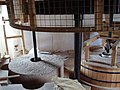
 Inside Tuxford Windmill - geograph.org.uk - 4128424.jpg 1,280 × 960; 204 KB
-
 Inside Tuxford Windmill - geograph.org.uk - 4128426.jpg 929 × 1,280; 172 KB
-
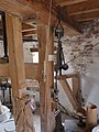 Inside Tuxford Windmill - geograph.org.uk - 4128430.jpg 960 × 1,280; 207 KB
-
 John White MP.jpg 983 × 1,168; 1.05 MB
-
 Land near Westwood Farm - geograph.org.uk - 4766207.jpg 4,928 × 3,264; 5.75 MB
-
 Lincoln Road, Tuxford - geograph.org.uk - 4766176.jpg 3,696 × 2,448; 2.29 MB
-
 Lodge Farm - geograph.org.uk - 3455125.jpg 2,276 × 1,396; 1.16 MB
-
 Long Lane - geograph.org.uk - 5204161.jpg 1,024 × 768; 153 KB
-
 Long Lane, Tuxford - geograph.org.uk - 4126884.jpg 1,280 × 960; 242 KB
-

-
 Looking towards Tuxford - geograph.org.uk - 1582513.jpg 640 × 493; 85 KB
-
 Maple Close, Tuxford - geograph.org.uk - 2691319.jpg 640 × 480; 73 KB
-
 Markham Road - geograph.org.uk - 2272137.jpg 640 × 427; 68 KB
-
 Markham Road crossing A1 - geograph.org.uk - 5992165.jpg 1,024 × 576; 93 KB
-
 Marnham Road - geograph.org.uk - 2272097.jpg 640 × 427; 84 KB
-
 Merryfields Farm.jpg 4,677 × 3,427; 3.39 MB
-
 Mid day shadows - geograph.org.uk - 3417499.jpg 768 × 1,024; 239 KB
-
 Muck on the ground and muck in the air - geograph.org.uk - 4314080.jpg 1,024 × 768; 102 KB
-
 Newark Road (A6075) - geograph.org.uk - 2691308.jpg 640 × 480; 89 KB
-
 Newark Road, Tuxford - geograph.org.uk - 4128389.jpg 1,280 × 960; 195 KB
-
 Newark Road, Tuxford - geograph.org.uk - 4128398.jpg 1,280 × 960; 206 KB
-
 Newcastle Street - geograph.org.uk - 1833241.jpg 640 × 426; 85 KB
-
 Newcastle Street - geograph.org.uk - 3309915.jpg 3,648 × 2,736; 1.96 MB
-
 North bound train from Kings Cross - geograph.org.uk - 1582400.jpg 640 × 445; 107 KB
-
 North Road Tuxford postbox ref NG22 76 - geograph.org.uk - 4128415.jpg 1,280 × 960; 392 KB
-
 Northbound - geograph.org.uk - 1889025.jpg 640 × 426; 137 KB
-
 Oil seed rape field, north of Tuxford Windmill - geograph.org.uk - 3514236.jpg 1,024 × 614; 125 KB
-

-

-
 Old Great North Road - geograph.org.uk - 1898218.jpg 640 × 426; 103 KB
-
 Old railway van in sheep pasture - geograph.org.uk - 5228478.jpg 1,024 × 768; 173 KB
-
 Ollerton Road (A6075) - geograph.org.uk - 4396420.jpg 640 × 480; 59 KB
-
 Ollerton Road (A6075) - geograph.org.uk - 4396448.jpg 640 × 480; 51 KB
-
 Ollerton Road (A6075) - geograph.org.uk - 4396472.jpg 640 × 480; 49 KB
-
 Ollerton Road - geograph.org.uk - 1372063.jpg 640 × 460; 65 KB
-
 On the way to Hull - geograph.org.uk - 4105636.jpg 1,280 × 960; 200 KB
-

-
 Orchard Crescent, Tuxford - geograph.org.uk - 4126858.jpg 1,280 × 960; 169 KB
-
 Ordnance Survey Flush Bracket (S0644) - geograph.org.uk - 4968082.jpg 491 × 640; 123 KB
-
 Ordnance Survey Flush Bracket S0644 - geograph.org.uk - 3057607.jpg 3,264 × 2,448; 2.04 MB
-
 Ordnance Survey Flush Bracket S8844 - geograph.org.uk - 3057610.jpg 3,264 × 2,448; 2.07 MB
-
 Outbuildings at Pump Farm - geograph.org.uk - 4126813.jpg 1,280 × 960; 245 KB
-
 Outbuildings at St John's College Farm - geograph.org.uk - 4126865.jpg 1,280 × 950; 202 KB
-
 Overbridge north of Tuxford, A1 - geograph.org.uk - 2514601.jpg 640 × 432; 42 KB
-
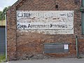 Painted wall sign - geograph.org.uk - 4128408.jpg 1,280 × 960; 275 KB
-

-
 Platelayers hut, Egmanton Crossing - geograph.org.uk - 3156381.jpg 1,024 × 768; 197 KB
-
 Ploughed field - geograph.org.uk - 4766179.jpg 3,696 × 2,448; 2.28 MB
-
 Ploughed field and Harvest Cottage - geograph.org.uk - 6274641.jpg 1,024 × 512; 128 KB
-
-
 Priors Park Farm - geograph.org.uk - 5995056.jpg 640 × 480; 54 KB
-
 Public footpath off Ollerton Road - geograph.org.uk - 4126899.jpg 960 × 1,280; 299 KB
-
 Pump Farmhouse, Lincoln Road, Tuxford - geograph.org.uk - 4126811.jpg 1,280 × 960; 196 KB
-
 Pylon by the ECML - geograph.org.uk - 4237527.jpg 640 × 430; 52 KB
-
 Pylon in a field - geograph.org.uk - 4237526.jpg 640 × 430; 30 KB
-

-
 Pylon line south of Tuxford - geograph.org.uk - 4701623.jpg 1,600 × 1,064; 300 KB
-
-
 Railway bridge at Tuxford - geograph.org.uk - 4117700.jpg 1,280 × 954; 281 KB
-
 Railway bridge near Tuxford - geograph.org.uk - 4745047.jpg 4,114 × 2,608; 3.17 MB
-
 Railway bridge over A1 - geograph.org.uk - 5992162.jpg 1,024 × 576; 76 KB
-
 Railway bridge over Egmanton Road - geograph.org.uk - 2693136.jpg 640 × 480; 100 KB
-
 Railway Bridge over the A1 near Tuxford - geograph.org.uk - 4925682.jpg 640 × 480; 331 KB
-
 Railway bridge over the A1, Tuxford - geograph.org.uk - 2514592.jpg 640 × 393; 43 KB
-
 Railway towards Retford - geograph.org.uk - 2691323.jpg 640 × 480; 105 KB
-
 Rainbow near Tuxford - geograph.org.uk - 4142082.jpg 1,280 × 960; 175 KB
-
 Rear of the former Newcastle Arms Hotel - geograph.org.uk - 4126850.jpg 1,280 × 963; 184 KB
-
 Rebel Stone and Great North Road - geograph.org.uk - 149906.jpg 640 × 427; 116 KB
-
 Roadway to Lodge Farm - geograph.org.uk - 4314081.jpg 1,024 × 768; 211 KB
-
 Roadway to Westwood - geograph.org.uk - 4313872.jpg 1,024 × 768; 202 KB
-
 Roughly cut field edge - geograph.org.uk - 6259404.jpg 1,024 × 768; 212 KB
-
 Rural view - geograph.org.uk - 2272141.jpg 640 × 427; 88 KB
-

-
 Site of Dukeries Junction Low Level station, 1992 - geograph.org.uk - 4842080.jpg 2,394 × 1,484; 3.77 MB
-
 Solar panels - geograph.org.uk - 4396423.jpg 640 × 480; 50 KB
-
 Southbound A1 near to Tuxford - geograph.org.uk - 4922753.jpg 640 × 427; 341 KB
-
 Southbound A1 near Tuxford - geograph.org.uk - 4925628.jpg 640 × 480; 363 KB
-
 Southbound A1, Markham Road Bridge - geograph.org.uk - 4922750.jpg 640 × 427; 347 KB
-
 Southbound express - geograph.org.uk - 1894909.jpg 640 × 426; 78 KB
-
 St Nicholas' church, Tuxford - geograph.org.uk - 4766410.jpg 3,733 × 2,598; 7.08 MB
-
 St.John's College Farm - geograph.org.uk - 2278803.jpg 640 × 427; 116 KB
-
 Static homes at Eastfield Farm - geograph.org.uk - 2351909.jpg 640 × 371; 42 KB
-
 Step-over stile - geograph.org.uk - 4126895.jpg 960 × 1,280; 337 KB
-
 Stocks on The Green, Tuxford - geograph.org.uk - 5205518.jpg 1,024 × 768; 291 KB
-
 Stone Road End - geograph.org.uk - 4105666.jpg 1,280 × 925; 309 KB
-
 Stone Road End Mill - geograph.org.uk - 1894899.jpg 640 × 426; 85 KB
-
 Stone Road End postbox Ref NG23 73 - geograph.org.uk - 4105660.jpg 944 × 1,280; 564 KB
-
 Stone Road End windmill - geograph.org.uk - 3156364.jpg 1,024 × 768; 152 KB
-
 Stone Road End windmill - geograph.org.uk - 4105626.jpg 1,280 × 978; 419 KB
-
 Stones inside Tuxford Windmill - geograph.org.uk - 1924357.jpg 800 × 600; 86 KB
-
 Stopping the windmill - geograph.org.uk - 4359196.jpg 1,267 × 950; 234 KB
-
 Sunset and wind turbine from Markham Road - geograph.org.uk - 3281753.jpg 810 × 1,024; 68 KB
-
 Taylor White.jpg 1,462 × 1,830; 2.75 MB
-
 Telecomms mast - geograph.org.uk - 1817144.jpg 640 × 426; 45 KB
-
 The Chantry, Tuxford - geograph.org.uk - 3155238.jpg 1,024 × 768; 133 KB
-
 The Chantry, Tuxford - geograph.org.uk - 4126792.jpg 1,280 × 960; 187 KB
-
 The Fountain - geograph.org.uk - 2274628.jpg 640 × 427; 55 KB
-
 The Fountain - geograph.org.uk - 3185742.jpg 640 × 427; 78 KB
-
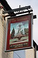 The Fountain sign - geograph.org.uk - 2274632.jpg 427 × 640; 80 KB
-
 The Great North Road - geograph.org.uk - 1455197.jpg 640 × 427; 61 KB
-
 The Lock up. Tuxford - geograph.org.uk - 5205513.jpg 1,024 × 768; 245 KB
-
 The Mail House, 1-3 Eldon Street - geograph.org.uk - 4126845.jpg 1,280 × 960; 202 KB
-
 The Mine of Information and Tuxford Post Office - geograph.org.uk - 4126843.jpg 1,280 × 862; 158 KB
-
 The Newcastle Arms - geograph.org.uk - 2863177.jpg 640 × 480; 73 KB
-
 The Newcastle Arms Hotel, Tuxford - geograph.org.uk - 3155293.jpg 1,024 × 768; 173 KB
-
 The Old Lockup, Tuxford - geograph.org.uk - 4126854.jpg 1,280 × 960; 285 KB
-
 The Old Lockup, Tuxford, rear view - geograph.org.uk - 4129588.jpg 640 × 480; 157 KB


_-_geograph.org.uk_-_2691331.jpg)


_station_site_geograph-3422104-by-Ben-Brooksbank.jpg)


_-_geograph.org.uk_-_2691308.jpg)


.jpg)


_-_geograph.org.uk_-_4396420.jpg)
_-_geograph.org.uk_-_4396448.jpg)
_-_geograph.org.uk_-_4396472.jpg)


_-_geograph.org.uk_-_4968082.jpg)


