Category:Tynemouth
town in north east England   | |||||
| Upload media | |||||
| Instance of | |||||
|---|---|---|---|---|---|
| Location | North Tyneside, Tyne and Wear, North East England, England | ||||
| Inception |
| ||||
| Population |
| ||||
 | |||||
Subcategories
This category has the following 20 subcategories, out of 20 total.
B
C
G
K
- King Edwards Bay (6 F)
L
- Longsands, Tynemouth (52 F)
M
N
P
- People from Tynemouth (1 F)
- Preston, Tyne and Wear (1 F)
- Prior's Haven, Tynemouth (5 F)
S
- Sharpness Point (7 F)
- Silverlink Park Sundial (5 F)
T
- Tynemouth Station Market (17 F)
W
Media in category "Tynemouth"
The following 200 files are in this category, out of 311 total.
(previous page) (next page)-
 'Viking Warrior' fishing boat - geograph.org.uk - 5521352.jpg 800 × 570; 103 KB
-
 002614- Tynemouth The Spanish Battery C1870.jpg 1,024 × 820; 475 KB
-
 30 x3 tyne.psd (19740352516).jpg 13,505 × 1,428; 1.55 MB
-

-
 Alice Boyd - View from the window of Balcony House, Tynemouth.jpg 2,048 × 1,468; 287 KB
-
 Back of the Toy Museum, Tynemouth - geograph.org.uk - 1184605.jpg 640 × 428; 46 KB
-
 Bath Terrace, Tynemouth - geograph.org.uk - 1800868.jpg 640 × 480; 98 KB
-

-
 Blue Reef Aquarium Tynemouth Tank 01.jpg 2,048 × 1,536; 1.04 MB
-
 Blue Reef Aquarium Tynemouth.jpg 1,650 × 1,237; 417 KB
-
 Boat in Tynemouth.jpg 4,032 × 2,249; 1.4 MB
-
 Boats on the River Tyne - geograph.org.uk - 5897205.jpg 640 × 436; 73 KB
-

-
 Bridge over tyne01 (9343359846).jpg 5,177 × 3,441; 1.1 MB
-
 C2C finishing point - geograph.org.uk - 1745575.jpg 640 × 480; 72 KB
-
 C2C finishing post - geograph.org.uk - 1745567.jpg 640 × 480; 63 KB
-
 Camerons sun (8502380589).jpg 4,562 × 3,037; 1.12 MB
-
 Crane-2 (22892977855).jpg 3,456 × 5,184; 21.54 MB
-
 Cranes (22474588418).jpg 5,184 × 3,456; 19.78 MB
-

-
 Cycle route sign - geograph.org.uk - 1651331.jpg 600 × 450; 278 KB
-
 Disused Lido - geograph.org.uk - 789369.jpg 640 × 426; 54 KB
-
 Doorhead of Tynemouth Police Station, 13 July 2008.jpg 3,072 × 2,304; 5.54 MB
-
 Drawing, Two Women and a Child at a Rail, Overlooking Beach at Tynemouth, 1881 (CH 18174053).jpg 4,096 × 3,186; 15.92 MB
-
 Dredger at the mouth of the Tyne - geograph.org.uk - 5995142.jpg 4,484 × 3,363; 2.55 MB
-
 Entrance to River Tyne - geograph.org.uk - 3136452.jpg 4,288 × 3,216; 3.31 MB
-
 Estuaire Rivière Tyne Tynemouth North Tyneside 1.jpg 5,184 × 3,456; 6.63 MB
-
 Estuaire Rivière Tyne Tynemouth North Tyneside 2.jpg 5,184 × 3,456; 6.63 MB
-
 Estuaire Rivière Tyne Tynemouth North Tyneside 3.jpg 5,184 × 3,456; 5.27 MB
-
 Estuaire Rivière Tyne Tynemouth North Tyneside 4.jpg 5,184 × 3,456; 6.04 MB
-
 Estuaire Rivière Tyne Tynemouth North Tyneside 5.jpg 5,184 × 3,456; 6.48 MB
-
 Estuaire Rivière Tyne Tynemouth North Tyneside 6.jpg 5,184 × 3,456; 6.68 MB
-
 Exit to the North Sea - geograph.org.uk - 2362746.jpg 1,824 × 1,368; 941 KB
-
 Farmland at New York - geograph.org.uk - 78028.jpg 640 × 475; 83 KB
-
 Ferry on tyne (8545155274).jpg 3,600 × 1,050; 625 KB
-
 First World War Patrol boat on the River Tyne (22912884496).jpg 1,134 × 796; 115 KB
-

-

-
 Flower Gardens - Tynemouth Park - geograph.org.uk - 522024.jpg 640 × 480; 184 KB
-

-

-

-

-
 Freestone Point - geograph.org.uk - 3462179.jpg 2,048 × 1,536; 515 KB
-
 Fridel Meyer (1a).jpg 1,008 × 636; 72 KB
-
 Frosty morning (8395301250).jpg 2,048 × 1,364; 1.92 MB
-
 Frosty north pier (8394058937).jpg 2,048 × 1,364; 1.76 MB
-
 George Fay, soldier, arrested for stealing (21990871656).jpg 608 × 902; 243 KB
-
 Gone fishing on South Shields Pier - geograph.org.uk - 5803612.jpg 5,369 × 3,020; 3.01 MB
-
 Herd Sand - geograph.org.uk - 4619109.jpg 640 × 480; 36 KB
-
 High Light and Low Light - geograph.org.uk - 590419.jpg 640 × 480; 68 KB
-
 HMS 'Volage' RMG BHC3705.jpg 1,200 × 921; 96 KB
-
 HMS Illustrious, 18-06-1982 South Shields (35503927812).jpg 1,415 × 943; 950 KB
-
 HMS Volage RMG RP6489.jpg 841 × 630; 471 KB
-
 Winslow Homer - Two Girls On The Beach, Tynemouth (1881).jpg 1,821 × 1,249; 822 KB
-
 Winslow Homer - On the Beach, Tynemouth - 1881.jpg 3,200 × 2,180; 1.28 MB
-
 Winslow Homer - Tynemouth Beach (1883).jpg 3,200 × 922; 220 KB
-
 Hotspur Street in Tynemouth - geograph.org.uk - 2926494.jpg 1,500 × 1,000; 160 KB
-
 In my Peqasus Quik microlight - geograph.org.uk - 1126932.jpg 640 × 480; 64 KB
-

-

-

-
 John Scott - The 'Marshall' ERY HUMM 2009 2254.jpg 1,200 × 844; 98 KB
-
 John Scott - The Collier Brig 'Mary' TWMS SSM TWCMS G4228.jpg 800 × 531; 61 KB
-
 John Scott - The ship Utinia off Tynemouth.jpg 4,688 × 2,880; 2.15 MB
-
 John Spence Community High School. - geograph.org.uk - 295159.jpg 640 × 480; 88 KB
-

-

-

-
 King Edward's Bay, Tynemouth - geograph.org.uk - 1706998.jpg 640 × 480; 68 KB
-
 Knott's Flats, Tynemouth - geograph.org.uk - 1712787.jpg 1,024 × 768; 184 KB
-
 Leaving the Tyne - geograph.org.uk - 5123494.jpg 5,376 × 3,024; 4.67 MB
-
 Light on the South Pier - geograph.org.uk - 5844705.jpg 1,600 × 1,200; 439 KB
-
 Lighthouse at end of North Pier - geograph.org.uk - 4111441.jpg 1,600 × 1,117; 191 KB
-
 Lighthouse at the end of Tynemouth's North Pier - geograph.org.uk - 4517731.jpg 1,600 × 1,025; 203 KB
-
 Lighthouse on the North Pier - geograph.org.uk - 5676878.jpg 800 × 544; 62 KB
-
 Lighthouse on the South Groyne - geograph.org.uk - 5676889.jpg 800 × 454; 82 KB
-
 Lighthouse on the South Pier - geograph.org.uk - 5676868.jpg 800 × 470; 68 KB
-
 Lighthouse on Tynemouth North Pier - geograph.org.uk - 2973879.jpg 2,092 × 1,480; 171 KB
-
 Lighthouses, Tynemouth - geograph.org.uk - 5832511.jpg 1,600 × 1,060; 557 KB
-
 Long Sands - geograph.org.uk - 4189112.jpg 640 × 480; 55 KB
-
 Long Sands, near Tynemouth - geograph.org.uk - 5820159.jpg 1,600 × 1,154; 301 KB
-
 Long Sands, Tynemouth - geograph.org.uk - 1636099.jpg 640 × 480; 82 KB
-

-
 Looking across the harbour at the mouth of the Tyne - geograph.org.uk - 5995638.jpg 4,459 × 3,345; 2.88 MB
-
 Looking across the River Tyne Entrance - geograph.org.uk - 3159331.jpg 4,608 × 3,456; 5.16 MB
-

-

-
 Looking towards North Pier - geograph.org.uk - 4017772.jpg 640 × 480; 58 KB
-

-
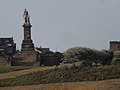 Lord Collingwood's Monument - geograph.org.uk - 3136355.jpg 4,288 × 3,216; 2.8 MB
-
 Millview Drive, Tynemouth - geograph.org.uk - 2897109.jpg 480 × 640; 77 KB
-
 Morning tyne (8503696848).jpg 5,400 × 1,909; 851 KB
-
 Morrison's Tynemouth - geograph.org.uk - 2612795.jpg 3,872 × 2,592; 3.82 MB
-
 Mouth of River Tyne - geograph.org.uk - 714144.jpg 640 × 480; 52 KB
-
 Mouth of River Tyne - geograph.org.uk - 714172.jpg 640 × 480; 68 KB
-
 Mouth of the River Tyne, 1949 (15176273591).jpg 877 × 668; 374 KB
-
 Mouth of the Tyne - geograph.org.uk - 4846583.jpg 640 × 480; 217 KB
-
 Mouth of the Tyne - geograph.org.uk - 728004.jpg 640 × 426; 60 KB
-
 Mouth of the Tyne from Tynemouth, Tyne and Wear (256490251).jpg 1,280 × 960; 105 KB
-
 Mouth of tyne (8394729800).jpg 2,048 × 273; 90 KB
-
 Mouth of Tyne pier (8394230725).jpg 2,048 × 1,365; 371 KB
-
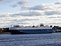
 MSC Magnifica leaves the Tyne - geograph.org.uk - 5803610.jpg 4,969 × 2,255; 1.8 MB
-
 MV Nordic Ace on the River Tyne (48586145791).jpg 5,184 × 3,888; 3.7 MB
-
 New tyne02 (9558436234).jpg 5,199 × 1,443; 828 KB
-
 Newcastle upon Tyne img 3680 (3657083927).jpg 3,264 × 2,448; 3.14 MB
-
 Newcastle upon Tyne img 3681 (3657877886).jpg 3,264 × 2,448; 3.11 MB
-
 Newcastle upon Tyne img 3688 (3657078845).jpg 3,264 × 2,448; 3.14 MB
-
 Newcastle upon Tyne img 3689 (3657078227).jpg 3,264 × 2,448; 2.63 MB
-
 Newcastle upon Tyne img 3693 (3657870510).jpg 3,264 × 2,448; 2.73 MB
-
 Newcastle upon Tyne img 3696 (3657074061).jpg 3,264 × 2,448; 2.64 MB
-
 Newcastle upon Tyne img 3697 (3657073523).jpg 3,264 × 2,448; 2.95 MB
-
 Newcastle upon Tyne img 3703 (3657864922).jpg 3,264 × 2,448; 2.16 MB
-
 Newcastle upon Tyne img 3711 (3657064605).jpg 3,264 × 2,448; 4.66 MB
-
 Newcastle upon Tyne img 3712 (3657858194).jpg 3,264 × 2,448; 5.24 MB
-
 Newcastle upon Tyne img 3723 (3657850596).jpg 2,448 × 3,264; 5.01 MB
-
 Newcastle upon Tyne img 3724 (3657849788).jpg 2,448 × 3,264; 4.87 MB
-
 Newcastle upon Tyne img 3725 (3657848852).jpg 3,264 × 2,448; 5.53 MB
-
 Night on the tyne (7999544437).jpg 5,176 × 2,637; 649 KB
-
 North Pier at Tynemouth - geograph.org.uk - 2709412.jpg 1,500 × 1,125; 1,016 KB
-
 North pier light - geograph.org.uk - 3462164.jpg 2,048 × 1,536; 581 KB
-
 North Pier Lighthouse, Tynemouth - geograph.org.uk - 4057141.jpg 480 × 640; 43 KB
-

-
 Northumberland Square. - geograph.org.uk - 295246.jpg 640 × 480; 113 KB
-
 Once an Open Air Swimming Pool - geograph.org.uk - 1651305.jpg 600 × 450; 302 KB
-

-
 Paddle boarder at Tynemouth - geograph.org.uk - 5869959.jpg 447 × 640; 80 KB
-
 Percy Gardens - geograph.org.uk - 2897463.jpg 640 × 480; 81 KB
-
 Percy Park, Tynemouth - geograph.org.uk - 2897115.jpg 640 × 480; 72 KB
-
 Picking Daisies - geograph.org.uk - 773079.jpg 640 × 481; 115 KB
-
 Pilot boat reaches the waiting ship, Tyne estuary - geograph.org.uk - 4517726.jpg 1,600 × 1,191; 263 KB
-
 Pilot Vessel Collingwood - geograph.org.uk - 6149999.jpg 800 × 600; 523 KB
-
 Point Freestone Tynemouth North Tyneside 1.jpg 5,184 × 3,456; 7.17 MB
-
 Point Freestone Tynemouth North Tyneside 2.jpg 5,184 × 3,456; 7.13 MB
-
 Point Freestone Tynemouth North Tyneside 3.jpg 5,184 × 3,456; 6.62 MB
-
 Point Freestone Tynemouth North Tyneside 4.jpg 5,184 × 3,456; 7.06 MB
-
 Point Freestone Tynemouth North Tyneside 5.jpg 5,184 × 3,456; 5.39 MB
-
 Point Freestone Tynemouth North Tyneside 6.jpg 5,184 × 3,456; 6.85 MB
-
 Port of Tyne Pilot Boat Collingwood - geograph.org.uk - 6149993.jpg 800 × 600; 480 KB
-
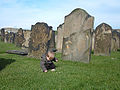
 Preston Cemetery - geograph.org.uk - 91549.jpg 640 × 430; 70 KB
-
 Prior's Haven and Freestone Point - geograph.org.uk - 4130006.jpg 640 × 480; 71 KB
-
 Prior's Terrace - geograph.org.uk - 3136301.jpg 4,288 × 3,216; 3.63 MB
-
 Quaint Towers (123131634).jpg 1,728 × 2,304; 941 KB
-
 Quay side05 effects-1 (16092112027).jpg 8,474 × 3,633; 14.87 MB
-
 Railway on Tynemouth North Pier - geograph.org.uk - 2973885.jpg 480 × 640; 60 KB
-
 Rake House Farm - geograph.org.uk - 78027.jpg 640 × 475; 98 KB
-
 Rake House Farm - geograph.org.uk - 78754.jpg 640 × 475; 114 KB
-
 Rake Lane Hospital - geograph.org.uk - 78025.jpg 640 × 475; 83 KB
-
 Rake Lane Hospital - geograph.org.uk - 78026.jpg 640 × 475; 115 KB
-
 Red Arrows Display - geograph.org.uk - 36594.jpg 640 × 480; 65 KB
-
-
 River Tyne (downriver) - geograph.org.uk - 5201.jpg 640 × 480; 166 KB
-
 River Tyne Entrance - geograph.org.uk - 2530334.jpg 3,496 × 2,334; 1,016 KB
-
 River Tyne Entrance - geograph.org.uk - 2611519.jpg 3,872 × 2,592; 4.99 MB
-
 River Tyne Entrance - geograph.org.uk - 3159308.jpg 4,608 × 3,456; 5.98 MB
-
 River Tyne Entrance - geograph.org.uk - 4105907.jpg 1,600 × 1,169; 237 KB
-
 River Tyne Entrance.jpg 556 × 430; 62 KB
-
 River Tyne Estuary - geograph.org.uk - 2479083.jpg 1,280 × 960; 547 KB
-
 River Tyne, (upriver) - geograph.org.uk - 5200.jpg 640 × 480; 162 KB
-
 Rockpool (123131637).jpg 2,304 × 1,728; 962 KB
-
 Rockpool 2 (123131638).jpg 2,304 × 1,728; 981 KB
-
 Roker, Sunderland, UK - panoramio.jpg 5,184 × 3,456; 5.31 MB
-
 Roundabout in Tynemouth - geograph.org.uk - 1124772.jpg 640 × 480; 116 KB
-
 Royal quays (8502391635).jpg 5,184 × 3,456; 1.02 MB
-
 Sailing Club - geograph.org.uk - 3638876.jpg 640 × 427; 268 KB
-
 Saved Doorhead - geograph.org.uk - 331565.jpg 640 × 480; 111 KB
-
 Seal Cove Outdoor at the Blue Reef Aquarium in Tynemouth.jpg 2,048 × 1,536; 1.06 MB
-
 Seal Cove Underwater Viewing Blue Reef Aquarium Tynemouth.jpg 2,048 × 1,536; 804 KB
-
 Short Sands - geograph.org.uk - 325609.jpg 640 × 480; 67 KB
-
 Short Sands, Tynemouth - geograph.org.uk - 1651309.jpg 600 × 450; 240 KB
-
 Sinuous stonework - geograph.org.uk - 3462114.jpg 2,048 × 1,536; 1.38 MB
-
 South Pier and lighthouse - geograph.org.uk - 5676871.jpg 800 × 588; 119 KB
-
 South Pier and Lighthouse, Tynemouth - geograph.org.uk - 3005359.jpg 640 × 480; 399 KB
-
 South Pier Lighthouse, Tynemouth - geograph.org.uk - 2479108.jpg 1,280 × 960; 509 KB
-
 South Pier, River Tyne Entrance - geograph.org.uk - 2224510.jpg 640 × 282; 31 KB
-
 South Shields, Haven Point - geograph.org.uk - 6150064.jpg 800 × 600; 593 KB
-
 Southlight 11 (8217237943).jpg 2,700 × 1,768; 938 KB
-
 StateLibQld 1 131411 Stanley (ship).jpg 1,000 × 626; 107 KB
-
 Sun. morning ferry (8364635726).jpg 2,047 × 1,363; 1.68 MB
-
 Sunday tynemouth , uk. (8394936208).jpg 4,800 × 1,200; 4.29 MB
-
 The beach at Tynemouth - geograph.org.uk - 1631864.jpg 640 × 428; 39 KB
-
 The Betsy Cains (BM 1871,0812.5319).jpg 2,500 × 2,000; 812 KB
-
 The City Of St Petersburg passes the South Pier - geograph.org.uk - 3182984.jpg 1,500 × 999; 112 KB
-
 The Cork Sand - geograph.org.uk - 2793701.jpg 994 × 517; 72 KB
-
 The end of the South Pier of the River Tyne - geograph.org.uk - 5153161.jpg 2,000 × 1,500; 219 KB
-
 The Harbour Wall - panoramio.jpg 3,878 × 2,600; 502 KB
-
 The Haven, Tynemouth - geograph.org.uk - 1712798.jpg 1,024 × 768; 174 KB
-
 The lighthouse on South Pier - geograph.org.uk - 2611527.jpg 3,872 × 2,592; 2.84 MB
-
 The lighthouse on the South Pier - geograph.org.uk - 3182992.jpg 1,500 × 1,000; 141 KB
-
 The lighthouse on the South Pier - geograph.org.uk - 3182996.jpg 1,500 × 995; 130 KB
-

-
 The Links, Grand Parade, Tynemouth - geograph.org.uk - 1635343.jpg 5,559 × 2,387; 1.83 MB
-
 The Mouth of the River Tyne - geograph.org.uk - 5691642.jpg 4,637 × 3,478; 6.79 MB
-
 The mouth of the Tyne - geograph.org.uk - 703854.jpg 640 × 426; 40 KB
-

-
 The Narrows, Tynemouth - geograph.org.uk - 50499.jpg 640 × 424; 203 KB
-
 The North Pier at Tynemouth - geograph.org.uk - 2925289.jpg 1,500 × 1,000; 111 KB
-
 The North Pier, Tynemouth - geograph.org.uk - 5691581.jpg 2,592 × 1,936; 1.18 MB
-
 The Old Swimming Pool (5468646077).jpg 3,888 × 2,592; 3.38 MB
-
 The Old Swimming Pool (5468648783).jpg 3,888 × 2,592; 3.25 MB


.jpg)


.jpg)
.jpg)
.jpg)


.jpg)


.jpg)


.jpg)
.jpg)

.jpg)
.jpg)
.jpg)
.jpg)


.jpg)

.jpg)


.jpg)
.jpg)
.jpg)


.jpg)


.jpg)


.jpg)
.jpg)

.jpg)
.jpg)
.jpg)
.jpg)
.jpg)
.jpg)
.jpg)
.jpg)
.jpg)
.jpg)
.jpg)
.jpg)
.jpg)
.jpg)
.jpg)


.jpg)
.jpg)


.jpg)
_-_geograph.org.uk_-_5201.jpg)


_-_geograph.org.uk_-_5200.jpg)
.jpg)
.jpg)


.jpg)


.jpg)
.jpg)
.jpg)

.jpg)


.jpg)
.jpg)
.jpg)
.jpg)
.jpg)
.jpg)
.jpg)
.jpg)
.jpg)